


Long-Awaited Dixon Trail Takes Hikers to the Summit of Cheyenne Mountain
Since the state acquired parts of Cheyenne Mountain and the prairies and woodlands around it in 2000, the goal has been to build a trail to the Pikes Peak region’s second-most famous summit. The dream became reality almost two decades later. The summer of 2018 will mark a pivotal moment in Cheyenne Mountain State Park’s history, when hikers finally get access to the place they’ve only been able to view from Colorado Springs.
Rangers have issued warnings, ranking the Dixon Trail difficult to extreme. The trip is a long one from the Limekiln parking lot, and users should especially be cautious of continuing on the Top of the Mountain figure-eight loop, totaling another 3½ miles above 9,300 feet.
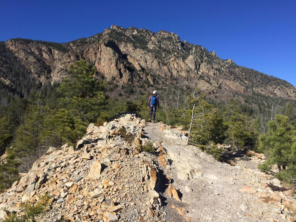
Dixon Trail. Photo Credit: Seth Boster.

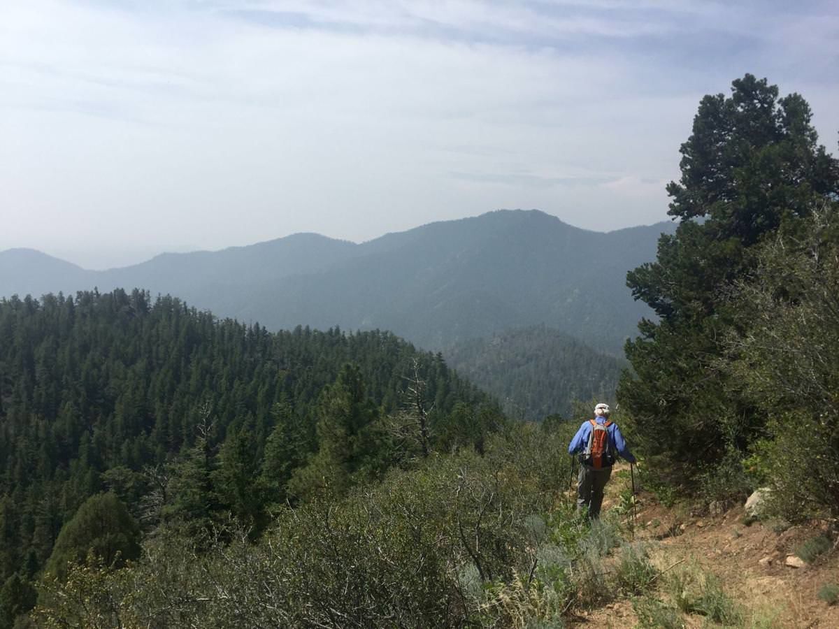
Dixon Trail. Photo Credit: Seth Boster.
On our visit before the official opening, we found the loop — as well as portions of Dixon — hard to follow, as some corridor clearing was still underway. Whatever your experience has been on the park’s mostly flat trails, expect something totally different.
Start on the Talon Trail, following the yellow markers through a meadow where the granite mountain dominates the view. The trail rises gently into the foothills, following ridges that overlook mighty outcrops. At 2.35 miles, take the spur for Talon North. The trail leads to wide-open craggy terrain. You’re atop the Dakota Hogback formation. Look left for the Dixon Trail heading into the tall woods.
It’s another 4 miles and 2,500 feet to the top. After about 2 miles, come to a saddle, where mountain bikers and equestrians are permitted no more. That’s due to the rugged nature of the trail ahead.
Amid downed timber and rock piles, we had pinflags to follow, showing the way where the path seemed to disappear. Around 8,300 feet, out of the dense forest of ponderosa pine and Douglas fir, the views open to the mountains over the Emerald Valley. The Sangre de Cristo peaks are spotted to the south on a clear day. You’re likely to hear occasional artillery fire from Fort Carson, seen to the east with the far plains.
The final push is through switchbacks built along rocky slopes. You’ll come to a wavy meadow home to big aspen groves and metal ruins of a 1957 plane crash. Before turning onto the loops — rock scramblers only on Dragon’s Backbone — decide whether you’ve had enough adventure for the day.
Trip log: 15 miles round trip (Talon plus Dixon out and back), 3,330 feet elevation gain, 9,354 feet max
Difficulty: Difficult
Getting there: The park’s entrance is off Colorado 115, directly across from the Fort Carson entrance. Past the pay kiosk, the Limekiln parking lot will be to your left.
FYI: Park day fee is $7. About half of Dixon Trail is multiuse. No dogs.
Get OutThere
Signup today for free and be the first to get notified on new updates.
PREV
PREVIOUS
8 Reasons Snow Mountain Ranch Should Be Your Next Winter Getaway
Facebook Twitter WhatsApp SMS Email Print Copy article link Save Facebook Twitter WhatsApp SMS Email Print Copy article link Save Presented by: YMCA of the Rockies – Snow Mountain Ranch is set amongst some of the most beautiful landscape in the Centennial State. Meadows, snow-covered peaks, and unparalleled opportunities for winter recreation define an experience […]
8 Ways to Get Away from It All this Winter in Estes Park
Facebook Twitter WhatsApp SMS Email Print Copy article link Save Facebook Twitter WhatsApp SMS Email Print Copy article link Save Presented by: Estes Park, Colorado sits at the base of Rocky Mountain National Park—a stunning setting for one of Colorado’s most charming towns. Situated off the well-trodden I-70 corridor, Estes Park transforms into a peaceful […]