


How to Hike to the Top of Castle Rock
Castle Rock, Colorado. Photo Credit: ivanastar (iStock).
Ivana Starcevic
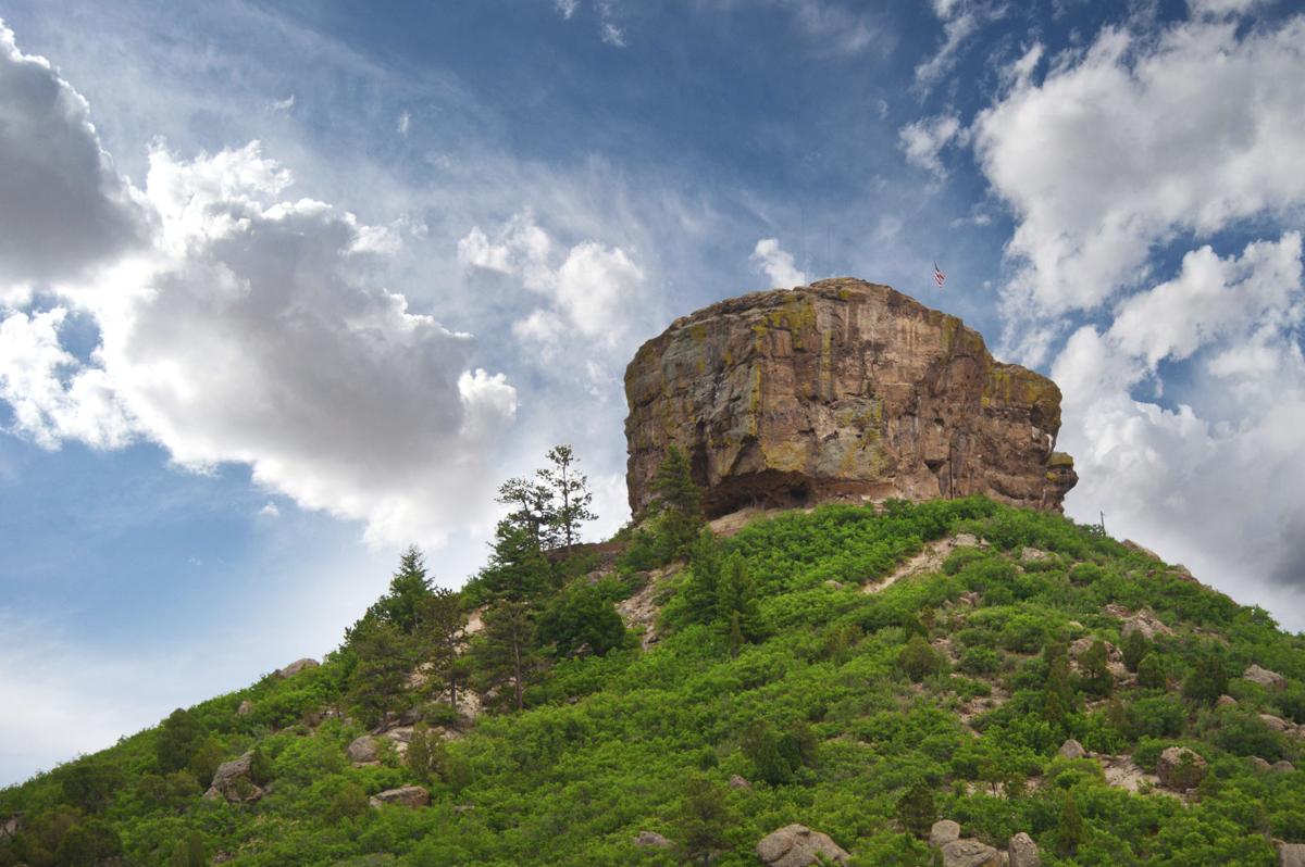
You’ve seen the landmark from Interstate 25 — the commanding promontory from which the town of Castle Rock gets its name. Now exit the highway and take a closer look.
Being home to the sight that captured imaginations long before the pioneers, Rock Park is perhaps the town’s most cherished open space. Residents demanded protection in the 1980s when development threatened. And now the park is enjoyed by all seeking a quick and easy escape, with fantastic views of Rocky Mountain National Park to the west and north and Pikes Peak to the south.
At the trailhead, we gazed at the rock and realized we had underestimated it from the interstate. It is truly impressive perched on its oak- and pine-spotted throne. And it demands more respect the closer you get on the well-marked path, formed by timber steps in some places to prevent erosion.
We recently started through snow before reaching the the sun-splashed side of the slope. The ground was dry this day but is notorious for mud. The trail switchbacks steadily to the sandy base of the rock and continues left, looping back to the parking lot.
On the rock’s north side, hikers plot a route to the plateau summit. But we cannot recommend this to anyone without the strength and balance. Signs warn of climbers being severely injured.
Trip log: 1.3 miles round trip (loop), 370 feet total elevation gain
Difficulty: Easy
Getting there: Off I-25, take exit 182 for Wilcox Street toward Castle Rock’s downtown. Turn left onto Sixth Street and then left on Perry Street, which becomes Front Street. Park will be on the right.
FYI: Dogs on leash. Hiking only.
Get OutThere
Signup today for free and be the first to get notified on new updates.