







Colorado snowpack now below average due to recent dry spell

Colorado’s snowpack is shrinking as a dry spell has hit the state.
According to Denver CBS4, the average statewide snowpack has dropped below the typical norm due to recent lack of precipitation across parts of the state. The southwest portion of the state is far below the norm, with the San Juan Mountains dropping to 20% of the average snowpack median and Upper Rio Grande Region dropping to 49% of the median for mid-November. The South Platte River basin has the highest snowpack in the state right now, with 137% of the typical median.
The SW Colorado basins’ snowpack remains well below normal. This trend is similar to the past 3 yrs thru early winter…then 2 of those ended up above normal. The other year…yuck. A lot of winter left to catch snow. 🤞 #cowx pic.twitter.com/JhOotISlnv — NWS Grand Junction (@NWSGJT) November 11, 2019
According to the United States Department of Agriculture, here’s a look at the current snow water equivalent around the state compared to the norm this time of the year.
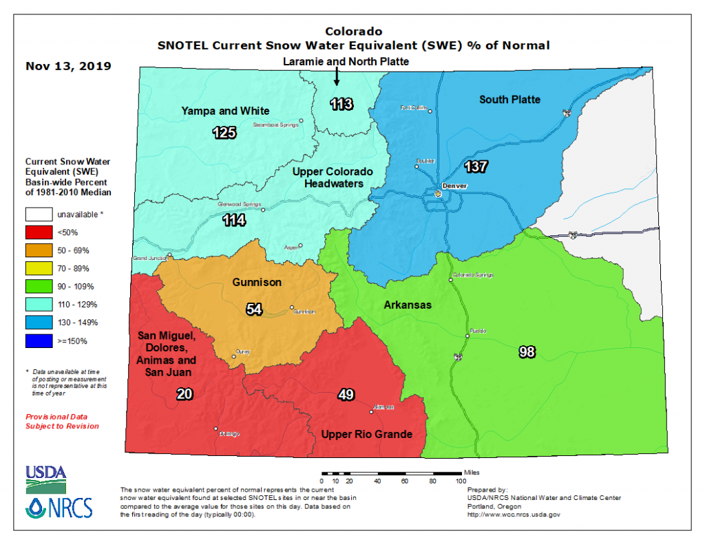
Photo Credit: USDA website.

Photo Credit: USDA website.
Keep snow dancing! The quiet weather will continue across parts of Colorado over the next few days with the next chance for perception predicted for Saturday. If you’re itching to hit the slopes, here’s a list of ski resorts that are open and spinning lifts in Colorado.