


Colorado Wildfires | A look at the fires burning in the state
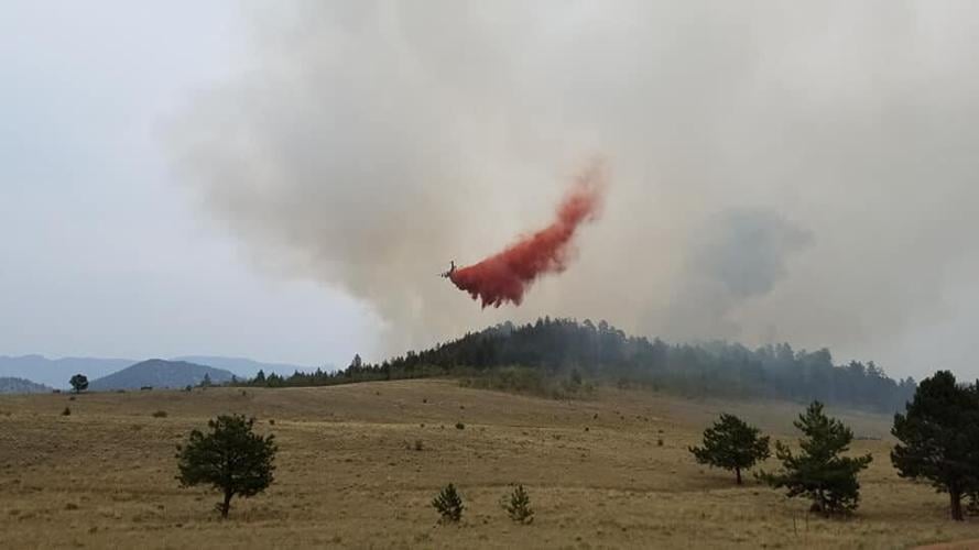
Photo courtesy George Argeropoulos.


Here’s a look at the size and other stats about Colorado’s wildfires, including the new Thorpe fire in Park County.
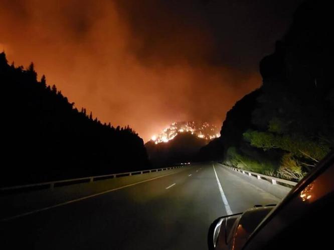
Grizzly Creek fire
Acres/Location: 32,060 acres/Glenwood Canyon
Containment: 61%
Started: Aug. 10, human caused
Firefighters: 775
Interstate 70 re-opened for through traffic between Gypsum and Glenwood Springs Monday after a short closure when the fire flared-up. Drivers are encouraged to be extremely careful and to drive slowly. No stopping is allowed and rest areas are closed. More sporadic closures are expected as mudslides and other events occur.
Flare ups in the center of the fire are possible as high temperatures, low moisture and windy conditions persist.
RELATED:
– Fire reported near Bishop Castle; pre-evacuation order issue for Willis Creek fire
– Poor air quality in Pikes Peak region ‘incredibly rare,’ Colorado meteorologist says
– Ash raining down on Colorado a sign of hotter, drier and more dangerous fire seasons
–Grizzly Creek fire increases flood risk in Glenwood Canyon
–Gov. Polis activates National Guard to assist with wildfire response
Pine Gulch fire
Acres/Location: 135,903/18 miles north of Grand Junction
Containment: 47%
Started: July 31, lightning
Firefighters: 932
Pine Gulch fire progression map
Burning north of Grand Junction, the fire continued to grow and became the second largest fire in Colorado history, behind only the 2002 Hayman fire.
Tuesday the fire became the state’s top priority fire, replacing the Grizzly Creek fire, as energy infrastructure is at risk.
Wind gusts up to 27 mph are expected Tuesday with temperatures near the low 90s. Thunderstorms forecast throughout the week pose a concern for high winds and lightening. But moistening rains could also follow.
Williams Fork fire
Acres/Location: 11,266/seven miles southwest of Fraser in the Arapaho and Roosevelt National Forests
Containment: 5%
Started: Aug. 14, human caused
Firefighters: 298
The fire threatened Henderson Mine and Mill but moved away from Fraser, Tabernash and Winter Park according to the U.S. Forest Service. Firefighters worked to create containment lines around the mine and mill Tuesday.
The fire is burning dry beetle-killed timber and is expected to continue until wetting rains or snow stop the flames.
Cameron Peak fire
Acres/Location: 21,017/West of Fort Collins, Arapaho and Roosevelt National Forests
Containment: zero percent
Started: Aug. 13, unknown cause
Firefighters: 722
Storms brought gusty winds Monday.
The fire still burned beetle-killed timber and threatened the City of Fort Collins water source.
Thorpe fire
Acres/location: 159/Pike and San Isabel National Forest, South Park Ranger District, off Forest Service Road 230 and Park County Road, west of Lake George.
Containment: 50%
Started: 1 p.m. Sunday, unknown cause
Firefighters: Forest Service fire resources including one bulldozer, one type 3 helicopter, three large air tankers and one very large air tanker
Crews continued to use natural and man-made barriers to contain the fire.
Two subdivisions in the Weber Park area received evacuation notices as the small blaze moved through grass and timber. There have been no reports of injuries, but some structures are threatened.
Evacuations were lifted late Monday, but residents remained on pre-evacuation status.
Lewstone fire
Acres/location: 165/Rist Canyon 15 miles northwest of Fort Collins
Containment: 100%
Firefighters: 100
Started: 2:30 p.m. Saturday, unknown cause
No air support was ordered Tuesday.
636-4809
@leslie_m_james