


Colorado Wildfires | Cooler temps could help firefighting efforts around state
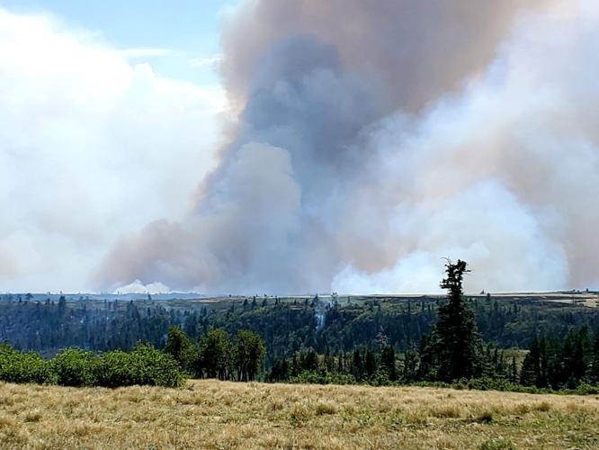
View of the East Fork fire on the Lake Dorothey State Wildlife Area adjacent to Fishers Peak State Park south of Trinidad on Friday.
Courtesy of Parks & Wildfire Park Manager Crystal Dreiling


Here’s a look at wildfires burning in Colorado:
Pine Gulch fire
Acres/Location: 139,007 acres/18 miles north of Grand Junction
Containment: 79%
Started: July 31, lightning
Firefighters: 686

The giant fire started by lightning on July 31 in a remote area north of Grand Junction quickly got out of control and has since grown to the largest wildfire in Colorado history as it races through grass, sage, pinyon-juniper and fir. The combination of drought, dry vegetation, unseasonably hot weather and steep terrain led to several weeks of explosive growth. In one night, the fire grew by 30,000 acres. As of Friday, it was estimated at just more than 139,000 acres, surpassing the 138,114-acre Hayman fire in 2002 as the state’s largest.
Despite its massive size, only one abandoned building has burned and no injuries have been reported.
Crews will continue to watch hot spots and control the fire’s spread Monday, which only grew one acre overnight.
A red flag warning was issued Monday cautioning firefighters about the the likelihood of dry and windy weather. Gusts could reach up to 30 mph and humidity will remain low. Evening thunderstorms could brings flash-flooding and temperatures are expected to stay in the 80s.
Firefighters expect to reach full containment by Oct. 15.
Grizzly Creek fire
Acres/Location: 32,464 acres/Glenwood Canyon
Containment: 73%
Started: Aug. 10, human caused
Firefighters: 626
The Grizzly Creek fire erupted outside of Glenwood Springs and surrounded Interstate 70 between Gypsum and Glenwood Springs consuming a mix of oak brush, conifer and Aspens. Because of the fire’s proximity to the highway it has often been the state’s top priority in firefights this month.
Monday’s weather outlook is not necessarily a positive factor as dry conditions and winds up to 40 mph threaten firefighting efforts.
“If we get any spotting or flare ups, we’ll have personnel in the appropriate places to take action,” according to the Operations Planning Section Chief Karen Scholl with the Alaska Incident Management Team. “We have safety zones for firefighters identified if we need them.”
Interstate 70 drivers should expect sporadic delays as crews repair power lines and drivers should be aware of hazardous weather forecasts that include flash floods in the case of strong rains.
Officials predicted the fire would be fully contained by Sept. 18 but expended the date to Oct. 18.
RELATED:
– Fire reported near Bishop Castle; pre-evacuation order issue for Willis Creek fire
– Poor air quality in Pikes Peak region ‘incredibly rare,’ Colorado meteorologist says
– Ash raining down on Colorado a sign of hotter, drier and more dangerous fire seasons
–Grizzly Creek fire increases flood risk in Glenwood Canyon
–Gov. Polis activates National Guard to assist with wildfire response
Williams Fork fire
Acres/Location: 12,097 acres/seven miles southwest of Fraser in the Arapaho and Roosevelt National Forests
Containment: 10%
Started: Aug. 14, human caused
Firefighters: 361
The Williams Fork fire is burning on the Arapaho and Roosevelt National Forests and Pawnee National Grassland seven miles southwest of Fraser. The human-caused fire started near the Henderson Mill Aug. 14 and quickly grew due to high winds and steep slopes. Local firefighters immediately responded, but hot, dry and windy conditions allowed the fire to race through the timbered crowns of the lodgepole pine, fir and aspen forest.
Cold weather Monday is expected to bring rain, lower temperatures, and wind with gusts up to 45 mph.
The fire is not expected to threaten Fraser, Tabernash and Winter Park. Some residents’ pre-evacuation orders were lifted Sunday and others were lifted Friday.
The fire is not expected to be fully contained until Oct. 31.
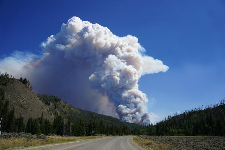
Cameron Peak fire
Acres/Location: 23,022 acres/West of Fort Collins, Arapaho and Roosevelt National Forests
Containment: zero percent
Started: Aug. 13, unknown cause
Firefighters: 893
The Cameron Peak fire ignited on Aug. 13 on the Arapaho and Roosevelt National Forests near Cameron Pass and Chambers Lake. It is burning in heavy timber stands over rugged terrain. Hot, dry, windy weather, combined with critically dry fuels have kept firefighters from slowing its spread.
Response to the fire grew by more than 100 people over the weekend with a total of 893 firefighters.
Crews are working to construct containment lines as well as protecting structures.
Cooler weather with wind gusts up to 35 mph are expected Monday.
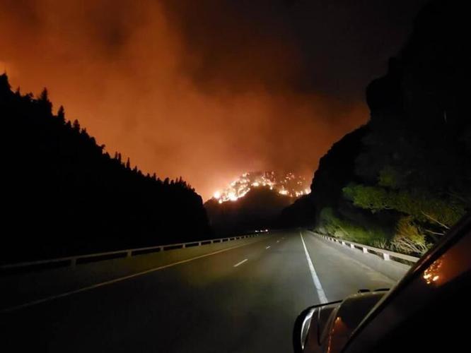
East Fork fire
Acres/location: 1,680 acres/11 miles southeast of Trinidad
Containment: 15%
Started: Aug. 22, lightning
Firefighters: 95
The fire is burning on two state wildlife areas near the New Mexico border: James M. John State Wildlife Area and Lake Dorothey State Wildlife Area. Winds pushed the fire to the south toward the Colorado/New Mexico border, resulting in the evacuation of Sugarite Canyon State Park in New Mexico. The park is located on the Colorado–New Mexico state line 6 miles northeast of Raton, N.M. Although the fire remains in Colorado, a watershed near Raton is threatened and has seen some impact above Lake Dorothy.
The fire’s response teams nearly doubled over the weekend to 95 total firefighters.
Crews are working to create containment lines along natural barriers. Teams are using air support to attack the fire, including the use of two large air tankers and two Blackhawks from the Colorado National Guard.
Lake Dorothy is closed as helicopters use the lake to carry water to the fire.
East Fork fire. Courtesy of Colorado Department of Public Safety.

Here’s what to know about the federal ban threatening the market for THC-infused drinks and snacks
Gene Johnson
gene.johnson@associatedpress.com
Updated 39 minutes ago
MINNEAPOLIS (AP) — The production lines at Indeed Brewing moved quickly, the cans filling not with beer, but with THC-infused seltzer. The product, which features the compound that gets cannabis users high, has been a lifeline at Indeed and other...
Gene Johnson
Reporter

Denver area events for Nov. 28
Carlotta Olson
carlotta-olson@denvergazette.com
Updated 15 hours ago
If you have an event taking place in the Denver area, email information to carlotta.olson@gazette.com at least two weeks in advance. All events are listed in the calendar on space availability. Friday Street Fair and Artisan Market — 11 am.-6 p.m., The...
Carlotta Olson
Reporter

Broncos make it clear the goal of having AFC’s top playoff seed
Chris Tomasson
chris.tomasson@gazette.com
Updated 5 hours ago
ENGLEWOOD – The Broncos have made it clear. They’re looking to end up with the No. 1 playoff seed in the AFC. Entering Sunday night’s game at Washington, the Broncos are 9-2 and a half-game behind 10-2 New England for...
Chris Tomasson
Reporter

Ex-Broncos coaches Gary Kubiak, Wade Phillips call for Vance Joseph to again be NFL head coach
Chris Tomasson
chris.tomasson@gazette.com
Updated 7 hours ago
ENGLEWOOD — Former Broncos head coaches Gary Kubiak and Wade Phillips have both been following Vance Joseph’s career closely for much of this century. Both now see him ready to be an NFL head coach again. Joseph, 53, was the...
Chris Tomasson
Reporter

Trump: One of the two National Guard members has died
Wire Services
wire-services@denvergazette.com
Updated 3 hours ago
The Denver Gazette wire services WEST PALM BEACH, Fla. — President Donald Trump said that one of the two West Virginia National Guard members shot by an Afghan national near the White House had died, calling the shooter who had...
Wire Services
Reporter

Colorado College hoping growth, maturity pay off against third straight ranked foe in No. 16 Providence
Hugh Johnson
hugh-johnson@denvergazette.com
Updated 5 hours ago
Colorado College has learned tough lessons from playing top-ranked opponents, but now the Tigers are hoping to earn tough wins alongside them. CC hockey hosts No. 16 Providence at Ed Robson Arena during this holiday weekend. Puck drop is 7...
Hugh Johnson
Reporter

Air Force hockey looks to stay hot on the road, challenges Canisius after Thanksgiving holiday
Hugh Johnson
hugh-johnson@denvergazette.com
Updated 5 hours ago
The Falcons have much to be thankful for this holiday week. Air Force hockey is 6-2 in its last eight games. The Falcons (7-6-1, 4-4) are coming off a series sweep of rival Army at West Point, New York, the...
Hugh Johnson
Reporter

Amid rising food needs, a Thanksgiving community meal in Aurora aims to bring joy
Bernadette Berdychowski
bernadette.berdychowski@denvergazette.com
Updated 9 hours ago
On the road leading to Salvation Army’s Aurora Corps, several volunteers wearing inflatable snowman, reindeer and penguin costumes pranced around the sidewalk on Thanksgiving Thursday with bells and signs saying “free food.” Another wave of volunteers greeted guests telling them...
Bernadette Berdychowski
Reporter

How to watch Air Force football at Colorado State on Black Friday
Brent Briggeman
brent-briggeman@denvergazette.com
Updated 10 hours ago
The season and a longstanding series come to an end as Air Force and Colorado State square off in the 2025 season finale before splitting off into separate conferences. Air Force (3-8, 2-5 MW) at Colorado State (2-9, 1-6) Kickoff: 1...
Brent Briggeman
Reporter

Enhanced Games to offer performance enhancers – and stock – to the public
The Associated Press
the-associated-press@denvergazette.com
Updated 10 hours ago
The no-drug-testing Enhanced Games is going public in two ways — with a new listing on the Nasdaq stock exchange and also by offering a direct-to-consumer business focused on performance products in a move it says “aims to democratize access...
The Associated Press
Reporter