







‘Inundated roads, mudslides, and debris flows,’ warns National Weather Service ahead of weekend storms
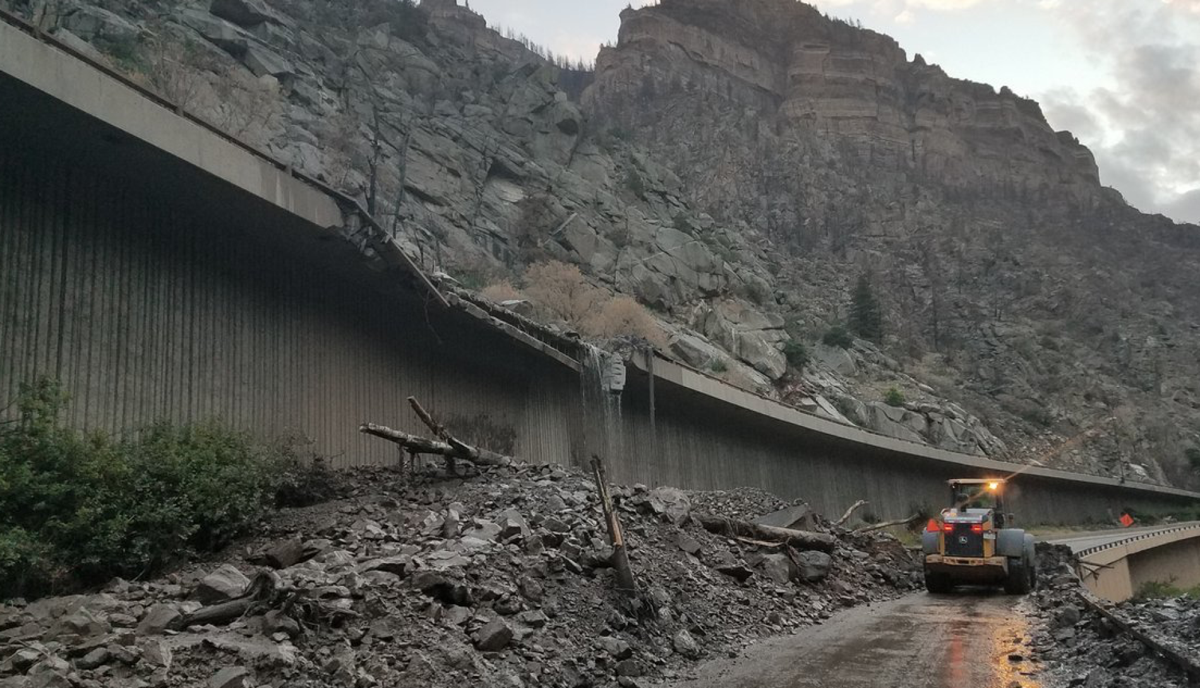
Colorado could see five consecutive days of flash flooding as heavy monsoon rains continue to pour down across parts of the state.
Heavy monsoon rains are expected to kick off again this weekend with flash flooding possible across south-central and southeast portions of the state, extending from Friday through Tuesday.
Flash flooding will be possible each day from today through Tuesday, especially over the mountains and valleys. On Saturday, significant flash flooding will be possible. Never drive into a flooded area. #cowx pic.twitter.com/wzdHKx83I8
— NWS Pueblo (@NWSPueblo) July 30, 2021
The National Weather Service (NWS) says significant flash flooding is likely on Saturday warning of “inundated roads, mudslides, and debris flows.”
Thunderstorms are expected to produce rainfall amounts of one to two inches in less than an hour on Saturday.
Flash flooding is possible over the mountains and valleys. The Cameron Peak, East Troublesome, Williams Fork, and Calwood burn scar areas and the Chalk Cliffs Region will also see an elevated risk.
⚠ Flash Flood Watches Expanded ⚠
The Flash Flood Watch has been expanded into the I-25 Corridor/Palmer Divide/South Park. This will go into effect at 6:00 PM this evening. Heavy rain will be possible through tomorrow evening. #cowx pic.twitter.com/QDiAlhgBXc
— NWS Boulder (@NWSBoulder) July 30, 2021
DISCOUNT: Help support OutThere Colorado through our online store. Explore t-shirts, hoodies, gaiters, mugs, stickers & more. Use code OTCGEAR15 at checkout for 15% OFF.
Several flash flood watches have been issued across the state, stretching through late Saturday evening, according to the National Weather Service.
Thunderstorms capable of producing flash flooding will be possible across the central mountains this afternoon and evening. The Chalk Cliffs will be most vulnerable to flash flooding. Do not drive through flood waters across roadways. #cowx pic.twitter.com/hXoRDf5o4s
— NWS Pueblo (@NWSPueblo) July 30, 2021
Lake, Chaffee, Douglass, Gilpin, Clear Creek, Larimer, Boulder, Jefferson, Douglas, Park, Broomfield, Adams Arapahoe, Denver, Elbert, Weld.
Several mountain towns and high country areas will also be impacted including Eagle, Edwards, Glenwood Springs, Carbondale, Basalt, Aspen, Vail, Snowmass, Buford, Trappers Lake, Columbine, Hahns Peak, Toponas, Skyway, Crested Butte, Taylor Park, Marble, Telluride, Ouray, Lake City, Silverton, Rico, Hesperus, Breckenridge, Williams Fork Mountains, Glendevey, Indian Peaks, Nederland, Eisenhower Tunnel, Kremmling, Mount Evans, Grand Lake, Cameron Pass, Berthoud Pass, Winter Park, Granby, Hot Sulphur Springs, Kenosha Mountains, Estes Park, Dillon, Fraser, and Walden.
Editor’s Note: Get to higher ground if flash flooding is possible. Remember to never drive through flooded roadways. Avoid flooding-prone areas including canyons, rivers, and burn scars, before, during, and after rainfall. Get the latest on the forecast with the National Weather Service. Find more tips on what to do in a flash flood here.