




300 homes evacuated as Colorado wildfire burns, drone incursion investigated by officials
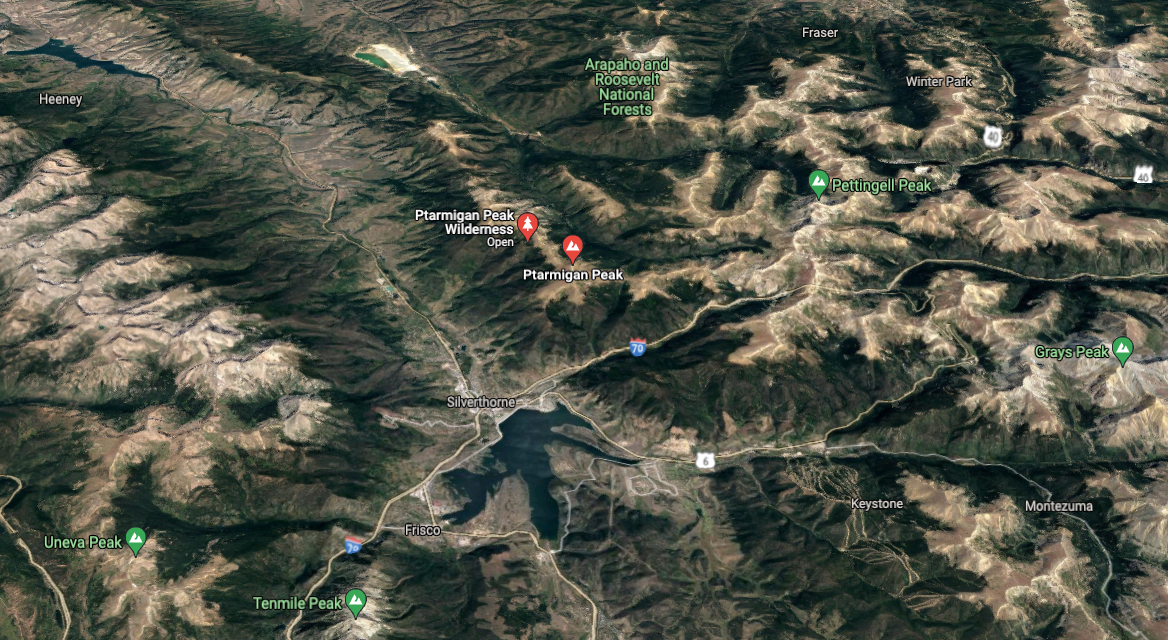
UPDATE: This fire has continued to grow, pushed by winds to the south. See our most recent article about this blaze here.
According to a Tuesday morning update from the US Forest Service, approximately 300 homes have been evacuated in Summit County due to a wildfire burning northeast of Silverthorne.
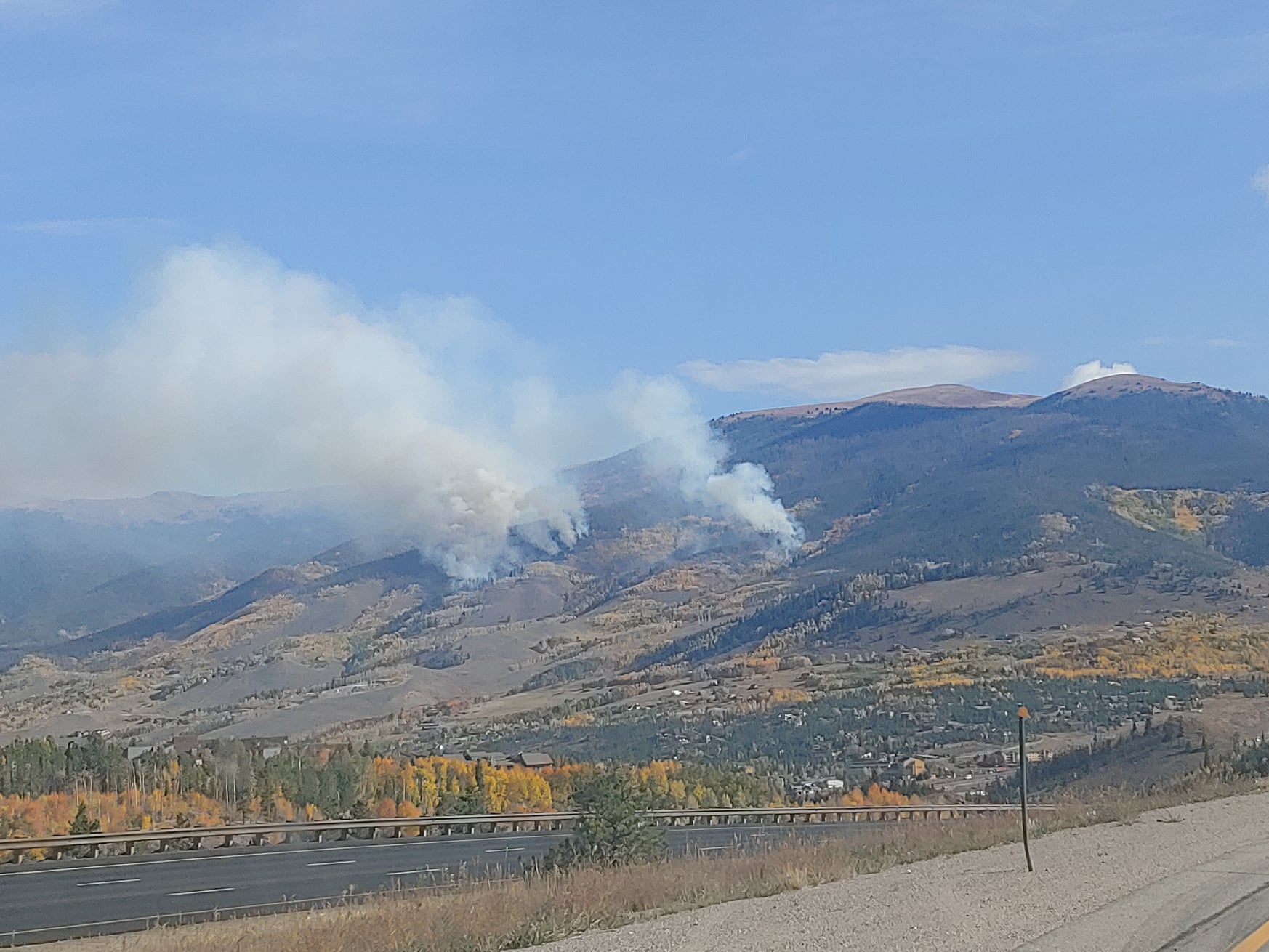
Dubbed the Ptarmigan Fire, found on Ptarmigan Peak, the blaze is now estimated to be 20 acres in size. This is a downgrade from a Monday night estimation of 30 to 40 acres. The fire continues to burn through heavy mixed forest consisting of aspen, dead-standing and downed lodgepole pine, and spruce.
Additional resources are arriving on the scene throughout Tuesday, with air operations resuming. On Monday, the fire was too dangerous to fight from the ground, making air operations crucial. A key concern today will be utilizing a fight from the air to keep the blaze from moving downslope toward structures.
It is unclear if the ground crew has been able to directly engage the blaze on Tuesday following the high-risk scenario on Monday. It was noted that ground crew members have been staged in specific areas with the goal of structural protection.
Officials are reminding the public to keep all personal drones out of the sky, as this forces all firefighting aircraft to stop flying. With an aerial assault being the most feasible way of stopping this blaze at this time due to risks associated with the ground fight, this is hugely detrimental to the firefighting effort. On Monday night, a drone incursion did occur over the fire. That is currently being investigated by law enforcement.
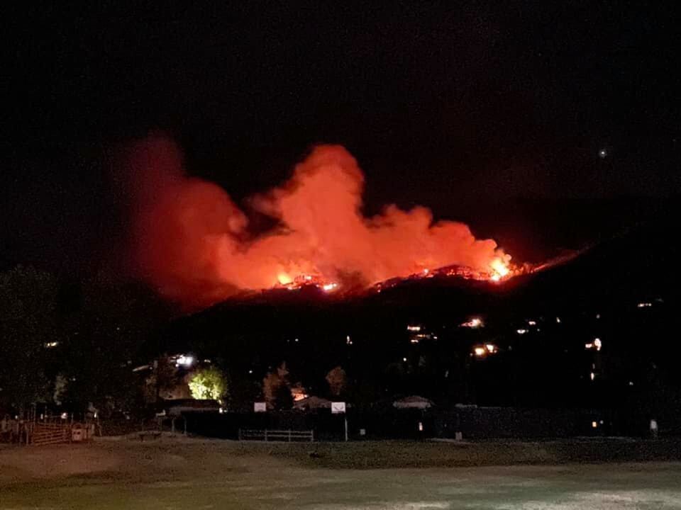
After the fire was first reported at around 4:30 PM on Monday, evacuation orders soon followed. As of Tuesday morning, the evacuation orders are for roughly 300 homes in the Hamilton Creek Neighborhood. Angler Mountain, South 40 neighborhoods, Fly Line Drive, and Bald Eagle Road (west of the bridge) are on pre-evacuation notice.
Multiple agencies have responded to the scene, including the US Forest Service, Summit Fire & EMS, Clear Creek Fire, Eagle River Fire, East Grand Fire, Grand Lake Fire, Greater Eagle Fire, Vail Fire, and Leadville/Lake County Fire Rescue.
Official information can be found on the InciWeb page for the fire.
STAY INFORMED: Sign-up for the daily OutThere Colorado newsletter here
Get OutThere
Signup today for free and be the first to get notified on new updates.
PREV
PREVIOUS
Bear
The bear that was hit by a vehicle Friday morning in Littleton on Kipling Pkwy was one we had relocated previously. This is actual video of that bear’s release when it was relocated back in 2015. pic.twitter.com/4cfbKwBbeQ — CPW NE Region (@CPW_NE) September 24, 2021

COVID-19 spread in Colorado may be slowing slightly: Polis
The spread of COVID-19 may be slowing across Colorado, while hospitals in El Paso County and elsewhere are getting stretched thin by demands. State data shows the seven-day average of new cases has fallen from 1,985 on Sept. 16 to 1,441 on Sunday. “We seem to be in a plateau to slight decline,” Gov. Jared […]