


Up to 18 inches of snow expected in Colorado in first of three “disturbances”
Kissalo
According to the National Weather Service, “a series of disturbances within a deepening trough” are set to drop both temperatures and snow around the state of Colorado from late Friday into Monday. Three weather events, what the Service is calling “disturbances,” are expected to take place over this period.
UPDATE: Here’s a link to a newer article with a more up-to-date forecast showing up to 24 inches over the weekend in some areas.
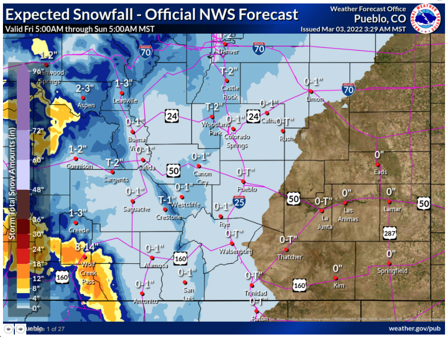
During the first “disturbance,” set to take place late Friday into Saturday, the Central and Sangre de Cristo Mountains will likely see two to four inches of snow. During this time, much higher totals are expected in Southwest Colorado’s San Juans, where projected totals range from 12 to 18 inches. Portions of the mountains northeast of Steamboat Springs may also get more than a foot.
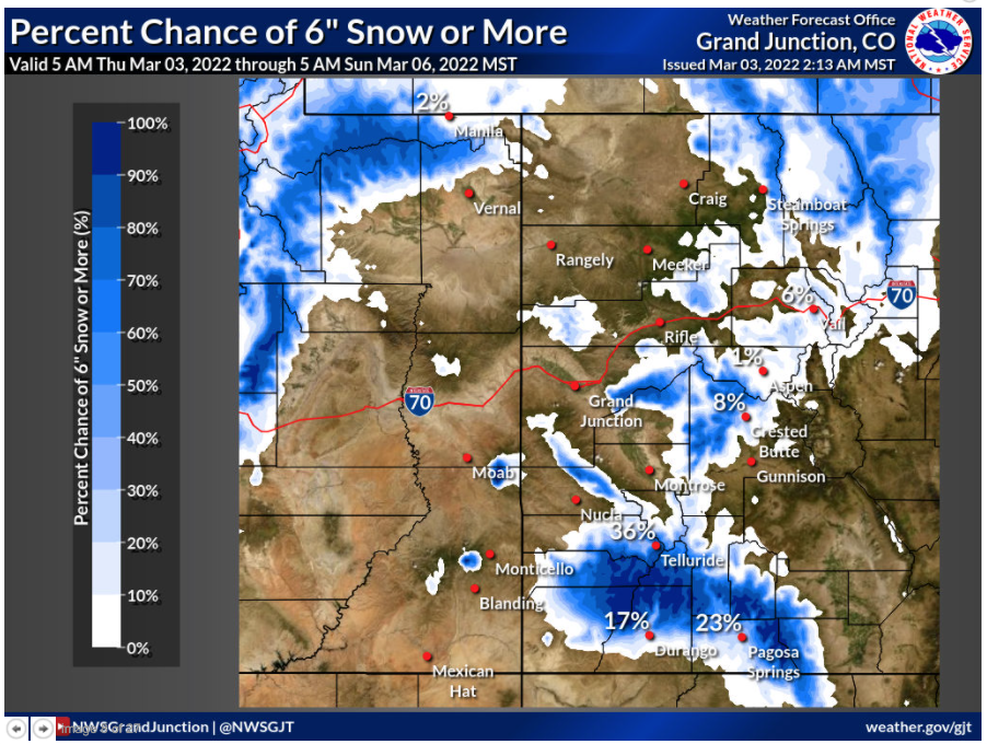
This map shows the percent chance that an area will get hit with six inches of snow or more. Note that this map is not centered on the state, but the state's western border. Map Credit: National Weather Service.

This map shows the percent chance that an area will get hit with six inches of snow or more. Note that this map is not centered on the state, but the state’s western border. Map Credit: National Weather Service.
This first disturbance will also bring a chance of precipitation over the Front Range and in the plains, but don’t expect much snow.
The map basically the snow forecast for the first of three disturbances. Photo Credit: National Weather Service.

The map basically the snow forecast for the first of three disturbances. Photo Credit: National Weather Service.
The second “disturbance” will take place on Sunday. This wave of weather is expected to plummet temperatures and bring a chance of snow to the Eastern Plains and mountain region.
A third “disturbance” on Monday will bring more snow to the state, but this will mostly be restricted to the mountain region.
Expected totals for the entire weekend, including the second and third wave of snow, will continue to solidify as this storm approaches.
While weather probably won’t be much of a concern for Front Range travelers, delays could be present in the mountains. The biggest issues will likely be found in the southwest, central, and northwest portions of the state.
After this weekend, there’s more snow in the forecast for next Wednesday.
Find official updates from the National Weather Service here.
STAY INFORMED: Sign-up for the daily OutThere Colorado newsletter here