


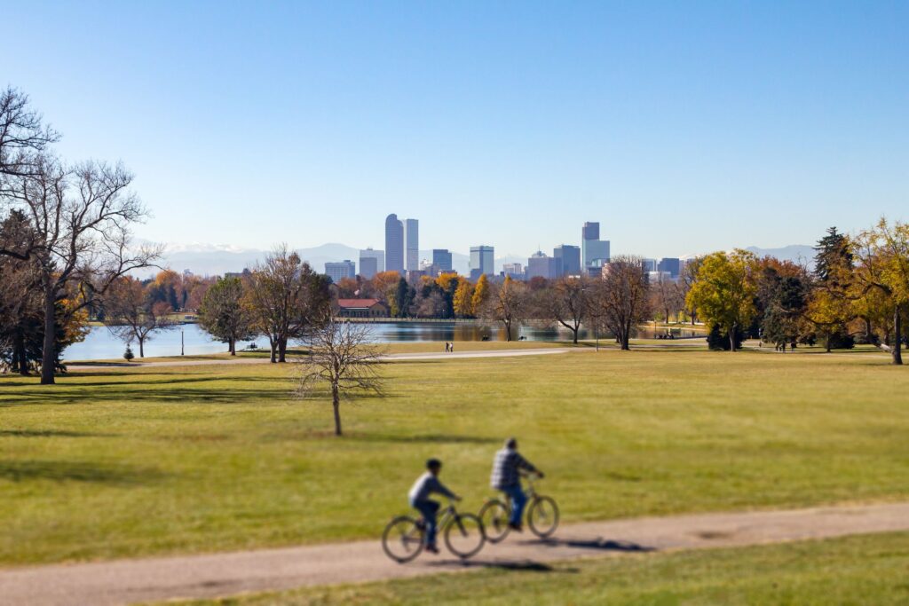
Officials eye completion of 63-mile trail through Colorado mountains

A scenic Colorado bike trail many years and many dollars in the making is down to the last 12 miles.
Work has been underway this summer on a stretch of pavement connecting Dotsero to Gypsum — one of the last four segments needing construction to realize the full Eagle Valley Trail. Once complete, cyclists will be able to pedal 63 miles between the top of Vail Pass to Glenwood Canyon without using the highway.

The Eagle Valley Trail connects the communities of Eagle County and passes scenic points along the way. Once complete, it will cover 63 miles of pavement away from the highway. Photo courtesy Eagle County Government
For the extra bold, that won’t be the only possibility, said Kevin Sharkey, trails program manager for Eagle County. Linking with other pavement, Eagle Valley Trail will allow for riding close to 140 miles from Breckenridge to Aspen off the highway.
STAY INFORMED: Sign-up for the daily OutThere Colorado newsletter here
“Anybody interested in sustainable tourism or bike tours, this should be on their list of places to go,” Sharkey said. “Just because it’s a safe way to cover a lot of miles in a beautiful part of the country.”
While eco-tourism is one consideration, Eagle Valley Trail was more so envisioned to connect residents across Eagle County, from Vail to Minturn to Edwards on west through Eagle.
The idea is to “shift to greener, healthier and more inclusive travel” and “ensure our communities have safe routes that are accessible for all ages, abilities and budgets,” explains the initiative’s website. The trail connects to bus stops, places of work and open spaces.
Sharkey traced the idea to 1996, when a sales tax program was born to fund the regional trail. Since then, more money has come from local governments, state and federal grants and various donors.
The latest major commitment: county commissioners’ $22 million pledge last year, through borrowing that put several county buildings up as collateral.
“That speaks directly to this project and how important it is,” Sharkey said.
For the final 12 miles, it’s expected to take $38.2 million. The biggest gap of trail is between Edwards and Wolcott.
“We saved the most difficult and most expensive segments for last,” Sharkey said. “Here we are in the middle part of the county, and it’s gonna be expensive because it’s narrow, and it’s gonna take a lot of retaining walls and several bridges.”
Pending fundraising, he said the goal is to finish in 2024.

Map showing progress on the Eagle Valley Trail
STAY INFORMED: Sign-up for the daily OutThere Colorado newsletter here
Higher home values, abatements to push DPS tax bills up in 2025
Nico Brambila
nico-brambila@denvergazette.com
Updated 2 hours ago
Denver homeowners will pay more in school taxes next year even though Denver Public Schools (DPS) slightly lowered its overall tax rate. The increase is being driven by rising assessed home values, a full 52.142-mill levy and a dramatic increase...
Nico Brambila
Reporter
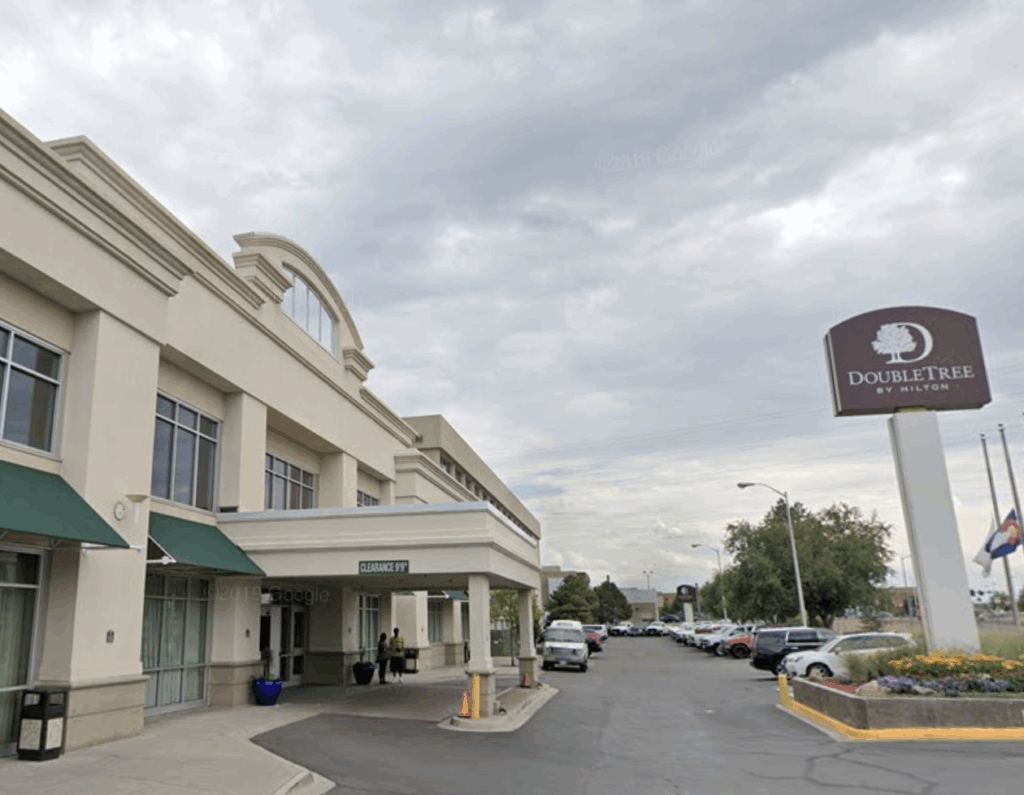
Denver approves $30M shelter contract with Urban Alchemy
Deborah Grigsby
deborah.smith@denvergazette.com
Updated 3 hours ago
With a 9-4 vote, Denver City Council members approved a new $30 million, three-year contract with Urban Alchemy, a San Francisco-based nonprofit, to run The Aspen, a former DoubleTree Hotel that has been turned into a homeless shelter. More than...
Deborah Grigsby
Reporter
Nicole Harrison will give you the shirt on your back
John Moore
john.moore@denvergazette.com
Updated 2 hours ago
2025 DENVER GAZETTE TRUE WEST AWARDS: DAY 9 Prolific costume designer had a hand in the making of 60 theatrical endeavors in 2025, surely the most of anyone in Colorado I’m pretty sure I first met Nikki Harrison in 1995...
John Moore
Reporter

Trump administration announces $12 billion soybean aid package
RACHAEL WRIGHT Special to The Gazette
rachael-wright-special-to-the-gazette@denvergazette.com
Updated 4 hours ago
President Donald Trump and Secretary of Agriculture Brooke Rollins announced Monday that the administration was planning to disburse a $12 billion dollar aid package as part of the Farmer Bridge Assistance (FBA) Program, to make targeted, one-time payments to crop...

Adams County officials call for resignation of county treasurer after ‘inappropriate behavior’
9News
9news@denvergazette.com
Updated 5 hours ago
Adams County Commissioners requested the resignation of the county’s treasurer after multiple allegations of inappropriate behavior toward staff members, but he has declined to step down. An independent investigation found multiple allegations against County Treasurer Alex Villagran to be credible,...
9News
Reporter

Warm up with cocoa, champurrado, and atole recommended by Denver foodies
Emily Bejarano
emily-bejarano@gazette.com
Updated 3 hours ago
Not a coffee drinker? Sip your way to happiness with these hot cups of chocolatey, corny goodness On a snowy day in Denver, nothing hits the spot quite like a warm cup of cocoa – that is, if you’re not...
Emily Bejarano
Reporter
Federal judge rejects Tina Peters’ request for release pending appeal
Michael Karlik
michael-karlik@denvergazette.com
Updated 5 hours ago
A federal judge rejected the petition of former Mesa County clerk Tina Peters on Monday to be released from incarceration pending the resolution of her criminal appeal. Chief U.S. Magistrate Judge Scott T. Varholak wrote in a Dec. 8 order...
Michael Karlik
Reporter
Denver explores moving city to biennial budget
Deborah Grigsby
deborah.smith@denvergazette.com
Updated 6 hours ago
The Denver City Council is considering moving the city to a two-year budget cycle, with the option to revert to a one-year cycle during “economic uncertainty.” The proposed measure, put forth during Monday’s Budget and Policy Committee meeting, aims to...
Deborah Grigsby
Reporter

Lakewood police still investigating burglary turned homicide
Sage Kelley
sage-kelley@denvergazette.com
Updated 5 hours ago
The Lakewood Police Department is investigating an alleged burglary that ended in a homicide Saturday evening. Police responded to 300 S. Kendall St. — in a cul-de-sac next to West Alameda Avenue — Saturday evening after someone reported that a...
Sage Kelley
Reporter
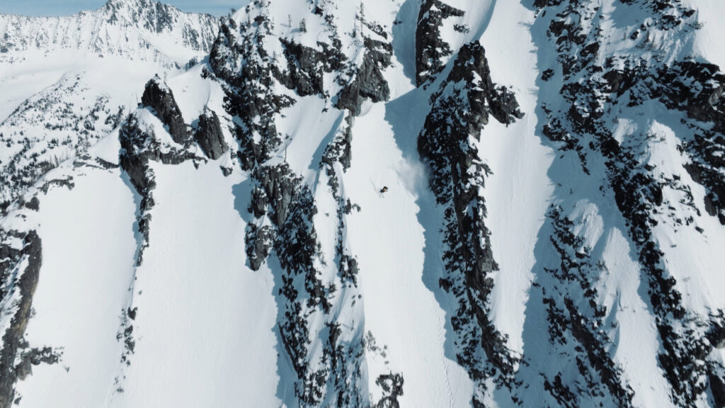
Ski film “Inaccessible” premieres in Boulder, looks at public land access from a skier’s perspective
Jonathan Ingraham
jonathan.ingraham@denvergazette.com
Updated 2 hours ago
There are approximately 640 million acres of public land in the United States but roughly 16 million acres of that land is ‘landlocked’ by private owners, making the land inaccessible. Knowing how to access these public lands is another challenge....
Jonathan Ingraham
Reporter
PREV
PREVIOUS

Overnight rescue saves exhausted hiker on remote Colorado mountain pass
Facebook Twitter WhatsApp SMS Email Print Copy article link Save Facebook Twitter WhatsApp SMS Email Print Copy article link Save Late on Monday night, Custer County Search and Rescue was activated to save a cold and exhausted climber on Broken Hand Pass, located below Crestone Needle and in the Sangre de Cristos. The report of […]

Three Colorado cities ranked among most 'dog-friendly' spots in country
Facebook Twitter WhatsApp SMS Email Print Copy article link Save Facebook Twitter WhatsApp SMS Email Print Copy article link Save Three Colorado cities have been deemed among the most ‘dog-friendly’ spots in the country, according to a recent data analysis conducted by LawnStarter. Lawnstarter considered 24 different metrics across 174 of the country’s largest cities […]