


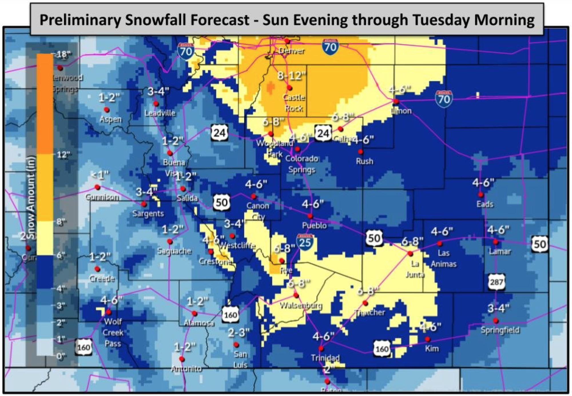
Up to 12 inches of snow could hit Denver in second weekend storm, says NWS
Following a wave of wintery weather set to hit the southeastern part of Colorado, more snow will likely be on the way.
According to the National Weather Service, big snow totals may hit the Front Range and Eastern Plains between Sunday night and Tuesday morning. An initial snow forecast is showing the possibility of eight to 12 inches in the Denver area, with four to six inches landing in Colorado Springs and six to eight inches in the area of Walsenburg.
Strong winds will also hit, likely up to 40 miles per hour. Slick roads and poor visibility may make travel difficult.
See the initial snowfall forecast that has been released below. Note that expected totals may be subject to major changes, per the National Weather Service, as this storm is still several days out. A statewide map will be released in upcoming days.
Find updates to the forecast on the National Weather Service website.
STAY INFORMED: Sign-up for the daily OutThere Colorado newsletter here
Get OutThere
Signup today for free and be the first to get notified on new updates.
PREV
PREVIOUS

Top Nikki Haley staffer joins Mike Pence
A top staffer for Nikki Haley, former United Nations ambassador and possible 2024 hopeful, joined Mike Pence’s camp. Tim Chapman departed his role as executive director at Haley’s political nonprofit group, Stand for America, to join Pence’s Advancing American Freedom, Politico reported. Chapman has served as a major player in the conservative movement for some […]
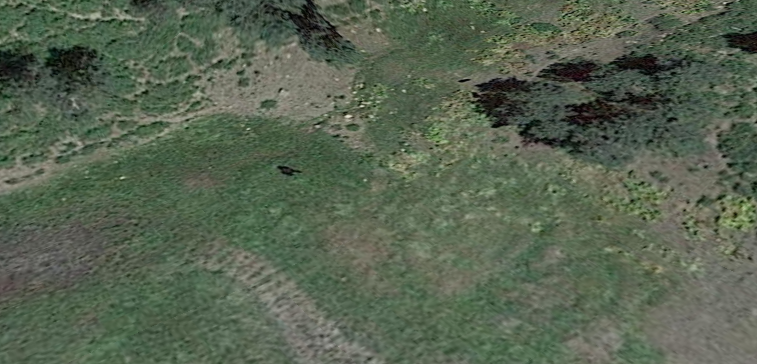
Person claims to have spotted Bigfoot on satellite image of Colorado landscape
Whether you know him as Bigfoot or Sasquatch, the ever-elusive ape-like creature that supposedly lurks in the Colorado wilderness has been spotted again–or has it? Reddit user u/33sushi, recently shared a Google Earth satellite image of what he believes could be the hairy beast. “Is it a bear? A puddle? A hiker without any gear? […]