


Significant spring snowstorm to impact the Front Range, Palmer Divide this week
A significant snowstorm is expected to impact areas along the Front Range and Palmer Divide early this week, with the National Weather Service (NWS) calling for up to two feet of snow to fall in some regions.
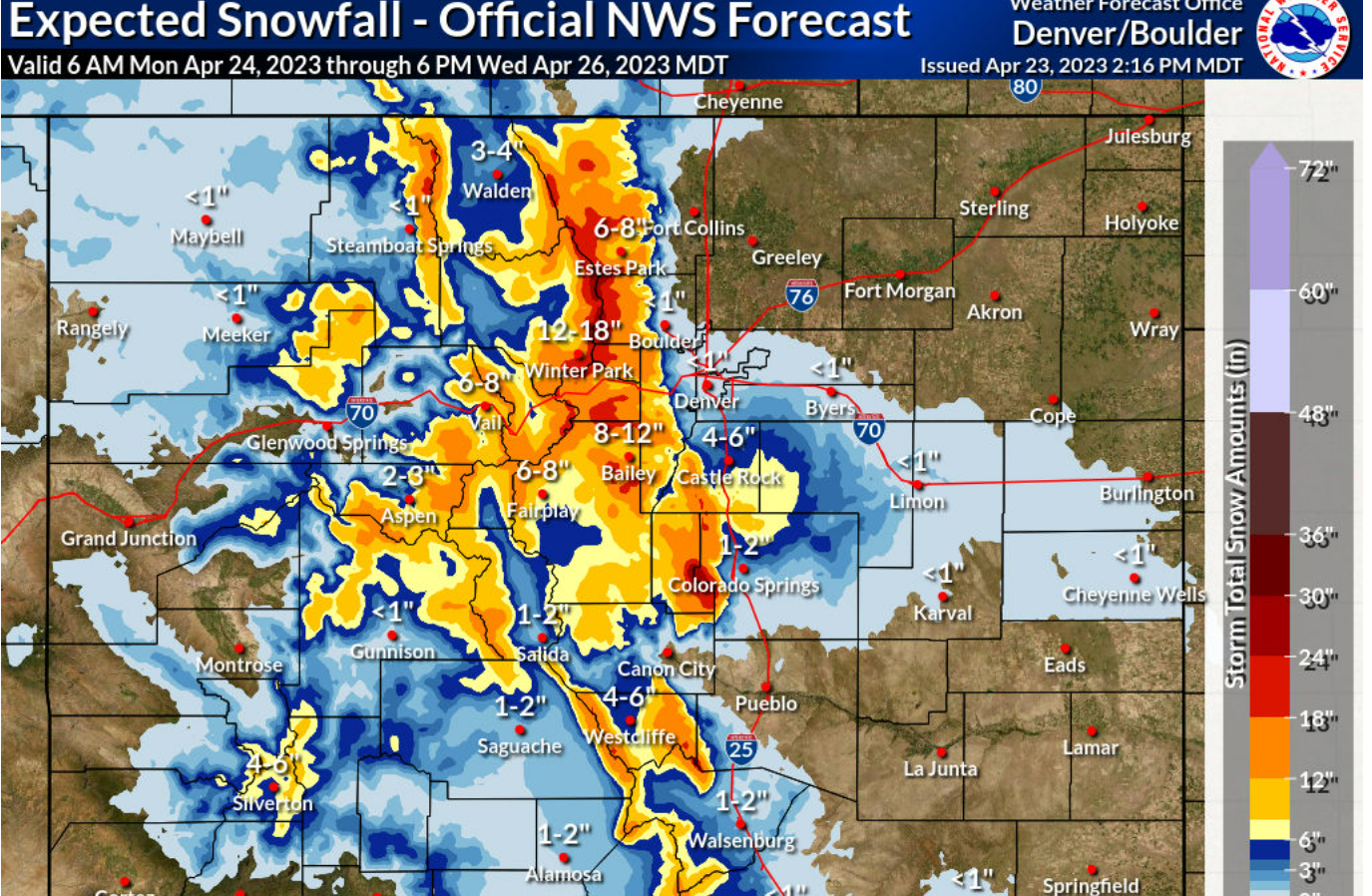
According to the NWS, snowfall will likely begin as early as Monday and will continue through Wednesday, with the heaviest periods of snowfall expected midday on Tuesday.
“Widespread storm total snowfall amounts between 1 and 2 feet are expected for a good portion of the Front Range mountains and upper elevations of the foothills. Snowfall rates of 2 inches per hour will be possible during the heavier snowfall, and travel will likely be very difficult during this period,” NWS said.
The ‘expected snowfall’ forecast for Monday through Wednesday has been released, and can found on the map below.
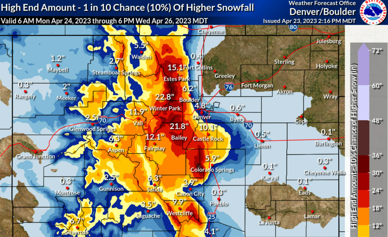
The ‘high end amount’ forecast, which has a 10 percent chance of taking place, shows significantly higher snowfall totals. If this scenario plays out, a much larger portion of Colorado’s Front Range mountains could see a foot or more of snow. This could result in serious travel impacts.
“Snow levels will lower Tuesday night, and may result in impactful snow accumulations for some of the lower elevations, particularly the Palmer Divide,” the service said.
Find additional updates on the National Weather Service website.
STAY INFORMED: Get free Colorado news with our daily newsletter (Click here)

Get OutThere
Signup today for free and be the first to get notified on new updates.