







Colorado Springs weather updates: Flood watch in effect; cars stranded, roads closed, flights delayed after downpour

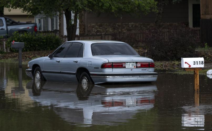
A car sits partially submerged in flood waters after rain hammered the southeast part of Colorado Springs Monday. (Screenshot via Colorado Springs Fire Department tweet)
Colorado Springs Fire Department
Severe thunderstorms rolled in the Pikes Peak region Monday, bringing heavy rain, flooding and hail to Colorado Springs and surrounding areas. The National Weather Service in Pueblo has issued a constant string of advisories today, including a tornado warning for southeast El Paso County.
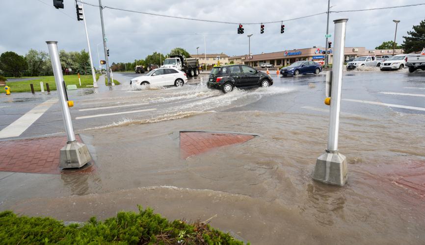
Flooding has shut down multiple roads throughout the city and the Colorado Springs police department is on accident alert.
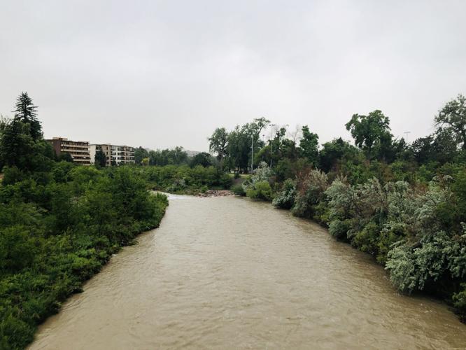
The weather service reports that widespread, heavy rainfall has impacted rivers and creeks in both Teller and El Paso counties, and continuing rain for the next 24 hours will continue to causes elevated water levels and possible flooding. The weather service says particular areas of concern include the Monument and Fountain creeks “where homeless communities are at notable risk.”


Have weather photos you’d like to share? Send them to [email protected]
Here are the latest weather updates:
4 p.m. update
The El Paso County Department of Public Works has listed the following road closures in the county:
- Peyton Highway (half mile south of County Line)
- Galley Road and Peterson
- Garret Road between E. Blaney and Good Fortune)
- Judge Orr from Curtis to Elbert
- Elbert (1 mile north of Murphy)
- Security and Main Street
- Widefield and Fontaine
- Sunny Slope (half mile east of Blaney Road)
- Bradley Road under Academy Boulevard
Also: Fort Carson’s Gate 4 is closed due to flooding. Milton E. Proby near the airport has reopened.
2:45 p.m. The Colorado Springs Fire Department reports vehicles are stranded in moving water, and posted a video of partially submerged cars in southeast Colorado Springs near Hancock and Clarendon.
#ColoradoSpringsFire. Colorado Springs has Flooding on roadways in areas. vehicles are stranded In moving water. A vehicle can be swept away into faster moving drainages in 6 inches of water. Stay dry and please don’t walk or drive across any roadways covered in water. pic.twitter.com/NwAepAapt1
— CSFD PIO (@CSFDPIO) June 12, 2023
2:25 p.m. update
Several flights are delayed in and out of Colorado Springs Airport. Click or tap here for the latest flight schedules.
2:20 p.m. update
The Peterson and Schriever Space Force Base has implemented an early release for personnel. Due to extensive flooding, multiple gates are closed, as well as the fitness and aquatics center.
1:45 p.m. update
Traffic:
- Marksheffel is closed between Barnes and North Carefree because of flooding. Drivers are reminded not to drive through water-covered roads. The Colorado Springs Police Department is also on accident alert.
- The Colorado Springs Airport is also reporting that there are road closures surrounding the airport. The Colorado Springs Fire Department reports that one of those roads is Milton E. Proby. The airport has also urged travelers to check the status of their flights.
- Hancock Expressway is closed at Chelton Road; Main Street and Security Boulevard are also closed, according to Mountain Metro.
Weather advisories:
- A tornado warning is in effect for southeast El Paso County. The area is south of Fountain and includes Hanover.
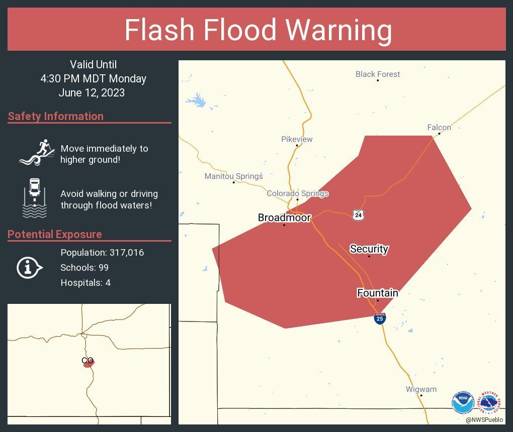
- A flash flood warning is in effect until 4:30 p.m. for northeastern El Paso County; areas affected include Calhan, Ramah and Peyton.
- A flood watch is in effect until midnight for Colorado Springs
- A severe thunderstorm watch remains in effect for El Paso County until 7 p.m.
1:15 p.m. update:
The warning was issued shortly after 1:15 p.m. and includes areas stretching from The Broadmoor in the southwest part of the city to Fountain, Security and Widefield along with parts near to the Falcon.


Parts further in northeast El Paso County were in a flood warning issued shortly after 10:30 a.m. It was is in effect until 2 p.m. for Peyton and areas around Falcon.
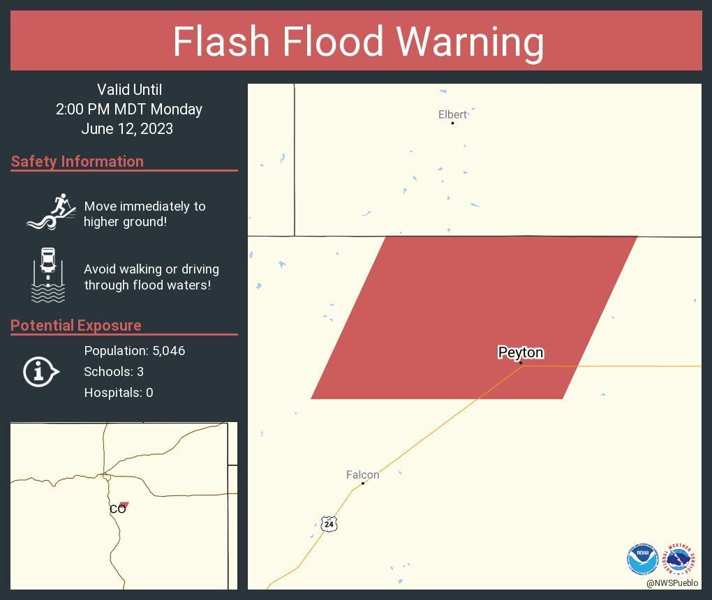
Flash flood warning for parts of El Paso County on Monday, June 12, 2023.
Courtesy of the National Weather Service


Flash flood warning for parts of El Paso County on Monday, June 12, 2023.
Flash Flood Warning including Peyton CO until 2:00 PM MDT pic.twitter.com/33zWngcckJ
— NWS Pueblo (@NWSPueblo) June 12, 2023
Several areas in and around Colorado Springs remain in a flash flood watch after heavy rain Sunday and an overnight downpour. Also, several severe thunderstorm watches and warnings are in effect in the Pikes Peak region all the way south to parts of New Mexico.
Severe Thunderstorm Warning continues for Security CO and Falcon CO until 1:30 PM MDT pic.twitter.com/QkWbteJ2K6
— NWS Pueblo (@NWSPueblo) June 12, 2023
8:30 a.m. update:
Police were on accident alert after midnight and after heavy rain caused reported street flooding in the southwest part of the city, according to a tweet from Colorado Springs police.
The water flows from the rain sweeping into Fountain Creek has washed away part of the foundation of the new Fountain Creek Regional Trail bridge, which was just finished in 2021. Now the bridge appears to be severely compromised. pic.twitter.com/7yBmkvKJTg
— Jon Mitchell (@byJonMitchell) June 12, 2023

Water races across Garrett Road in Falcon on Monday morning after heavy fell Sunday, June 11, 2023 around Colorado Springs.
Bill Radford, Gazette


Water races across Garrett Road in Falcon on Monday morning after heavy fell Sunday, June 11, 2023 around Colorado Springs.
Power outages hit Colorado Springs overnight
Child falls off tube, drowns in Colorado creek
Shortly before 12:30 a.m., CSPD Communications reported on Twitter that westbound Star Ranch Road was closed at Colorado 115 because of flooding. Around 2 a.m., CSPD tweeted that the the road had reopened.
Around 1:30 a.m., the Colorado Springs Fire Department reported on Twitter that crews were responding to a swift water rescue at East Platte Avenue and Hathaway Drive. Firefighters said they assisted one person who was under a bridge; the person was not injured.
A decade later, mitigation against new Black Forest inferno remains incomplete
Affected areas for the flash flood warning include southeast Colorado Springs, Fountain and Security.
The flood warning was in effect until 8:30 a.m. while the flash flood watch remains in place.
Large hail, damaging wind gusts and torrential rainfall are the main risks Monday, the Weather Service says. An isolated tornado risk will also be possible. Flash flooding on area burn scars and areas that have seen recent heavy rainfall is possible.
Colorado Springs had 1.47 inches of rain Sunday, according to th Weather Service. It’s been a soggy June in the city and region, with 2.69 inches of rain this month at the official measuring location at Colorado Springs Airport and measurable precipitation eight of 11 days. The city’s average June rain total is 0.87 of an inch.
Enough water this morning in Monument Creek that you could kayak. Be careful out there. #cowx #ColoradoSprings #floodwarning @csgazette pic.twitter.com/8jb9bLFl96
— Jerry Herman (@coloherman) June 12, 2023
A flash flood watch will remain in effect into the evening for the Pikes Peak region, including Teller County, Colorado Springs, Monument Ridge and Rampart Range. The flood watch, for some areas, remains in effect until Wednesday, according to the Weather Service.
The chance of heavy rain around Colorado Springs remains high throughout the day and night.
A special weather statement has been issued for Security CO, Fountain CO and Wigwam CO until 9:00 AM MDT pic.twitter.com/3F7G61OqAx
— NWS Pueblo (@NWSPueblo) June 12, 2023
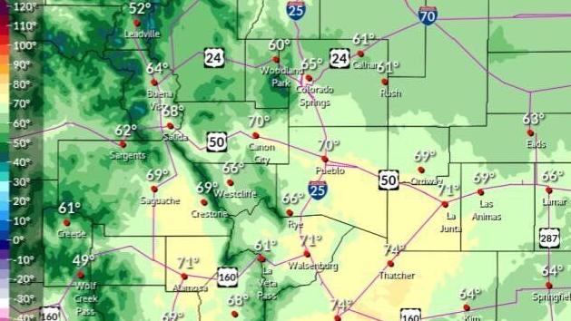
New rainfall amounts between a half and three quarters of an inch are possible around Colorado Springs, the Weather Service says. Expect a high temperature near 65.
Rain is possible each day throughout the week around Colorado Springs.
Torrential rainfall is possible with any thunderstorm this AM into this evening, along with the risk for flash flooding. While the highest risk of flash flooding is across Teller and El Paso Counties, a localized flash flooding risk is possible anywhere across the plains. #cowx pic.twitter.com/7v4OzjizB9
— NWS Pueblo (@NWSPueblo) June 12, 2023