Denver weather: Early thunderstorms, tornado warnings, flood watch & warning in effect
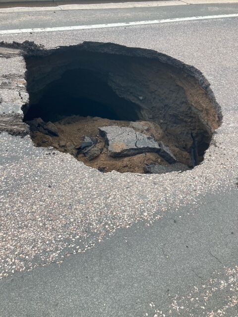
Sinkhole formed in Littleton, copious hail in Boulder
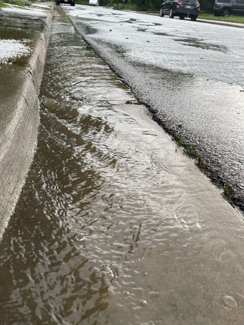
Thunderstorms rolled into Colorado before noon Monday with some producing hail and heavy rain, especially on the eastern plains and southeastern parts of the state.
Boulder was pelted with hail and most of eastern Colorado had a variety of weather warnings and watches set. By mid-afternoon, nearly 850 flights had been delayed at Denver International Airport which is around 40% of the days traffic, according to FlightAware.com. The airport’s Twitter account, @DENAirport, wrote at 12:30 p.m. that “Thunderstorms in the area are once again causing some delays.”
A flash flood warning was issued at 11 a.m. for north central El Paso County by the National Weather Service. It expired at 2 p.m., but similar watches and warning for creeks, streams and rivers fromthe Front Range and eastward were listed on the National Weather Service Boulder office’s website.
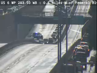
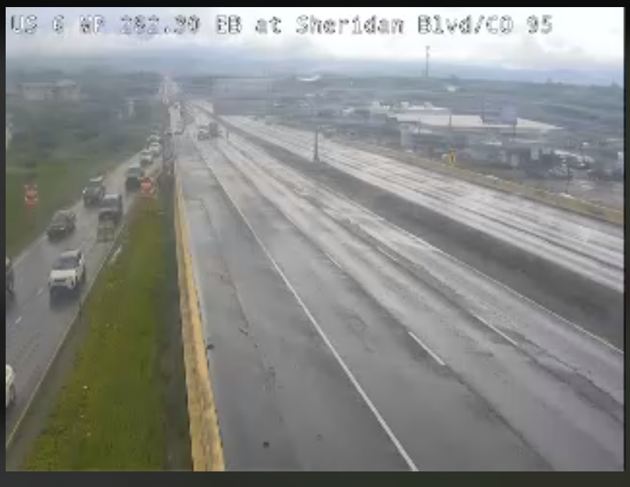
The Colorado Department of Transportation closed U.S. 6 at Perry Street in both directions due to flooding after heavy rains moved into metro Denver late Monday morning. Both lanes were reopened mid-afternoon.
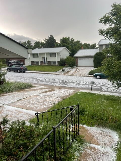
Video posted to social media showed hail covering parts of downtown Boulder around noon on Monday. The Boulder Police Department posted similar photos and a video clip.
Meanwhile, it looked like there’d been a snowstorm in June as mounds of hail fell on the city causing some flooding. Kim Hill, who lives in Table Mesa, said she saw the intense storm coming before it hit.
“We could see really dark, black clouds over the Flatirons,” said Hills. “It was hailing so intensely we couldn’t hear ourselves talking.”
In Littleton, an 8-foot-in-diameter sinkhole closed Jackass Road just north of Mineral. An SUV narrowly missed being swallowed up by the collapsed road. The roadway will remain closed until the city’s public works department can repair it.

In Douglas County, sheriffs closed Flintwood Road just North of Singing Hills Road due to road damage with no known time for a reopening.
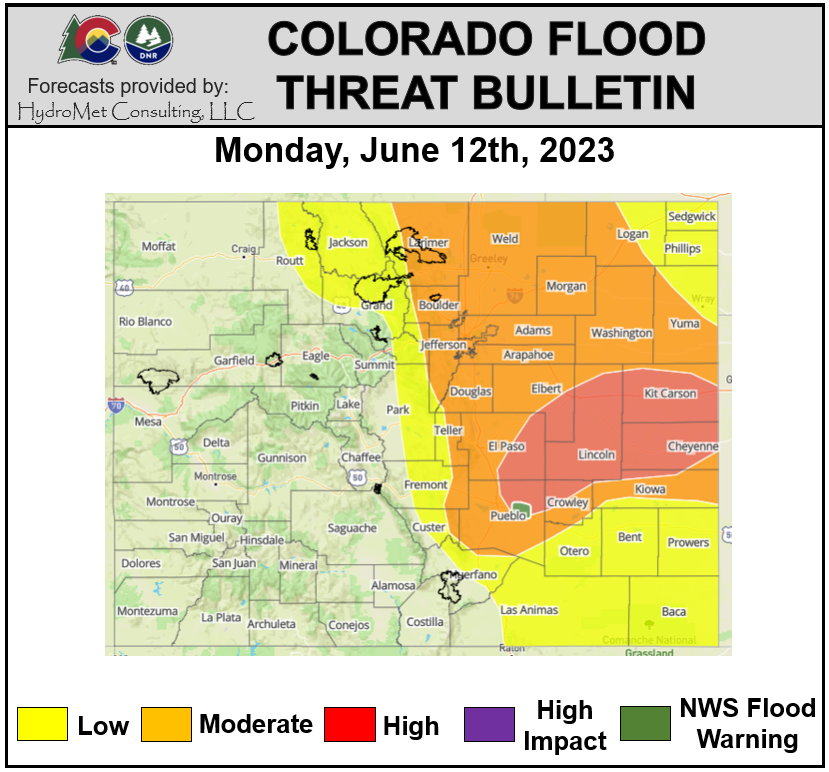
The threat of flooding was listed as high by the Colorado Flood Threat Bulletin for Monday with most of Lincoln, Kit Carson and Cheyenne counties in the threat area. El Paso county was split with the eastern half at high threat and the western with moderate.
Almost an inch of rain feel in the Ken Caryl neighborhood in southwest Littleton. Small hail was reported falling in Lakewood. Dark clouds moved over downtown Denver at midday and extended to the northern suburbs.
High winds and “penny-sized hail” were possible on Buffalo Creek and the South Platte River, according to a National Weather Service “Special Weather Statement” issued at 11:30 a.m. for an area near Pine Grove and southwest of Sedalia.
The flash flood watch continues Tuesday, and includes portions of eastern Larimer and Boulder counties, and Weld, Morgan, Washington and Logan counties.
Denver residents can expect showers and thunderstorms likely before 2 p.m. Tuesday, then showers and thunderstorms after 3 p.m., according to the National Weather Service in Boulder.
Some of the storms could produce heavy rain. High near 69. South wind 8 to 13 mph becoming east northeast in the afternoon. Winds could gust as high as 21 mph. Chance of precipitation is 80%.
Scattered showers and a few thunderstorms will continue across the mountains and plains early Tuesday morning, especially across Elbert and Lincoln counties. Storms will become more numerous Tuesday afternoon in all areas. Expect a few strong to marginally severe storms across the plains with hail up to one inch in diameter along with very heavy rain.
Here’s the full forecast from the National Weather Service.