


30 inches in 36 hours: Snow forecast intensifies in southern Colorado
According to the National Weather Service, the next 36 hours could bring quite a bit of snow to southern Colorado.
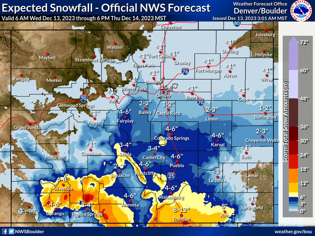
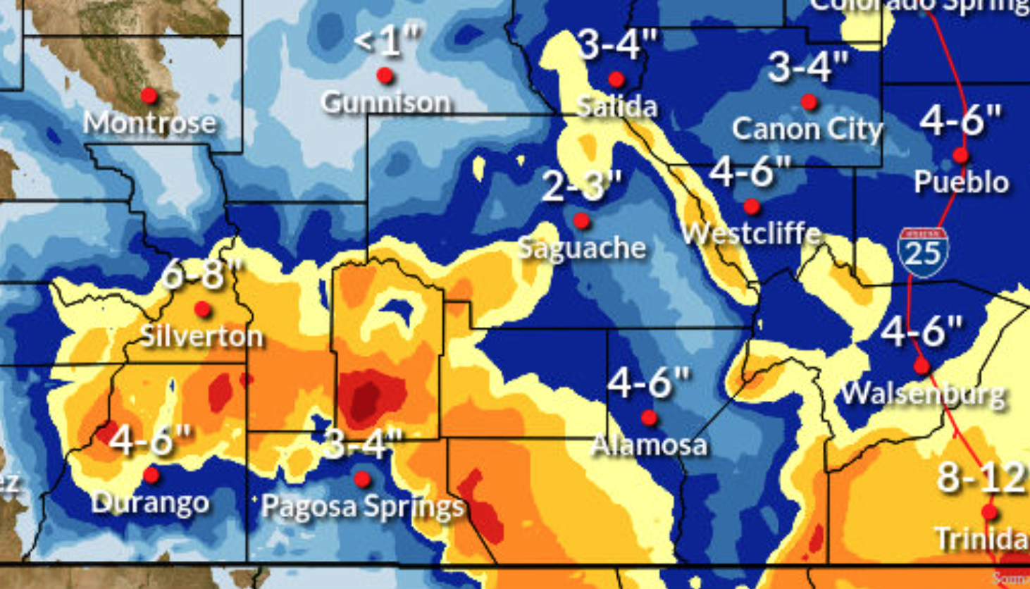
Up to 30 inches of snow could fall in the mountains north of Pagosa Springs between Wednesday morning and Thursday evening in the ‘most likely’ scenario, which is where the highest totals during this storm are expected. Meanwhile, areas around Trinidad and mountains south of Silverton could get up to two feet.
While this snow near the southern Colorado border is expected to be a bit heavier and a bit more widespread than was initially forecasted, what’s likely to be one of the most impactful changes comes in the form of snow totals expected to hit Colorado Springs. Originally, around two to three inches were expected. That has since increased to four to six inches, with the Pueblo forecast now in the same range, as well.
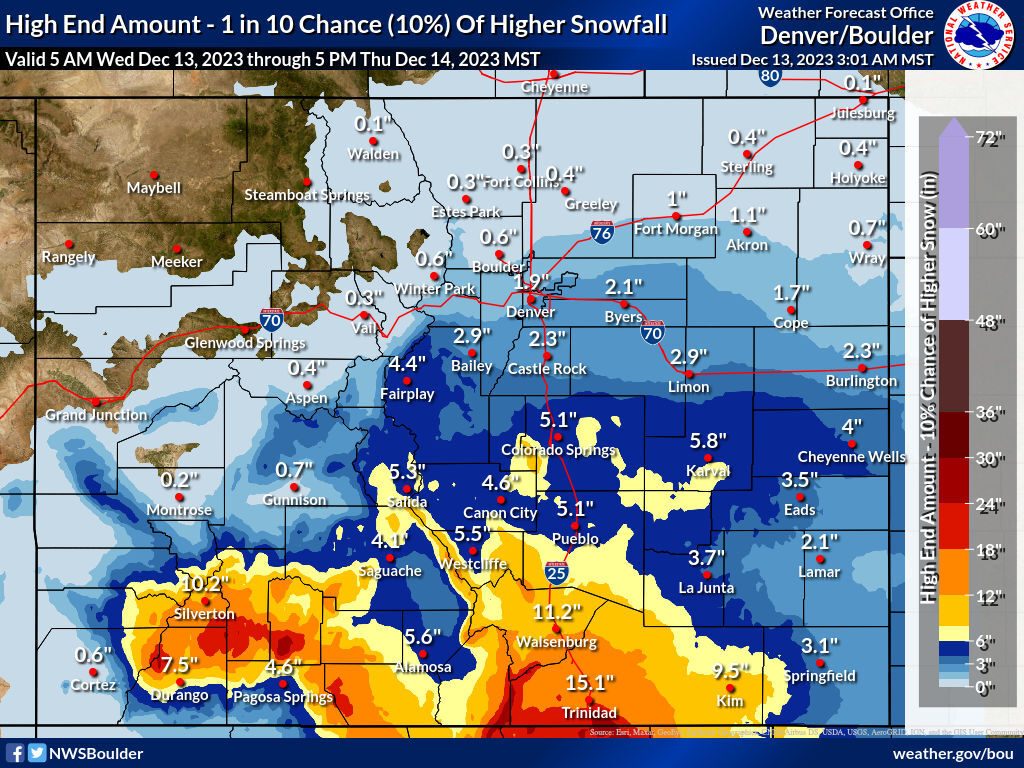
In a ‘high end’ snowfall scenario that has a one in 10 chance of playing out, deeper totals are more likely to be widespread.
See that high-end forecast below:
As a result of the incoming snow, multiple winter weather-related alerts have been activated in southern, southwest, and southeast Colorado.
Find more information about this incoming storm on the National Weather Service website.
Get OutThere
Signup today for free and be the first to get notified on new updates.
PREV
PREVIOUS

Byron York expresses doubt DOJ would cite Hunter Biden for contempt of Congress
The Washington Examiner’s Byron York has expressed doubt that the Department of Justice would cite Hunter Biden for contempt of Congress, as it has in the past for other people refusing to provide a deposition. York made the comment shortly after the president’s son spoke Wednesday in Washington, delivering a rare public statement outside the […]

No skis, no problem: 10 ideas for winter fun across the Front Range
Just because you don’t ski doesn’t mean you can’t have fun come winter. If you’re living on the Front Range, the possibilities are endless. Here are 10 must-dos: 1. Enjoy a beer run in Fort Collins: It’s more than New Belgium Brewing Co. and Odell Brewing Co. This town is saturated with some of the […]