




‘High-end’ snowfall forecast shows up to 24 inches on some Colorado peaks this weekend
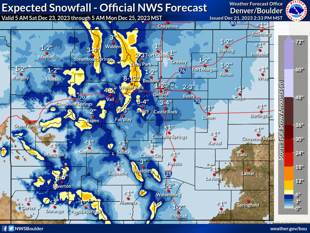
With the start of Christmas weekend hours away, the National Weather Service has released their snow forecast for Saturday morning through Monday morning. While it shows that nearly the entire state should see at least some snowflakes during this period, totals are unlikely to be deep enough to cause major problems compared to other storms that have already blown through this year should the ‘most likely’ scenario occur. If the ‘high-end’ scenario occurs, however, expect travel concerns on most of the state’s major highways.
Mapping shows that the highest totals in the ‘most likely’ scenario will likely fall along the Continental Divide found north of I-70. This includes a likely eight to 12 inches in Winter Park and up to 18 inches in small pockets of the mountains located just southwest of Estes Park. Meanwhile, some peaks in the Aspen area, parts of the Sangre de Cristos, and the San Juans north of Pagosa Springs could get around a foot of snow. All of that being said, most of the state will likely see fewer than six inches, with the majority of the state looking at about one to three inches in the most likely snowfall scenario.
In this ‘most likely’ scenario, it also looks like the I-70 corridor won’t get huge totals. Two places along this route where problems may arise could be in the area of the Eisenhower Tunnel and over Vail Pass.
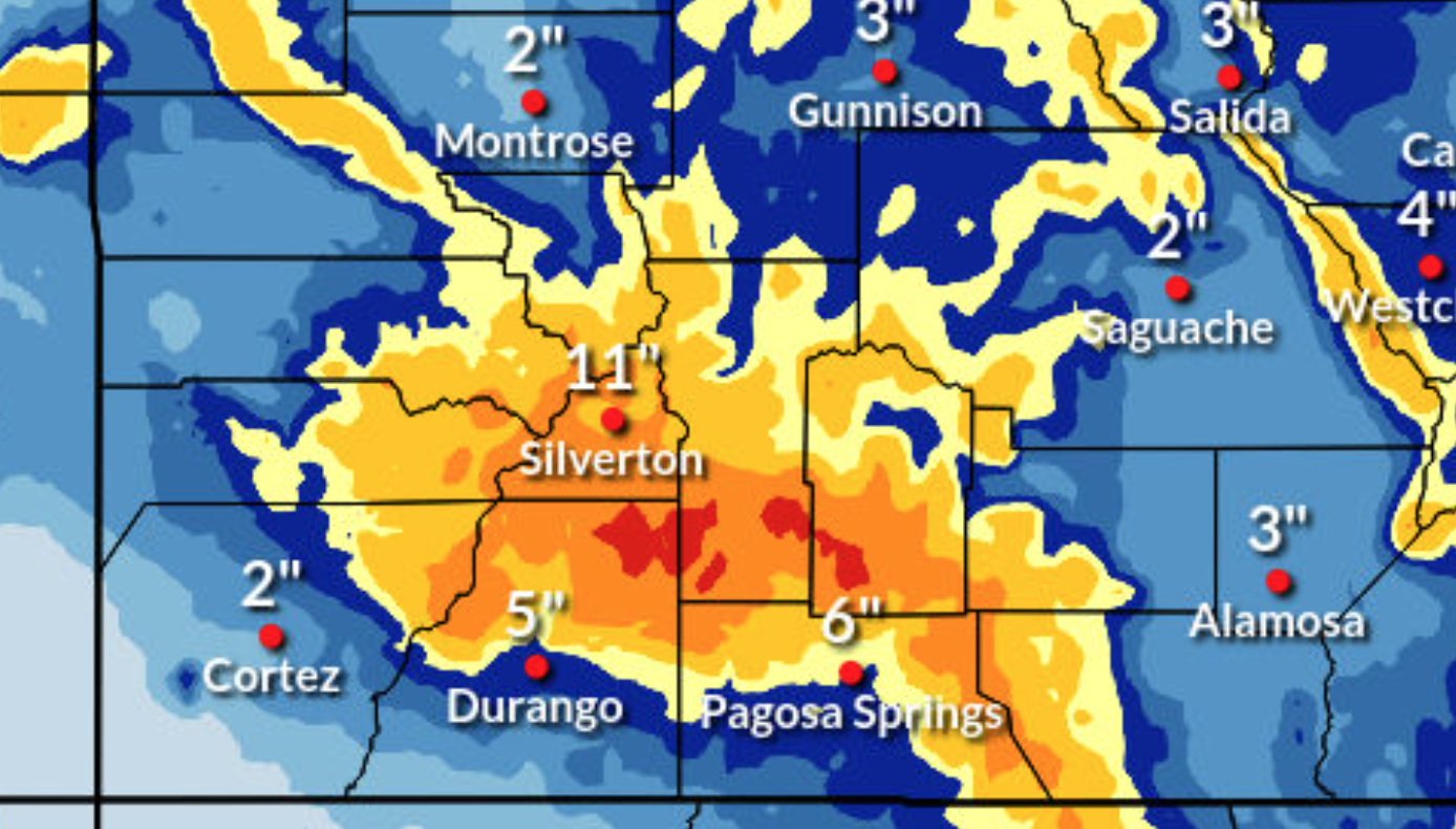
The ‘high-end’ scenario is where things get interesting.
In this ‘one-in-10 chance’ scenario, the southwest and central mountain regions get hit much harder. The San Juans in southwest Colorado could see up to two feet of snow in some places and totals of up to a foot will be more widespread in the central mountain region. This high-end scenario also calls for up to four inches of snow in Denver, six inches in Castle Rock, and three inches in Colorado Springs, which could cause travel concerns along I-25. The I-70 corridor also gets hit harder, with the potential for eight to 12 inches along some parts of the route.

The heaviest snow is expected to fall over Saturday night. Various winter weather alerts have been activated in parts of the southwest portion of the state, set to go into effect on Friday evening.
The OpenSnow resort report currently calls for the most powder over the next five days at Wolf Creek – 12 inches. Find the full resort-by-resort breakdown from OpenSnow here.
It’s also worth noting that there’s been quite a bit of ambiguity regarding snow totals leading up to this incoming storm. Be prepared for changes in the forecast.
Stay tuned on the National Weather Service website for additional updates related to this weather. And make sure you pack your trunk with survival essentials for winter travel.
Get OutThere
Signup today for free and be the first to get notified on new updates.
PREV
PREVIOUS
Trump ballot eligibility news: Read the latest
The Colorado Supreme Court took the unprecedented step of ordering Donald Trump removed from the 2024 presidential ballot on Dec.19, finding him constitutionally ineligible to hold future office.Trump’s campaign said it would appeal the decision to the U.S. Supreme Court. Read our latest coverage here.

Colorado Springs Olympic museum adjusting business model to boost lagging visitor numbers
The U.S. Olympic & Paralympic Museum is planning a business model changeup to attract more repeat visitors locally and statewide. The museum, the first City for Champions project to be completed, opened during the early stages of the pandemic in summer 2020, which made attracting visitors to an indoor venue difficult. The venue has struggled […]