


Whiteout daily snow report, Jan. 1
Skiers and riders will have to be patient for the first snows of 2024 in Colorado’s high country and on resort slopes. Luckily that looks like only three or four days.
Monday through Wednesday will be dry and have mostly clear and sunny skies from Powderhorn to Echo, Steamboat to Wolf Creek.
The storm approaching for Thursday into Friday appears to be of the garden variety with forecasted totals between 2-6 inches for the southern mountains and less in the central and northern mountains.
Friday’s first chairs at the southern San Juan resorts (Purgatory and Wolf Creek) could be soft and powdery.
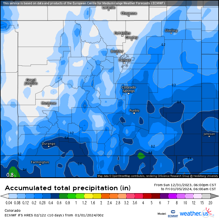
Saturday looks to be a drier day ahead of a larger storm that will work its way into Colorado Sunday into Monday. Once again, this storm shows higher snow accumulations for the southern mountains and less as one heads farther north.
The ECMWF model from Monday has snow accumulations from that storm ranging from 2-4 inches in the northern mountains, 4-8 inches in the central mountains, and to 8-20 inches in the southern mountains.

Additional chances for snow 10 and 14 days out is forecast for Colorado, but accumulation totals and projected paths of these storms will need more time to develop before being reported on with accuracy.
Today’s 24 hour snow total from Colorado resorts:
Arapahoe Basin – 0″
Aspen Mountain – 0″
Aspen Highlands – 0″
Beaver Creek – 0″
Breckenridge – 0″
Buttermilk – 0″
Cooper – 0″
Copper Mountain – 0″
Crested Butte – 0″
Echo Mountain – 0″
Eldora Mountain – 0″
Granby Ranch – 0″
Hesperus – Closed for season
Howelsen Hill – 0″
Kendall Mountain – 0″, open weekends
Keystone – 0″
Loveland – 0″
Monarch – 0″
Powderhorn – 0″
Purgatory – 0
Silverton – 0″
Snowmass – 0″
Steamboat – 0″
Sunlight – 0″
Telluride – 0″
Vail – 0″
Winter Park – 0″
Wolf Creek – 0″