







Whiteout daily snow report, Jan. 10
The snow pack is inching toward average, literally, and with accumulations Wednesday morning it is one step closer.
The northern and central mountains received 2-7 inches from Tuesday night’s storm and it is still snowing lightly in the high country, but winding down. Copper (7″), Steamboat (6″), Winter Park (6″) and Arapahoe Basin and Breckenridge (5″) are just some examples from the northern mountains with soft conditions for Wednesday.
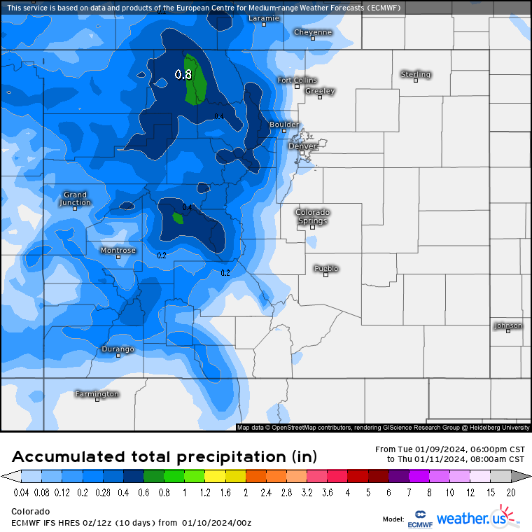
• The next storm is forecast for Wednesday night through Thursday, with most of the snow accumulating on Thursday, bringing more snow to the southern mountains on a southwest flow and giving the San Juan Mountains accumulations between 5-10 inches.
Snow totals on Thursday morning from both storms show the northern mountains receiving up to 12 inches, potentially more, and an added 5-10 inches for the central and southern mountains.
• Friday is still forecast to be ‘calm’ before the large, multi-day storm crosses Colorado from Saturday to early Tuesday morning. However, snow showers could work their way into the north and northwestern parts of the state with wrap around moisture from the low pressure pushing east into Kansas.
The ECMWF high resolution model forecast for Saturday has snow accumulating in most central and northern mountain ranges all day before snow begins to work its way into the southern mountains before midnight.
• On Saturday another 8-14 inches of snow is possible in the northern mountains by Sunday first chair, making for a powder day.
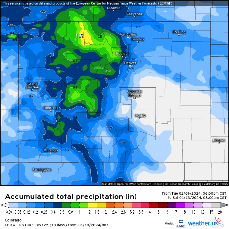
• Sunday morning snow is forecast to be falling from a line starting in Greeley southwest toward Durango, with accumulations in the mountains from 0.2-1.2 inches of snow-water equivalent every three hours, equaling between 3-18 inches in a 15-hour period.
• Monday, Martin Luther King Jr. Day, is going to be another powder day, this time nearly everywhere. On top of the snows from Friday and Saturday for Saturday and Sunday skiing and riding, another 3-12 inches is forecast to fall by Monday morning, with snow showers continuing on Monday.
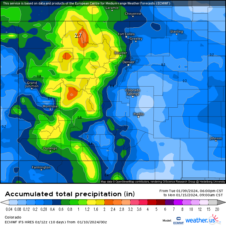
The higher snow accumulations will be in the northern and northwest mountains, but the central mountains should get between 5-10 inches of snow, and the southern mountains between 4-8 inches as well.
Snow on Monday continues into Tuesday morning with another 1-7 inches forecast before finally a short break from the storms on Tuesday.
Today’s 24 hour snow total from Colorado resorts:
Arapahoe Basin – 5″
Aspen Mountain – 4″
Aspen Highlands – 3″
Beaver Creek – 5″
Breckenridge – 5″
Buttermilk – 1″
Cooper – 2″
Copper Mountain – 7″
Crested Butte – 3″
Echo Mountain – 1″
Eldora Mountain – 3″
Granby Ranch – 3″
Hesperus – Closed for season
Howelsen Hill – 5.5″
Kendall Mountain – 1″, open weekends
Keystone – 2″
Loveland – 3″
Monarch – 5″
Powderhorn – 3″
Purgatory – 0″
Silverton – 2″
Snowmass – 2″
Steamboat – 6″
Sunlight – 3″
Telluride – 3″
Vail – 4″
Winter Park – 6″
Wolf Creek – 0″