


Up to 24 inches of snow could land in Colorado’s mountains this weekend
Weekend snow is set to keep packing on the powder on Colorado’s highest peaks.
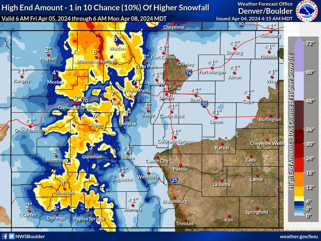
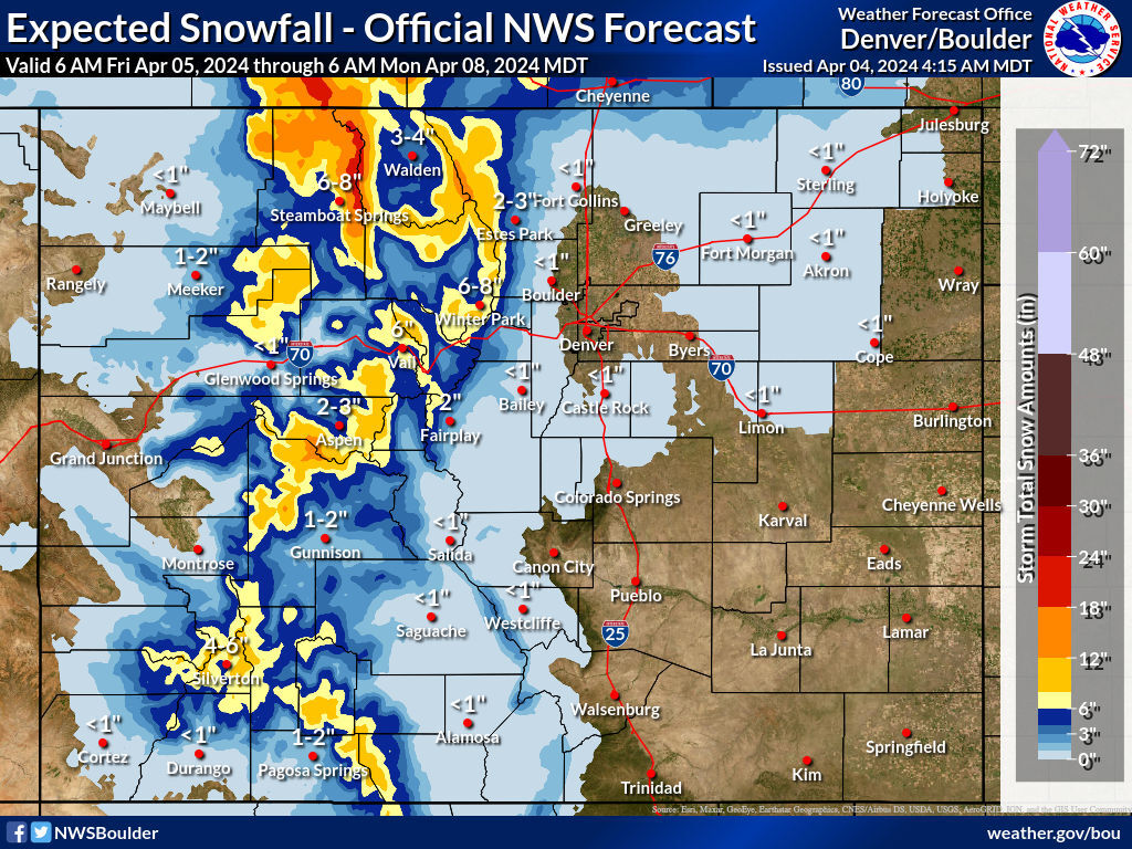
According to the National Weather Service, most high peaks in Colorado will get about a foot of snow in the most likely scenario from Friday morning through Monday morning, with the deepest totals landing on peaks east of Steamboat Springs – up to two feet.
While high points of elevation are set to get good accumulation, most population centers will not. The entire Front accumulation. Plus, warmer temperatures at lower elevations should help with quicker melting.
Even in the ‘high-end’ snowfall scenario, mountain towns should get single-digit totals.
Potential areas of problematic travel include the I-70 corridor, the Aspen area, northern Colorado, and the southwest.
Those looking to hit the slopes should know that OpenSnow predicts Steamboat will get the most snow over the next five days to the tune of 21 inches. Find their full breakdown here.
Colorado’s snowpack currently sits at about 108 percent of the norm for this point in the year on a statewide level. Expect the gap between the long-term norm and current snowpack to widen a bit following this round of wintery weather.
Find additional snow forecast information on the National Weather Service website.
Get OutThere
Signup today for free and be the first to get notified on new updates.
PREV
PREVIOUS

Rockies embrace local roots with Coors Field additions ahead of opening weekend
The Rockies went all-in on their Colorado ties and enlisted the help of a local to bring the same energy to the walls of their new Coors Field Toyota Clubhouse. Taylor Gallegos, a native Coloradan from Boulder and Colorado State University alum, was brought in to paint his vision of the Rockies — both the […]
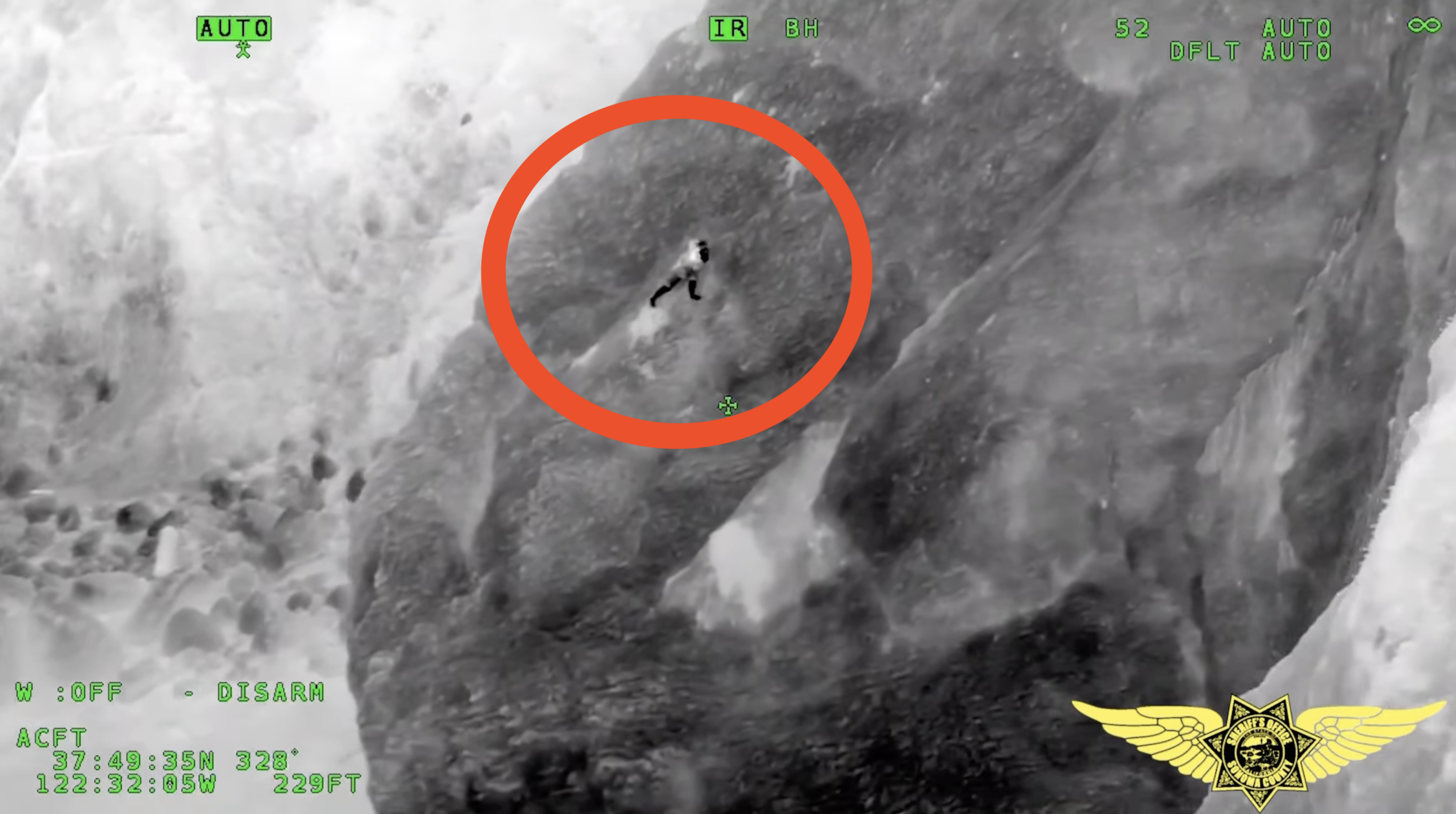
Man clung to cliffside for nearly an hour after taking 'shortcut' on hike
A scary situation unfolded on a Northern California cliffside last Sunday, when a hiker was left clinging to a rocky face roughly 50 feet above the ocean for nearly an hour. The Sonoma County Sheriff’s Office released shocking footage of the scene, with the incident taking place near the Battery Alexander trail in the Golden […]