







Upcoming snow for Colorado forecast to drop 12″ plus: Whiteout daily snow report, April 23
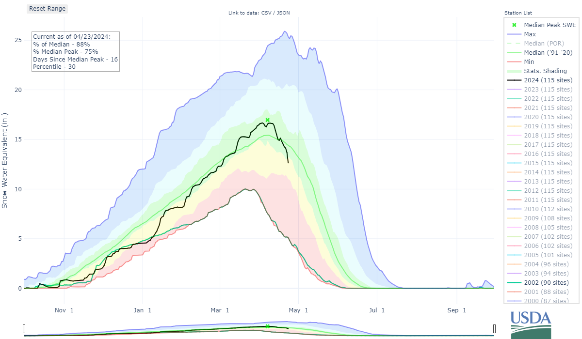
Snowpack melting rapidly as spring marches forward
The likelihood of another strong shot of snow in Colorado’s mountains is still forecast for the last few days of April.
Temperatures will remain warm ahead of the snow event, continuing to melt the snowpack during the above average temperatures period.
Snowpack:
The melt is on. Over the course of two days from Sunday to Tuesday, Colorado’s snowpack melted away nine percentage points of average and 1.5 inches of snow water equivalent.
Melting will continue through Thursday, but slow some during a forecasted stormy period from Friday through Sunday.
Recap:
Temperatures reached into the 40s Monday at Colorado’s remaining open ski areas — Copper Mountain recorded a high of 45 according to Accuweather. High level clouds drifted across the state on a zonal flow, keeping skies partly sunny with moderate winds blowing as well.
Forecast:
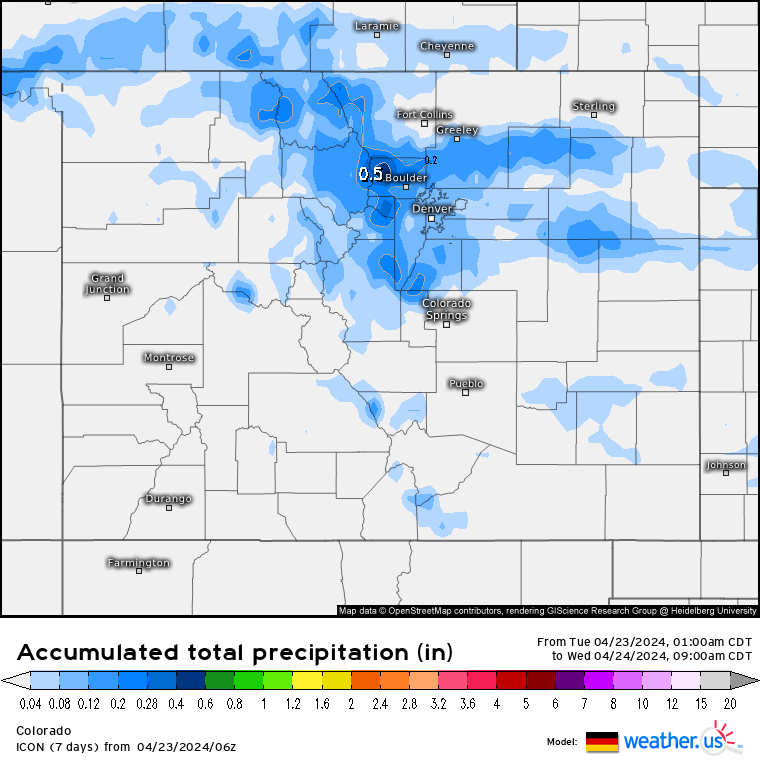
On Tuesday, a wave of energy trailing a large low pressure system in the Great Lakes is forecast to produce some snow showers in the afternoon into evening for the northern mountains.
The German ICON model forecasts snow accumulations of between 1-4 inches is possible for mountains in the Front Range, Summit County and Park and Gore ranges.
On Wednesday and Thursday, spring-like temperatures will return with highs in the 50s and sunshine both days.
Long Range:
Beginning Thursday night, rain will turn over to snow after sunset and a prolonged period of snow is forecast to start, with snow accumulating into Sunday.
Not all of the forecast models, like the ECWMF model, are lining up with the GFS or ICON models currently, but snow accumulations are showing for all mountain regions, especially the northern and eastern mountains.
From Tuesday morning’s model run, forecasted snow water equivalent grand totals range between 2-2.4 inches or 20-24 inches of snow. However, not all of this could fall as snow either, lessening snow accumulation totals.
ICON model:
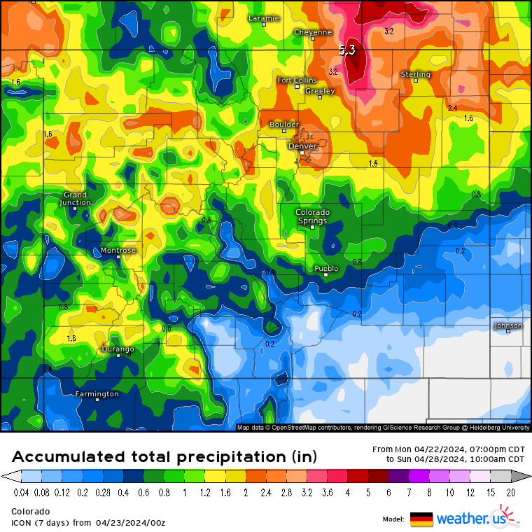
But snow accumulations at even half these amounts is still between 10-12 inches.
The storm is some what a conglomerate of two storms, one from the northwest, one from the southwest, mixing and intertwining over Colorado and Utah for about three days.
The southwest storm will affect the state first (Friday and Friday night), then the second storm will affect the state Saturday into Sunday, with the second storm bringing the bulk of snow.
Both Saturday and Sunday should offer skiers and riders at all remaining ski resorts some form of moderately dense snow each day.
Another snow report will be put out on Thursday with more details on the weekend storm.
Today’s 24 hour snow totals from Colorado resorts:
Arapahoe Basin – 0″
Breckenridge – 0″ (Parts of Peak 8, plus Peaks 9 and 10 closed)
Copper Mountain – 0″
Loveland – 0″
Purgatory – 0″ (Open Fri-Sun)
Winter Park – 0″
Aspen Highlands – Closed for season
Aspen Mountain – Closed for season
Beaver Creek – Closed for season
Buttermilk – Closed for season
Cooper – Closed for season
Crested Butte – Closed for season
Echo Mountain – Closed for season
Eldora Mountain – Closed for season
Granby Ranch – Closed for season
Hesperus – Closed for season
Howelsen Hill – Closed for season
Kendall Mountain – Closed for season
Keystone – Closed for season
Monarch – Closed for season
Powderhorn – Closed for season
Silverton – Closed for season
Snowmass – Closed for season
Steamboat – Closed for season
Sunlight – Closed for season
Telluride – Closed for season
Vail – Closed for season
Wolf Creek – Closed for season