




Up to 30 inches of snow could hit Colorado during multi-day storm that’s hours away
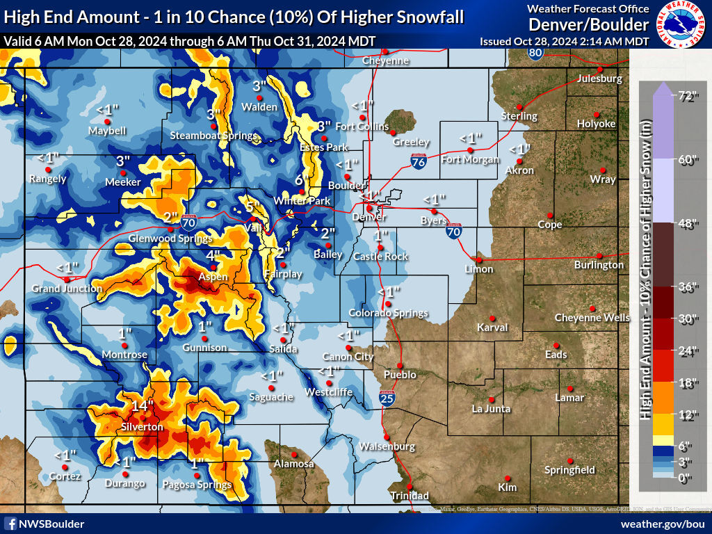
More snow is set to come roaring into Colorado during a storm that should stretch from Monday night to Wednesday night, dropping double-digit totals on many key mountains around the Centennial State.
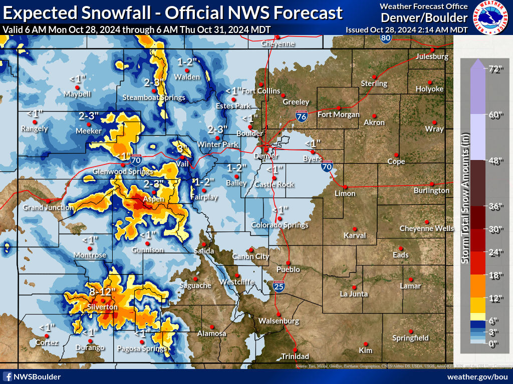
In the National Weather Service’s ‘expected’ snowfall scenario, which has roughly an 80 percent chance of taking place (seen in image at top of article), some mountains located southwest of Aspen have a shot at getting between 18 to 24 inches of snow. The same goes for peaks in the Silverton area of southwest Colorado, with these two regions expected to get the deepest totals from the incoming multi-day storm. Many mountains in this area, along with those north of Glenwood Springs and northeast of Steamboat Springs should get at least 12 inches, while Front Range peaks and the I-25 corridor set to be mostly missed.
The ‘high-end’ snowfall forecast, which has a one-in-10 chance of coming to fruition, predicts a similar scenario in terms of which peaks are favored, though with totals potentially nearing 30 inches. In this scenario, peaks around Vail Pass, as well as those along the Continental Divide in the area of Rocky Mountain National Park and Winter Park, get about a foot as well. Impacts along the I-25 corridor should still be relatively low.
This news comes as Colorado’s statewide snowpack sits at about 98 percent of the to-date norm, down from 379 percent of the to-date norm as of October 21 prior to the last major snowstorm and the 20-plus inches it dropped in southwest Colorado. It is, however, important to note that big swings of this nature in terms of the to-date snowpack comparison can be expected during the start of the snow season.
Perhaps most importantly in terms of the state’s winter slopesports, these snowy days will drop the temperature in the mountains, making favorable conditions for the snow-making that many major central mountain spots rely on for an early opening.
The National Weather Service has posted a ‘winter weather advisory,’ warning of hazardous travel during this snowstorm, for much of the Western Slope.
Find additional updates related to this storm on the National Weather Service website.
Get OutThere
Signup today for free and be the first to get notified on new updates.
PREV
PREVIOUS

Denver Christkindlmarket set to return for its 24th year in Colorado
The Denver Christkindlmarket is back for its 24th year and will run from Nov. 22 to Dec. 23 at the Denver Civic Park. The authentic German-style holiday market includes both local and European crafts vendors, food vendors, and holiday entertainment. The event is free and open to the public. Guests will stroll through a European […]

6 'food challenges' found around Colorado built for the hungriest people around
From huge servings of Pho soup to spicy chicken wings, Colorado offers some wild food challenges built for the hungriest eaters around. Here are six food challenges to check out across the state: 1. Pho 95 Noodle House’s Pho King Challenge This challenge consists of a giant bowl of traditional Vietnamese Pho soup that must […]