


Snow totals for incoming storm for Colorado by Tuesday | Whiteout snow report
Second storm following weekend should rebound snowpack, double snow event grand totals
There’s just three more aching days until Colorado’s next snowstorm arrives Sunday night, to skiers’ and riders’ delight.
Monday is forecast as a very light powder day for skiing and riding, with continued snow showers throughout the day.
A left-overs/soft snow day is in the forecast for Tuesday, then a period of dry but cooler conditions until Saturday, Dec. 14.
Recap:
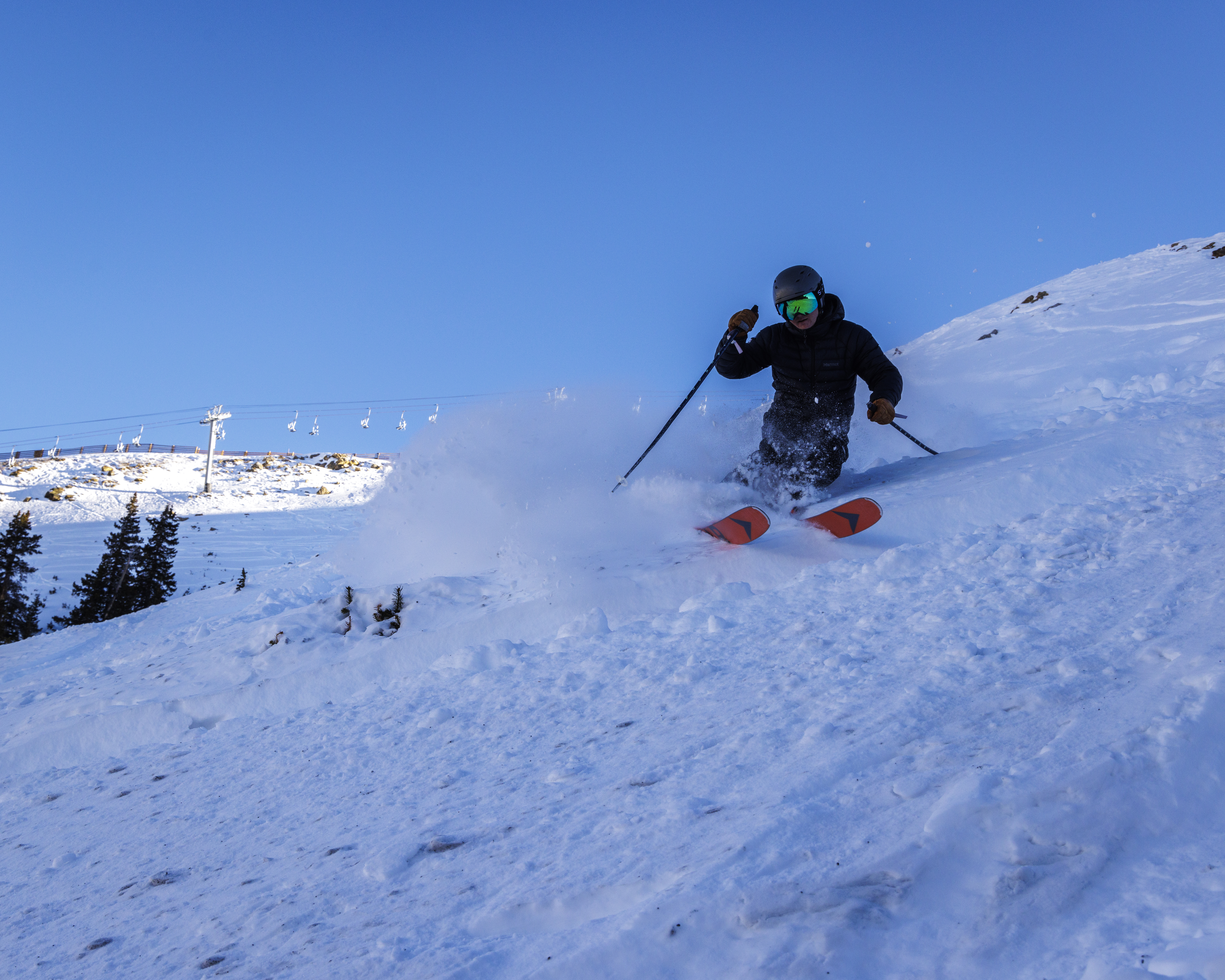
Wednesday and Thursday provided more sunshine and dry conditions, but Summit County’s Arapahoe Basin Ski Area opened a few trails under the legendary chairlift Pallavicini on Thursday.
Temperatures in Colorado’s ski country were on the warmer side, again, both Wednesday and Thursday.
The National Weather Service in Boulder recorded a high of 37 at Copper Mountain Thursday and the NWS office in Grand Junction recorded a high of 39 in Aspen.
Forecast:
Friday, Saturday, and Sunday day will be as forecast: dry, warm, and calm. High temperatures on Friday and Saturday are forecast to be in the upper 30s at high-elevation base areas like Copper Mountain and Snowmass, with low 40s at lower-elevation base areas like Purgatory and Sunlight.
Sunday’s highs are forecast to be in the lower 30s at high-elevation base areas and middle 30s at lower-elevation base areas, not able to climb higher as the snow event’s cold front begins pushing into Colorado by early afternoon.
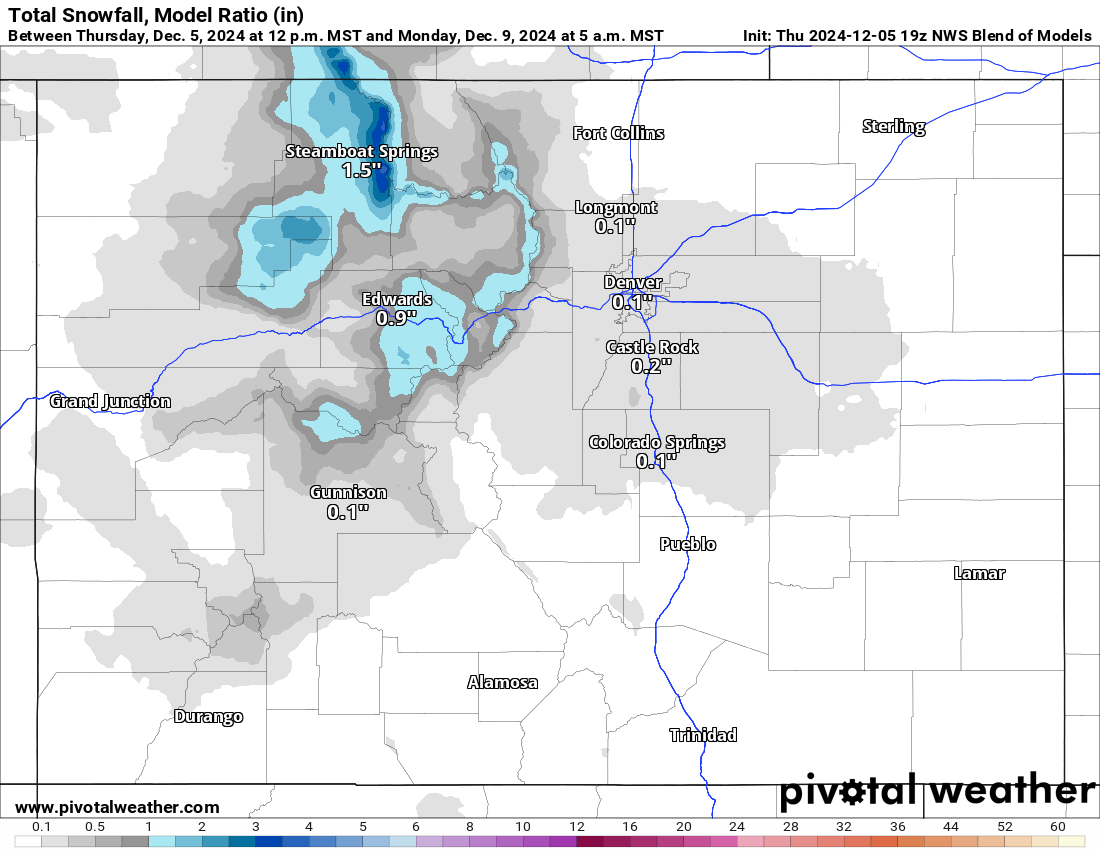
The ECMWF forecast model from Thursday afternoon has snow developing over northwestern Colorado after sunset to midnight, pushing south southeast overnight into Monday.
The European model and NWS Blend models have more snow forecast than the GFS model for Monday’s first chairs, with accumulations between 1-3 inches for the northern mountains and a trace to 1 inch along I-70 from Powderhorn to Loveland and northward to the Wyoming border. Steamboat and Howelsen could see double those totals and maybe Winter Park.
The NWS Blend of Models model:
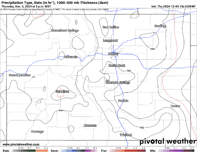
What’s driving the first storm is a low pressure pushing across southern Alberta, Canada, dragging moisture in off the Pacific Ocean from the northwest and trailing it into Colorado.
Snows will push from north-northwest to south-southeast from Sunday night to Tuesday.
Monday’s snow showers will intensify throughout the day making Tuesday the better mid-week skiing and riding day, especially in the northern and central mountains.
Forecasted additional snow accumulations for Tuesday in the northern mountains are between 3-7 inches, in the central mountains between 1-3 inches, and in the southern mountains between a trace to 2 inches. The outlier will be augmented totals in the southeastern mountains west of Pueblo, Walsenburg, and Trinidad, with between 3-6 inches.
The NWS Blend of Models model:
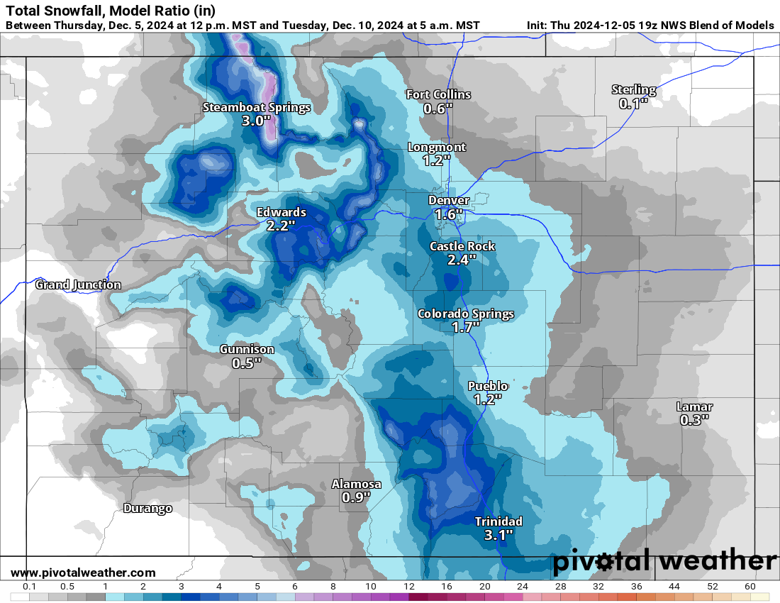
Additional snow will fall Tuesday morning, with perhaps another 1-3 inches total across favored mountain zones (east of a line from Steamboat to Wolf Creek Pass).
With this passing storm, temperatures are forecast to plunge into rather ‘cold ranges’ as morning lows drop below 0 for a large portion of the state’s western half.
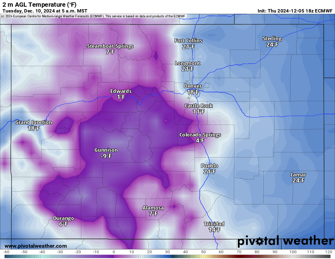
Both Tuesday’s and Wednesday’s lows more than likely will not be record breakers, but ski area towns like Crested Butte could be near between -15 to -20 below 0 each morning.
Long range:
The second storm is still forecast to arrive Saturday, Dec. 14, and hang around for a few days into early the following week.
This storm is trending toward a larger snow event than forecast models showed on Wednesday. Newer but still ‘way-to-early’ forecasts call for 3-6 additional inches in the northern mountains, 3-6 inches in the central mountains, and 2-4 inches in the southern mountains.
Today’s 24-hour snow totals from Colorado resorts:
Arapahoe Basin – 0″
Aspen Highlands – Opens Dec. 14
Aspen Mountain – 0″
Beaver Creek – 0″
Breckenridge – 0″
Buttermilk – Opens Dec. 14
Cooper – Opens Dec. 11
Copper Mountain – 0″
Crested Butte – 0″
Echo Mountain – Opens in December
Eldora Mountain – 0″
Granby Ranch – 0″
Hesperus – Closed for the season
Howelsen Hill – 0″
Kendall Mountain – Opens Dec. 20
Keystone – 0″
Loveland – 0″
Monarch – 0″
Powderhorn – 0″
Purgatory – 0″
Silverton – Opens Dec. 28
Snowmass – 0″
Steamboat – 0″
Sunlight – 0″, Open weekends, 7 days a week Dec. 13
Telluride – 0″
Vail – 0″
Winter Park – 0″
Wolf Creek – 0″