


Forecast: 130 hours of temperatures below freezing from Arctic air mass for Colorado
Snow storm accompanying polar vortex to bring 12-24 inches of snow over MLK weekend | Whiteout snow report
Three more days of ‘warm’ weather are forecast across Colorado’s high country before a deep freeze begins for several days from Friday to Tuesday.
The Arctic air mass, along with an accompanying snow event, is still ‘on schedule’ and will make for harsh skiing and riding conditions in the mountains, and difficult travel conditions around towns, cities, and the highway systems accessing the mountains.
Recap:
Monday and Tuesday were rather cold across Colorado, especially in the mountains. Daytime highs recorded by the National Weather Service in Boulder at Copper Mountain were 10 degrees each day. The NWS offices in Grand Junction recorded highs in Aspen at 23 and 22 each day respectively.
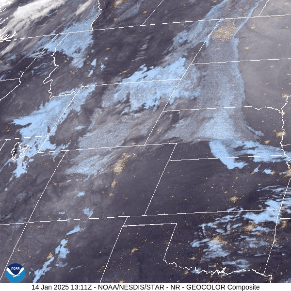
Skies cleared out in the afternoon as light snow ended for the western mountains near Aspen and northern San Juan Mountains around Telluride, where snowfall between 1-2 inches fell.
Forecast:
Arctic air will bring extremely cold temperatures, but moderate to heavy snowfall to much of Colorado’s high country, urban corridor, and eastern Plains over the the MLK Day weekend.
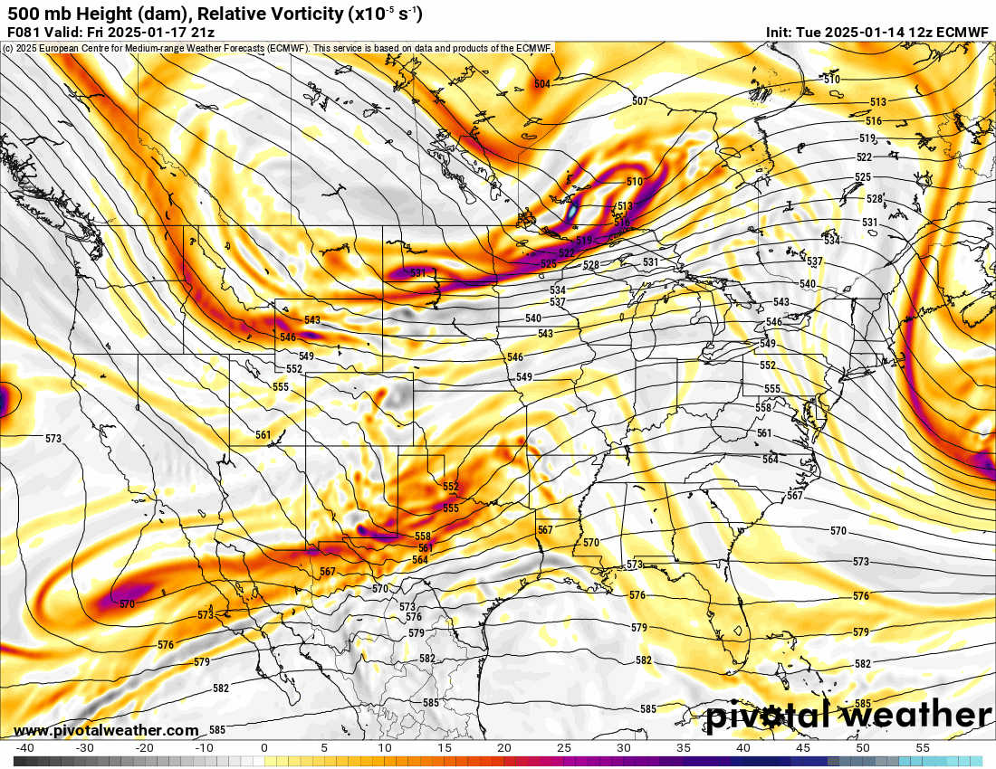
The storm is still ‘on schedule’ according to the latest model runs from multiple agencies like the GFS and ECMWF.
Arctic cold:
Colorado’s high country, I-25 corridor, and eastern Plains are in for approximately 130 hours or 5.5 days of temperatures below freezing starting Friday night.
In Colorado’s high country, forecasted lows of between -5 to -40 degrees can be expected for five nights straight, Saturday night through Wednesday night, on both sides of the Continental Divide.
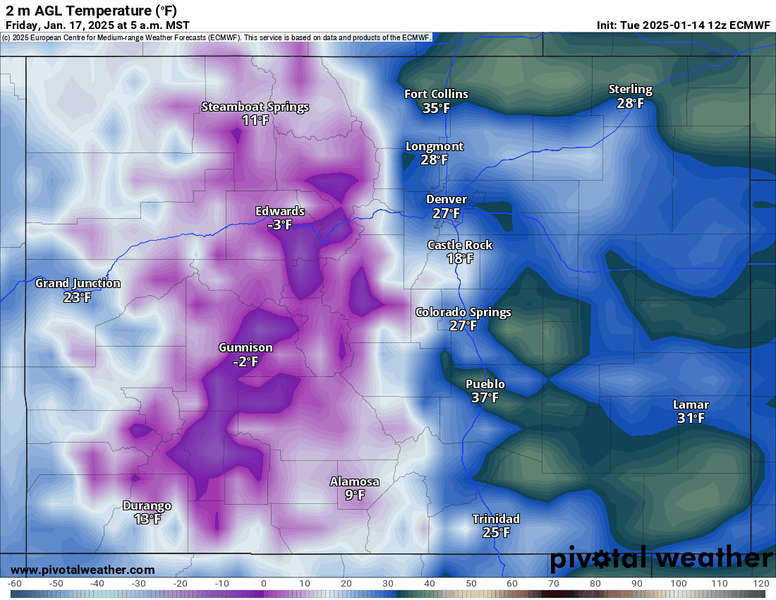
Daytime warming follows a similar story, with forecasted high temperatures staying in the single digits for five days straight as well; Saturday through Wednesday.
Snow:
Snow showers enter Colorado Friday night and last into Monday, with higher totals for ski areas east of the Continental Divide.
Storm energy will be broken into two waves with the first one bringing snow from Friday night through Saturday evening, then the second wave ramps back up from Sunday morning to late Monday night.
Forecasted snowfall totals from the first wave for the northern mountains west of the divide range between 4-10 inches west of the divide and between 8-16 inches east of the divide, for the central mountains between 1-3 inches, and for the southwestern mountains between 1-4 inches, and southeastern mountains between 4-16 inches.
High-elevation peaks like Pikes Peak and the Spanish Peaks should receive the highest totals down south.
The second wave is right behind the first as snow intensifies early Sunday and is forecast to continue into Monday night.
Additional snow accumulations for the northern mountains west of the divide are between 3-5 inches and east of the divide between 4-8 inches, in the central mountains between 3-5 inches, and in the southwestern mountains between 2-3 inches, in the southern mountains near Wolf Creek between 5-8 inches and in the southeastern mountains between 4-8 inches.
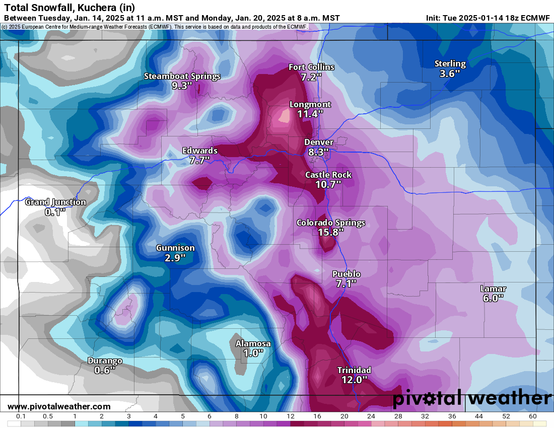
Snowfall totals from the MLK Day storm for the northern mountains range between 5-24 inches, in the central mountains between 2-8 inches and in the southern mountains between 3-24 inches.
The farther east you go the higher the snow totals will be.
Long range:
Drier weather will be featured across the state from Tuesday to Saturday, Jan. 25, when another storm tracking down on northwest flows again could bring snow to the northern half of the state.
Today’s 24-hour snow totals from Colorado resorts:
Arapahoe Basin – 0″
Aspen Highlands – 1″
Aspen Mountain – 1″
Beaver Creek – 0″
Breckenridge – 0″
Buttermilk – 1″
Cooper – 0″
Copper Mountain – 0″
Crested Butte – 0″
Echo Mountain – 0″, plus tubing
Eldora Mountain – 0″
Granby Ranch – 0″
Hesperus – Closed for the season
Howelsen Hill – 0″
Kendall Mountain – 0″
Keystone – 0″
Loveland – 0″
Monarch – 0″
Powderhorn – 0″
Purgatory – 0″
Silverton – 0″
Snowmass – 1″
Steamboat – 1″
Sunlight – 0″
Telluride – 1″
Vail – 0″
Winter Park – 0″
Wolf Creek – 0″