


‘Large moisture surge’ to bring heavy snow to Colorado for President’s Day weekend
More snow after holiday to augment snowpack | Whiteout snow report

Colorado’s high country is about to be replenished even more by a heavy snow event starting Friday after a quick-moving storm dropped fresh snow Tuesday into Wednesday.
Arctic air will still creep into the state for Wednesday and Thursday, with the coldest temperatures of the month so far awaiting skiers and riders Thursday morning.
The active pattern picks up again on President’s Day Monday, with regular snowfall happening through most of next week.
Recap:
On Monday, snow showers developed around noon in the southern mountains, but accumulations didn’t amount to much, with amounts from only a trace up to 2 inches falling around Silverton in the San Juan Mountains and Monarch in the southern Sawatch Mountains.
On Tuesday, snow showers moved in again after noon, but this time snow began accumulating after sunset, with much better results and across the entire state’s high country.
Snow accumulations in the northern mountains ranged from between 2-5 inches, in the central mountains between 3-6 inches, and the southern mountains between 3-6 inches.
Forecast:
On Wednesday, snow is forecast to continue throughout the day and end in the evening. Additional snow accumulations of between 2-5 inches across the northern and central mountains are forecast, with only between 1-2 inches accumulating in the southern mountains.
The coldest air of February will accompany the Wednesday snow. Clearing overnight Thursday will send low temperatures before sunrise to very cold recordings.
Forecasted lows of between -10 to -30 degrees are expected in mountain towns like Breckenridge, Walden, Crested Butte, Silverton, and Gunnison.
On Thursday, the sun will mostly return and warm the slopes up into the high teens and low 20s, but snow showers move back in during the afternoon and
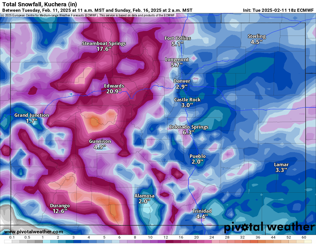
On Friday and Saturday, heavy snow is forecast to fall as a large surge of moisture pushes into central Colorado to kick off the President’s Day weekend with the potential for 2-3 feet of snow on the slopes by Sunday.
Snowfall accumulations from this large snow event are forecast to be between 14-24 inches in the northern mountains, between 18-28 inches in the central mountains and between 20-30 inches in the southern mountains.
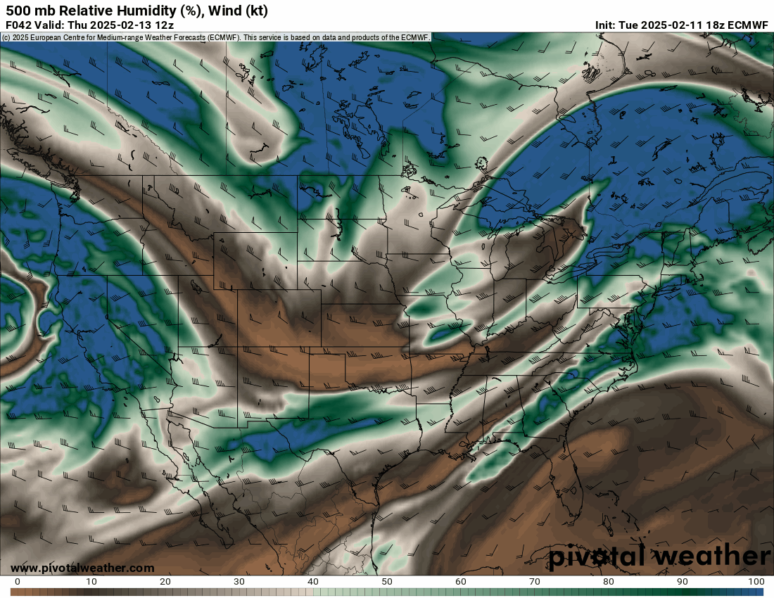
The ECMWF, Kuchera model:
On Sunday, light snow showers could continue on and off around the state, but mostly sunny skies will prevail ahead of more snow incoming Sunday night.
Long-term forecast:
On President’s Day Monday, another plume of moisture is trending toward pushing across the state’s northern half, bringing more snow to ski areas and resorts north of U.S Highway 50 approximately.

Snow showers will be heaviest from late Monday night through Wednesday morning.
Snow accumulations by Wednesday morning range from between 8-11 inches in the northern mountains, between 4-7 inches in the central mountains, and between 5-8 inches in the southern mountains.
Another wave of energy is forecast to arrive Thursday, Feb. 20, and last through approximately Saturday, Feb. 22. More details on this snow event will emerge as the date nears, including better estimates of snowfall, duration, and location of the snow.
Today’s 24-hour snow totals from Colorado ski resorts:
Arapahoe Basin – 1″
Aspen Highlands – 6″
Aspen Mountain – 6″
Beaver Creek – 6″
Breckenridge – 2″
Buttermilk – 5″
Cooper – 1″
Copper Mountain – 2″
Crested Butte – 3″
Echo Mountain – 0″, plus tubing
Eldora Mountain – 2″
Granby Ranch – 0″
Hesperus – Closed for the season
Howelsen Hill – 0″
Kendall Mountain – 1″
Keystone – 2″
Loveland – 2″
Monarch – 5″
Powderhorn – 7″
Purgatory – 1″
Silverton – 5″
Snowmass – 6″
Steamboat – 7″
Sunlight – 3″
Telluride – 0″
Vail – 7″
Winter Park – 5″
Wolf Creek – 2″