


Up to 30 inches of snow could fall in Colorado thru Sunday morning, says NWS report
Another round of big snow is hitting Colorado, with double-digit totals expected on many peaks around the state through the end of the weekend.
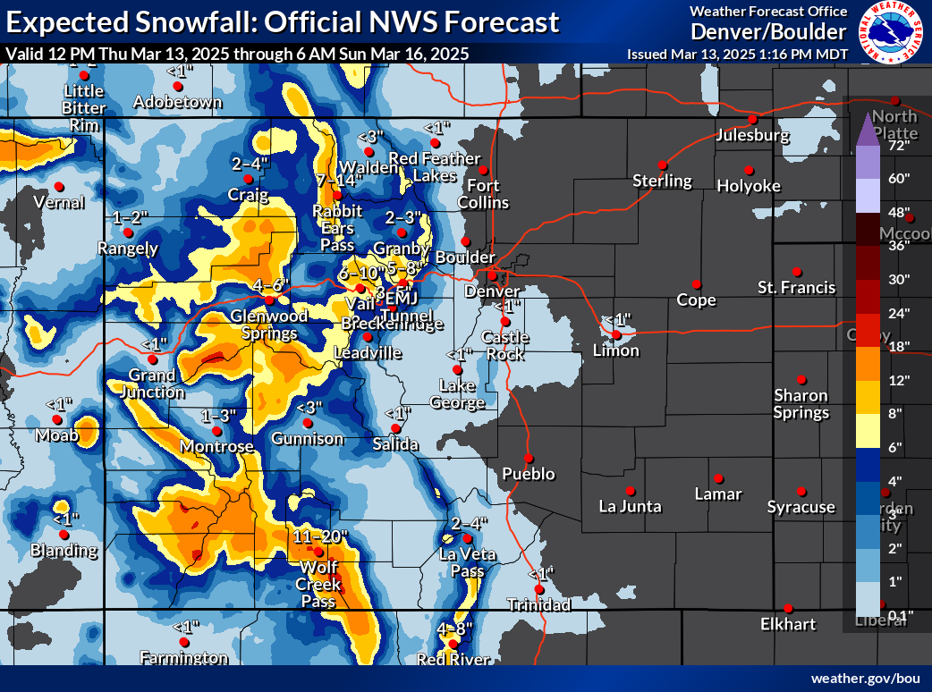
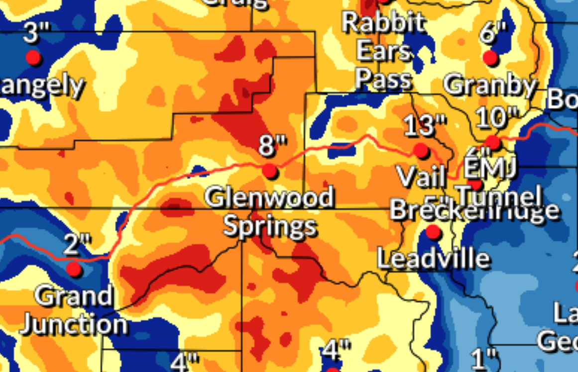
According to National Weather Service mapping, the state’s central and western peaks should be hit the hardest while the Front Range and Eastern Plains are mostly missed. In the most likely scenario, peak totals top out at about 24 inches through Sunday morning in a few area of the San Juans and Grand Mesa. Meanwhile, the ‘high-end’ forecast shows the potential for up to 30 inches in on some peaks of the San Juans and the Park Range, with 18 to 24 inches of snow being more widespread throughout the state’s mountainous region.
Portions of I-70 could get up to a foot of snow, maybe more. This will likely result in winter travel conditions and could mean delays for ski country travelers.
See both the ‘expected’ and ‘high-end’ snowfall scenarios depicted on the map below:

OpenSnow reports that ski areas in the southwest are expected to get the deepest totals, with Silverton and Wolf Creek tied at a projected 19 inches over the next five days (find a full resort-by-resort breakdown here).
Those planning to travel into the mountains this weekend should prepare by packing this list of 22 survival items.
Find additional weather updates and related alerts on the National Weather Service website.
Get OutThere
Signup today for free and be the first to get notified on new updates.
PREV
PREVIOUS

Denver Zoo needs help in naming its baby giraffe
Zoo officials set up live baby cam for the newborn

Driver reportedly caused $45,000 in damages after 'joyride' on ski slopes at American resort
For some reason this winter slopesports season, there have been multiple cases of drivers taking their vehicles off-road and onto the slopes at various ski areas around North America. That said, perhaps none of those instances have resulted in more property damage than a recent case out of Maine. According to the Oxford County Sheriff’s […]