


Snow totals increase to 11-20″ for Colorado as Easter-weekend storm approaches
Southern, eastern mountains expected to receive the most | Whiteout snow report
A spring snowstorm is on its way to Colorado for Easter weekend, and higher snowfall totals are forecasted with it.
The lower range totals for all three mountain zones have increased from around eight inches to 10-11, giving just a bit more snow to the remaining ski areas and resorts open.
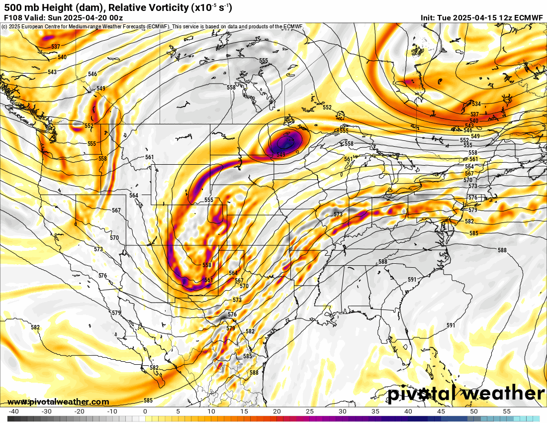
Continued storminess in the last 10 days of April is forecast as well, with between 3-5 storm waves possible, adding potentially more snow to the northern half of the state.
Recap:
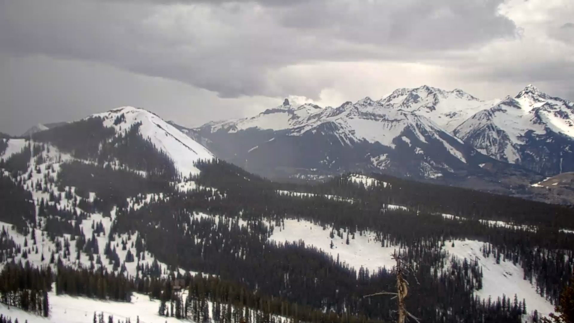
Snow moved into southern Colorado on Tuesday, as seen from the See Forever web camera atop Telluride Mountain, and brought with it a quick 1-2 inches of snow. Some snow showers made their way into the northern mountains around the Continental Divide as well by late afternoon and evening.
Further north, the central and northern mountains only saw clouds and sunshine as temperatures rose into the upper 30s and low 40s.
The CAIC remote sensor station atop Aspen Highlands recorded a high temperature of 43 degrees on Tuesday, and the DRI remote sensor station atop the Eagle Wind chairlift at Winter Park recorded a high temperature of 37 degrees.
Forecast:
• On Wednesday afternoon, light snow is forecast to develop across the central and northern mountain zones, with snowfall accumulations by Thursday’s first chairs between 1-3 inches.
Although either dust on crust or softening snow on crust will be apparent at the remaining open resorts, this light wave of snow is just the beginning of a larger storm brewing.
• Snow continues on Thursday, heavy at times, in the northern and central mountains. The Park and northern Front Range ranges, Flat Top Mountains and the Grand Mesa will see the heaviest snow totals for Friday’s first chairs.
Forecast snowfall totals in the northern mountains are between 6-10 inches, in the central mountains between 6-10 inches and in the southern mountains between 3-6 inches.

• Snow continues on Friday, heavy at times again, lasting through Saturday evening. Saturday will be more than likely be a powder day across all three zones, with Purgatory potentially having one last deep snow day before closing on Sunday.
This wave of storm energy will focus mostly on southern Colorado, but the central and northern mountain zones will receive snow as well.
Snow accumulations for Saturday’s first chairs in the northern mountains are between 1-3 inches, in the central mountains between 3-5 inches and in the southern mountains between 6-9 inches.

• Snow continues on Saturday, with the heaviest showers in the southern, southeastern and eastern mountains.
Additional accumulation totals in the northern mountain of between 2-4 inches, in the central mountains between 3-5 inches, and the southern mountains between 3-6 inches.
• Grand totals from the multi-day storm for Easter Sunday in the northern mountains are between 6-12 inches, in the central mountains between 8-16 inches and in the southern mountains 11-20 inches.

Long-term forecast:
• For the last 10 days of April several storm waves are forecasted to brush northern Colorado every couple of days starting Monday night and lasting through Wednesday, April 30.
Snowfall will stay mostly north of Interstate 70 during this time as these zonal-flowing storms move west to east across Wyoming with moisture dipping into the northern half of the state.
More details will emerge as more model runs render, including snowfall totals, timing, and duration of each storm wave, but the forecast looks to have precipitation continue heading into May for at least the northern half of the state.
Today’s 24-hour snow totals for Colorado ski resorts:
Arapahoe Basin – 0″
Aspen Highlands – Closed for the season
Aspen Mountain – 0″
Beaver Creek – Closed for the season
Breckenridge – 0″
Buttermilk – Closed for the season
Cooper – Closed for the season
Copper Mountain – 0″
Crested Butte – Closed for the season
Echo Mountain – Closed for the season
Eldora Mountain – 0″
Granby Ranch – Closed for the season
Hesperus – Closed for the season
Howelsen Hill – Closed for the season
Kendall Mountain – Closed for the season
Keystone – Closed for the season
Loveland – 0″
Monarch – Closed for the season
Powderhorn – Closed for the season
Purgatory – 0″
Silverton – Closed for the season
Snowmass – 0″
Steamboat – 0″
Sunlight – Closed for the season
Telluride – Closed for the season
Vail – 0″
Winter Park – 0″
Wolf Creek – Closed for the season
Get OutThere
Signup today for free and be the first to get notified on new updates.
PREV
PREVIOUS
Biden searches for new relevance in second Trump era
If he had his way, Joe Biden would be in the White House today. Instead, the former president is searching for newfound relevance in the second Trump era, making occasional speeches to remind the public that he’s still around and lambasting his old rival. “What makes us distinct from the rest of the world comes […]

Denver weather: Unseasonable warmth Wednesday ahead of 3-7 inches of snow Friday
The nicest day of the week weather wise is Wednesday, with temperatures jumping above seasonal averages into the upper 70s. Denver residents can expect mostly sunny skies, with a high near 76, according to the National Weather Service in Boulder. South southwest winds to blow between 6 to 8 mph become west northwest in the […]