


Easter powder snow forecast across Colorado with 10 to 20 inches expected
Will this be the last big snow event of winter 2024-25? | Whiteout snow report
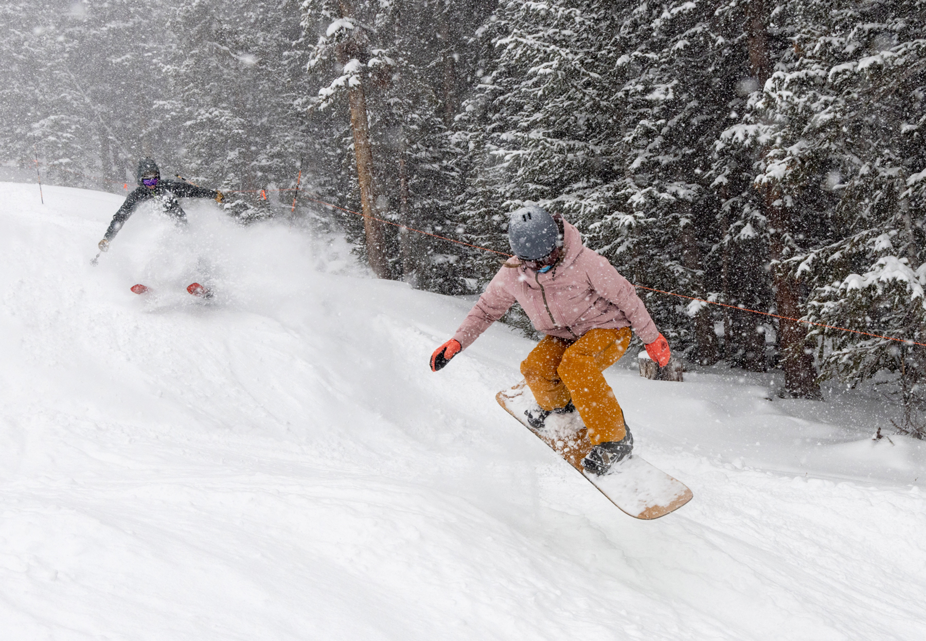

Powder snow days on Friday, Saturday, and Sunday are forecast for all three mountain zones in Colorado, and the ski areas and resorts still open will have a Happy Easter with all the new spring snow.
Colorado’s snowpack is melting fast, but the Easter weekend snows will slow it for a few days.
Light snow showers are forecast for an on-and-off effect next week leading up to a potentially larger system to bring better chances of snow during the last few days of April.
Recap:
The Easter-weekend cold front and storm arrived in northern Colorado around 1 p.m. Thursday, however, the associated low-pressure system was still loitering along the Wyoming/Colorado border north of Steamboat into the late evening.
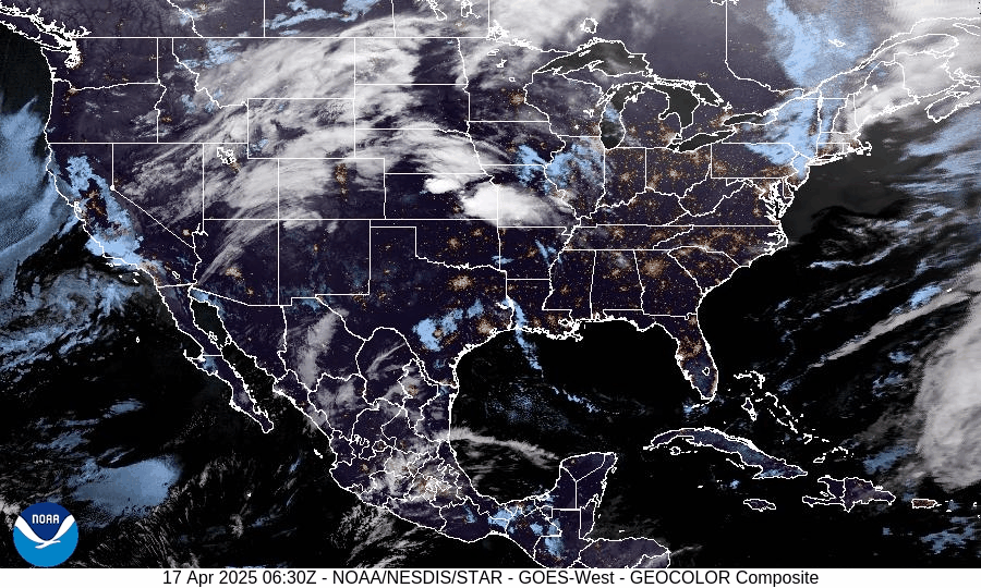
Winds west of the Continental Divide were pushing moisture into the higher terrain from the southwest while winds east of the divide were blowing from the north, creating snow showers in the northwestern mountains and northern Front Range foothills. The low pressure pushed southward overnight Friday and will take up residence in northern New Mexico and Arizona for the day.
Snowfall totals for Friday’s first chairs in the northern mountains are between 2-7 inches, in the central mountains between 2-3 inches, and in the southern mountains between 1-2 inches.
Colorado’s snowpack:
Colorado’s statewide snowpack is at 67% of the median average for April 18 and 10 inches of snow water equivalent, which is 4.9 inches below the median average of 14.9 inches.
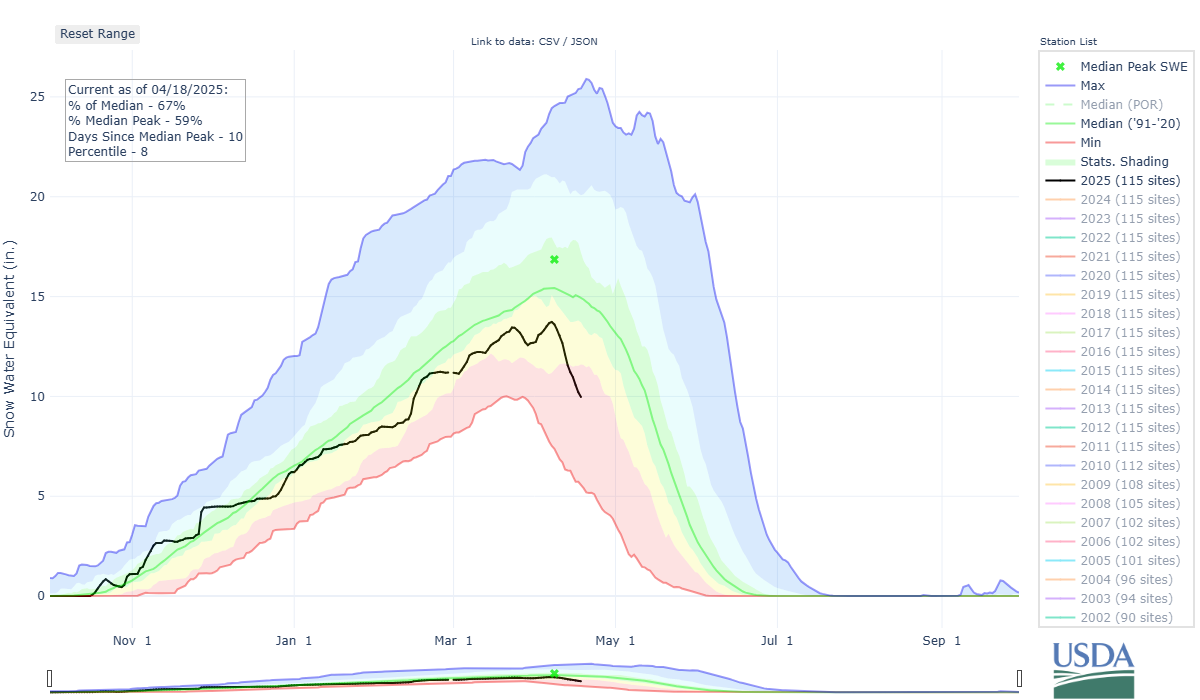
At this time of year, the snowpack and snow water equivalent numbers fluctuate more wildly due to increased sunlight and warmer air temperatures, accelerating the melting process for longer periods of the day even if the snow freezes during nighttime hours.
Forecast:
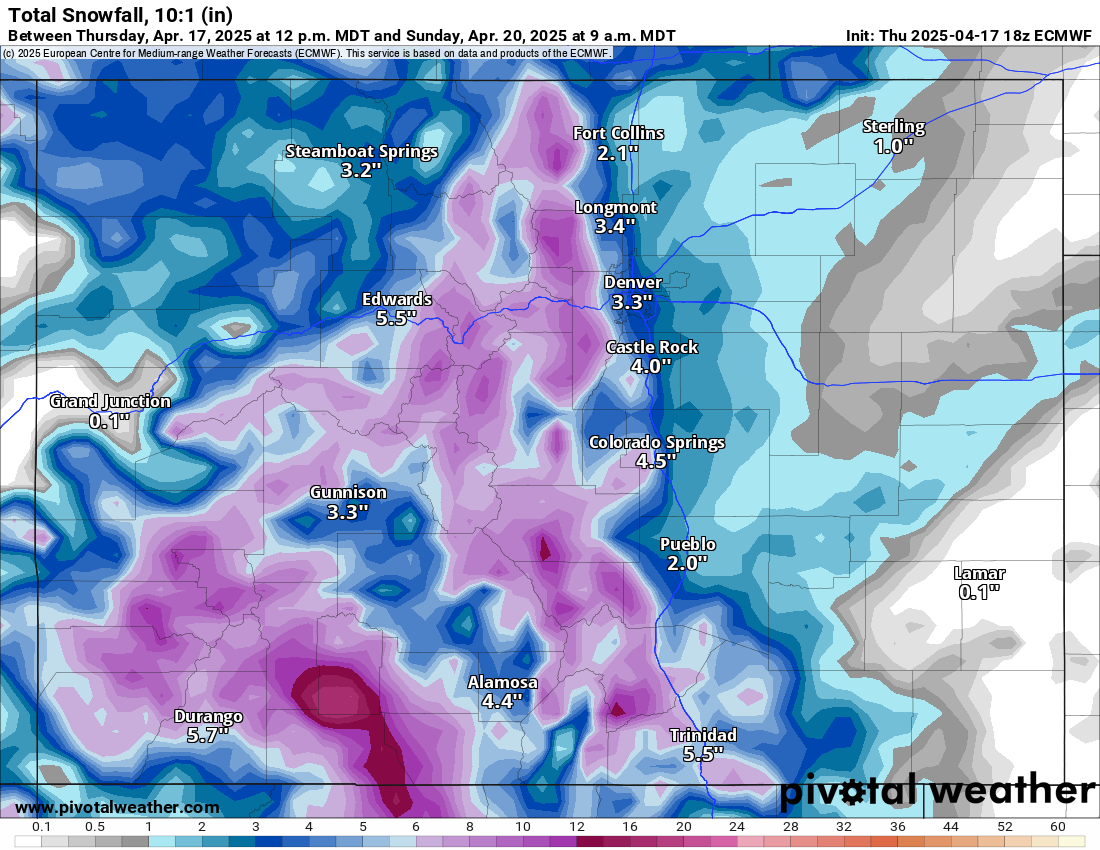
Snow will continue Friday, moving north to south and across all three mountain zones.
Snow will be heavy at times, with accumulations ranging from 5-12 inches, with the highest amounts east of the divide in the Front Range of the northern mountains, on the Grand Mesa and east side of the Sawatch Mountains in the central mountains, and in the San Juan, Sangre de Cristo and Wet mountains in the southern mountains.
Saturday’s first chairs are forecast to have between 3-6 inches of fresh powder snow, with potentially upwards of 8 inches at ski areas along the divide and east of it (Eldora, A-Basin, Loveland, and Winter Park).

Snow will continue to fall on Saturday as the low-pressure system pushes eastward into New Mexico and Texas. The southern mountains are forecast to receive the majority of additional snow from Saturday’s snow showers, with an additional 2-5 inches possible for Sunday’s first chairs; looking at you Purgatory.
Light snow showers develop Monday night after partly sunny skies during the day, but only for far north Colorado.
Similar conditions exist for Tuesday as another storm wave brushes far north Colorado Tuesday night into overnight Wednesday. Only a couple of inches of snow is forecast to fall from these two waves of energy.
Mostly calm conditions from Thursday to Monday, April 28 are forecast for Colorado
Long-term forecast:
From Monday, April 28 to Wednesday, April 30, a stormy pattern might fire back up bringing more snow to the high country. The most recent weather models have this storm forecast to come in from the southwest on a cut-off low, which would be beneficial to the southern mountains due to the lack of precipitation they have received all winter. No ski areas would be open during this time frame, however, backcountry skiing and riding would still be an option.
More details from this system will be clearer as the dates draw closer, including snowfall totals, duration, and timing.
Today’s 24-hour snow totals for Colorado ski resorts:
Arapahoe Basin – 7″
Aspen Highlands – Closed for the season
Aspen Mountain – 3″
Beaver Creek – Closed for the season
Breckenridge – 3″
Buttermilk – Closed for the season
Cooper – Closed for the season
Copper Mountain – 3″
Crested Butte – Closed for the season
Echo Mountain – Closed for the season
Eldora Mountain – 5″
Granby Ranch – Closed for the season
Hesperus – Closed for the season
Howelsen Hill – Closed for the season
Kendall Mountain – Closed for the season
Keystone – Closed for the season
Loveland – 3″
Monarch – Closed for the season
Powderhorn – Closed for the season
Purgatory – 1″
Silverton – Closed for the season
Snowmass – 3″
Steamboat – 3″
Sunlight – Closed for the season
Telluride – Closed for the season
Vail – 2″
Winter Park – 4″
Wolf Creek – Closed for the season