


Remote fourteener features narrow cliffside path, stunning views, and adventure
Spencer McKee
Towering above the remote town of Crestone, Colorado, the climb to the summit of 14,165-foot Kit Carson Peak offers hiking enthusiasts a chance to put their body to the test in one of the most scenic parts of the Centennial State.
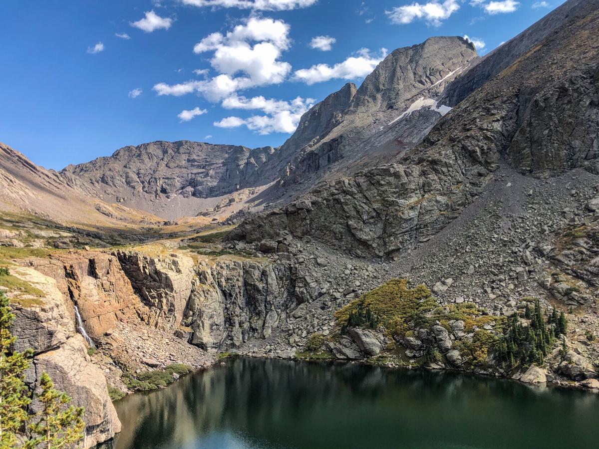
Kit Carson Peak in the center. Challenger Point is located on the right, though the summit is out of view. Photo Credit: Spencer McKee.
Spencer McKee

Kit Carson Peak in the center. Challenger Point is located on the right, though the summit is out of view. Photo Credit: Spencer McKee.
In total, the hike to the summit of Kit Carson Peak means 14.5 miles of hiking, with a good portion taking place on steep, loose scree. The route means a taxing vertical gain of 6,250 feet, sending hikers on a path that also requires summiting another 14,000-foot peak – Challenger Point.
This trail starts with a 5-mile class one approach to the Willow Lake area, a stunning and remote alpine lake.
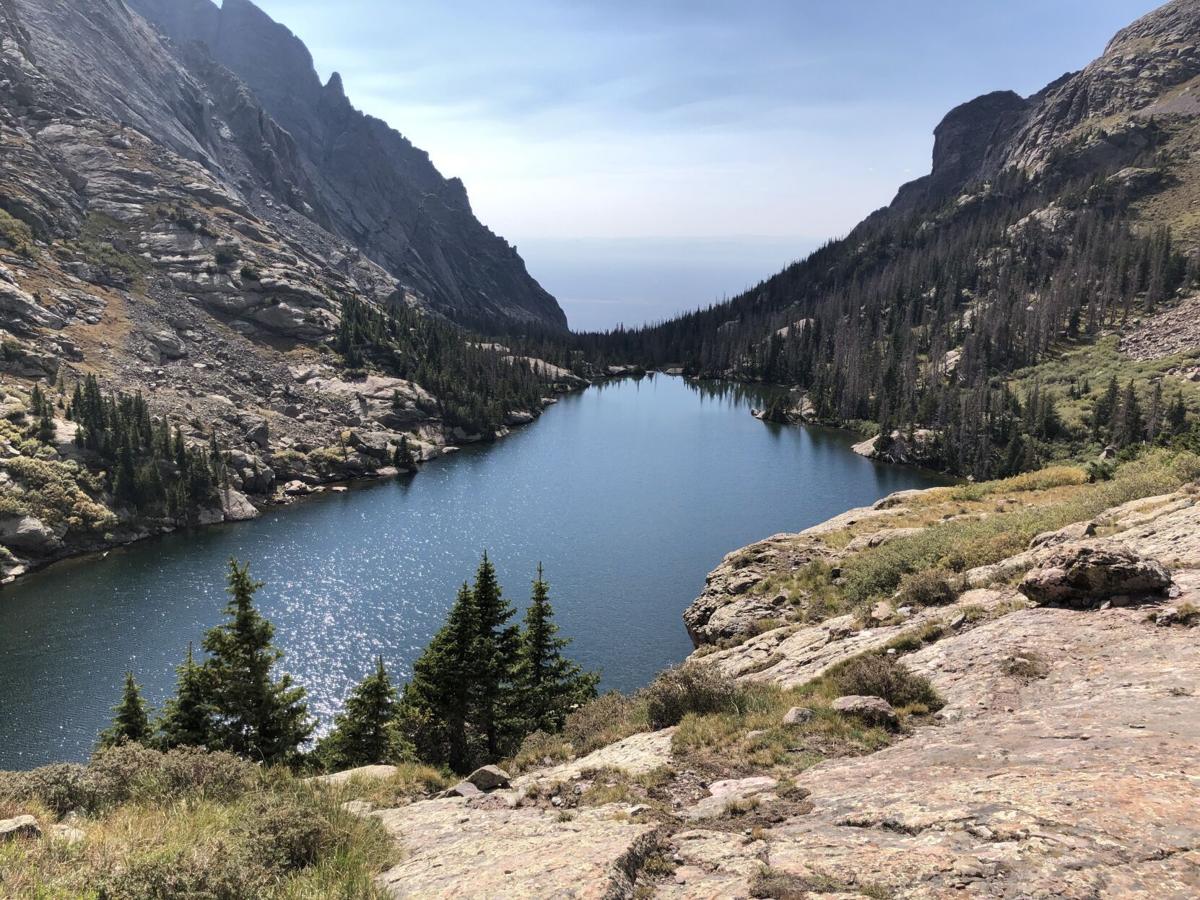
Willow Lake from above. Photo Credit: Spencer McKee.
Spencer McKee

Willow Lake from above. Photo Credit: Spencer McKee.
After hitting the lake, the trail quickly switches to hard class two scrambling up loose and difficult-to-navigate terrain. Mind your feet and be ready to catch yourself if you slip. Though death through this section is less likely, a minor injury could mean an extensive rescue effort.
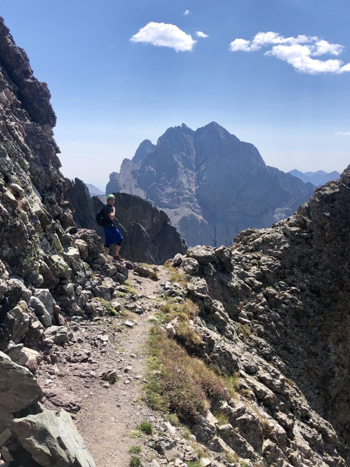
As the trail gains altitude, hikers eventually hit a ridge that leads to the Challenger Point summit. Along this portion of the hike, the daunting Kit Carson Peak towers in the backdrop.
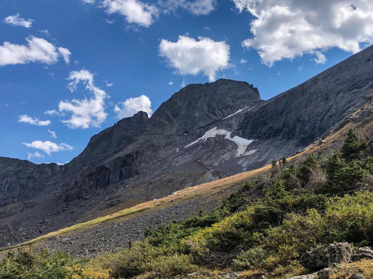
Challenger Point can be seen on the right. Kit Carson on the left. Way in the backdrop between the two, the Crestones can be seen. Photo Credit: Spencer McKee.
Spencer McKee

Challenger Point can be seen on the right. Kit Carson on the left. Way in the backdrop between the two, the Crestones can be seen. Photo Credit: Spencer McKee.
Snap some photos at the Challenger Point summit before descending toward a section of the climb called “The Avenue.”
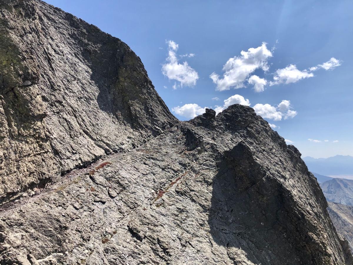
This image shows the start of "The Avenue," which is the narrow ledge leading to the notch on the mountain. Photo Credit: Spencer McKee.
Spencer McKee

This image shows the start of “The Avenue,” which is the narrow ledge leading to the notch on the mountain. Photo Credit: Spencer McKee.
This is a narrow ledge that wraps around Kit Carson Peak, setting hikers up for their final ascent. It’s narrow and there’s exposure, but it’s nothing like The Narrows on Longs Peak. Hikers that are comfortable with their footing and don’t mind hiking cliffside should manage just fine.
Spencer McKee on "The Avenue" of Kit Carson Peak. Photo Credit: A friendly hiker named Adam Jansons.

Spencer McKee on “The Avenue” of Kit Carson Peak. Photo Credit: A friendly hiker named Adam Jansons.
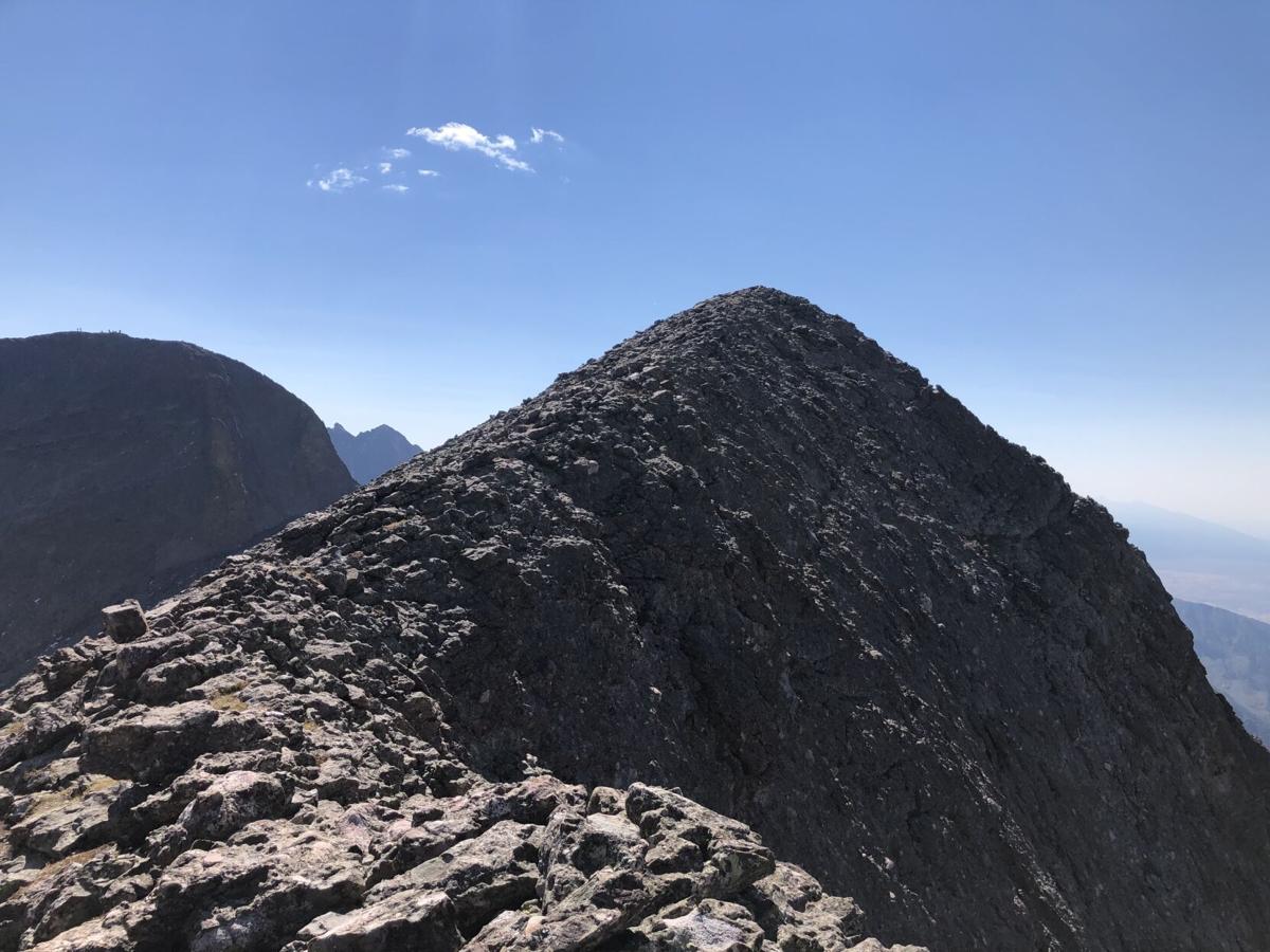
After the Avenue section of the hike, be ready for some steep scrambling up loose boulders. While this final gully leading to the summit of Kit Carson Peak isn’t too difficult compared to some other class three options in the state, large rocks can move and consequences could be dire.
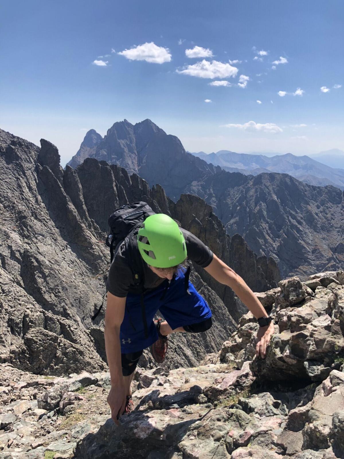
Spencer McKee scrambles to the summit of Kit Carson Peak with The Crestones in the backdrop.
Spencer McKee

Spencer McKee scrambles to the summit of Kit Carson Peak with The Crestones in the backdrop.
Once at the summit of Kit Carson Peak, hikers have stunning views of the Crestones, the Sand Dunes, Humboldt, Challenger Point, and the town of Crestone.
During your descent, use extra caution on the loose sections. Hikers must again summit the Challenger Point ridge and tired legs will likely be less reliable.
The hike to the summit of Kit Carson is a strenuous hike with big commitment, big exposure, and a serious risk for altitude sickness. If you’re looking to push yourself for the reward of a great summit view and a fun climb, enjoy, but proceed with caution.
Tips for the trail:
– Due to the loose nature of the route, falling is easy. Take your time and proceed with caution. Even a small trip could mean a day-stopping injury in a remote area. In a spot this remote, even a twisted ankle can be very problematic.
– Because a lot of time spent on this route takes place at a high-altitude, symptoms of altitude sickness may be more likely to rear their head. Know how to prevent this, what to do when it happens, and never be afraid to turn back.
– Lots of scrambling means lots of slow moving in an exposed spot. Pay extra attention to the weather, as you won’t be able to quickly descend to treeline or find cover as you might on other peaks.
– PACK IT IN, PACK IT OUT! This is a very remote spot and picking up your mess is difficult for others. Do your best to leave the trail better than you found it and always pack out what you pack in.
– Respect camping rules. There’s some backcountry camping in the area. If you choose to partake, make sure you’re following the best practices of Leave No Trace, camping at least 200 feet from water, and obeying all fire restrictions. Be aware of what local rules may be in place and only camp where allowed.
– Help keep other hikers safe. There are a lot of loose rocks on this trail. Do your best to keep them where they’re at to protect other hikers and the route. If one gets knocked loose, call it out for others to dodge it below you. Also, wear your helmet!
Editor’s Note: Find the trailhead for this hike at the end of a bumpy road that’s manageable for most vehicles. While online tips say 4WD required, the AWD sedan I was in at the time of my climb made it without issue. According to other accounts, few vehicles have issues. One user even stated that their Prius was able to make it problem-free. Find more information about this trailhead and the full route here.
STAY INFORMED: Get free Colorado news with our daily newsletter (Click here)
Get OutThere
Signup today for free and be the first to get notified on new updates.
PREV
PREVIOUS
The hike to America's highest lake, found at 13,435 feet in Colorado
Facebook Twitter WhatsApp SMS Email Print Copy article link Save Facebook Twitter WhatsApp SMS Email Print Copy article link Save Reaching America’s highest-elevation lake is a mission few take on. Found in Colorado at 13,435 feet above sea-level, according to the United State Geologic Survey, the journey to this alpine destination is remote and rugged, […]
13 towering castles that dot the state of Colorado
Facebook Twitter WhatsApp SMS Email Print Copy article link Save Facebook Twitter WhatsApp SMS Email Print Copy article link Save You won’t find kings or queens at these Colorado castles, but you will find amazing architecture, spectacular views, and a chance to explore something that’s a bit out of the ordinary. 1. Bishop Castle Bishop’s […]