


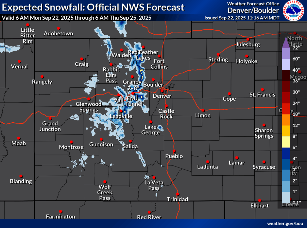
18 inches of snow could fall in parts of Colorado this week

It’s that time of the year again – when wintery weather starts to come roaring back into the Centennial State.
While a few inches of snow have landed here and there in Colorado already this fall, it’s looking like the next few days will bring the most significant snowfall yet. It’s also worth noting that this will likely be a storm where mountain roads and lower elevation valleys get hit, too.
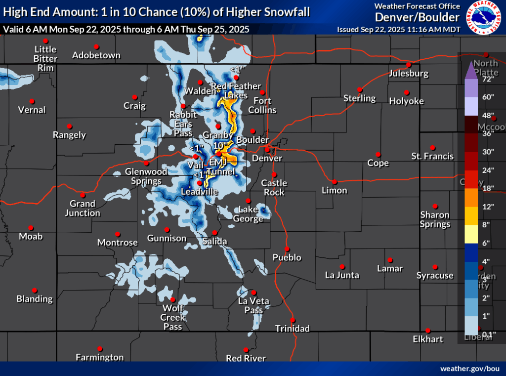
Based on reporting from the National Weather Service, some parts of the state’s northern and central mountains could get between eight and 18 inches if the ‘high-end’ snowfall scenario occurs (10% chance) between September 22 and the morning of September 25. Meanwhile, if the ‘expected’ and most likely snowfall scenario occurs (80% chance), expect peak totals to end up around eight inches.
Mapping depicts that one of the harder hit areas should be along Continental Divide in the area of Rocky Mountain National Park and just east of the Eisenhower Tunnel.
Ahead of the storm, Rocky Mountain National Park has already announced that Trail Ridge Road will be temporarily closing at 6 p.m. on Monday night from Rainbow Curve on the east side of the park to Milner Pass on the west side. Old Fall River Road will be closing at 5 p.m. It’s also worth noting that Longs Peak is expected to get quite a bit of snow – up to 12 inches based on some National Weather Service mapping. Meanwhile, Mountain-Forecast.com shows about 11 inches of snow in the forecast for the mountain through Tuesday afternoon.
Find additional forecasting information on the National Weather Service website here.
STAY INFORMED: Get free Colorado news with our daily newsletter (Click here)
Get OutThere
Signup today for free and be the first to get notified on new updates.
PREV
PREVIOUS

Get up close and personal with wildlife at these 7 experiences around Colorado
Colorado is known for its amazing wildlife, and provides opportunities to even interact with and observe the animals up close. Here are some opportunities to get up close and personal with animals across Colorado: Take a walk along the “Mile Into The Wild” Walkway at the Wild Animal Sanctuary in Keenesburg. This is the longest […]
Colorado Springs to lose Army Reserve helicopter units as brigades shutter nationally
The Army Reserve expects to divest all of its helicopters and associated units over the next year, including a brigade headquarters and one of its companies in Colorado Springs. Fort Carson-based Col. Adam Stanley, commander of the 11th Expeditionary Combat Aviation Brigade, said the deactivation of two brigades is a reflection of the hard decisions […]