


How a Colorado mountain snow affects the fall color change
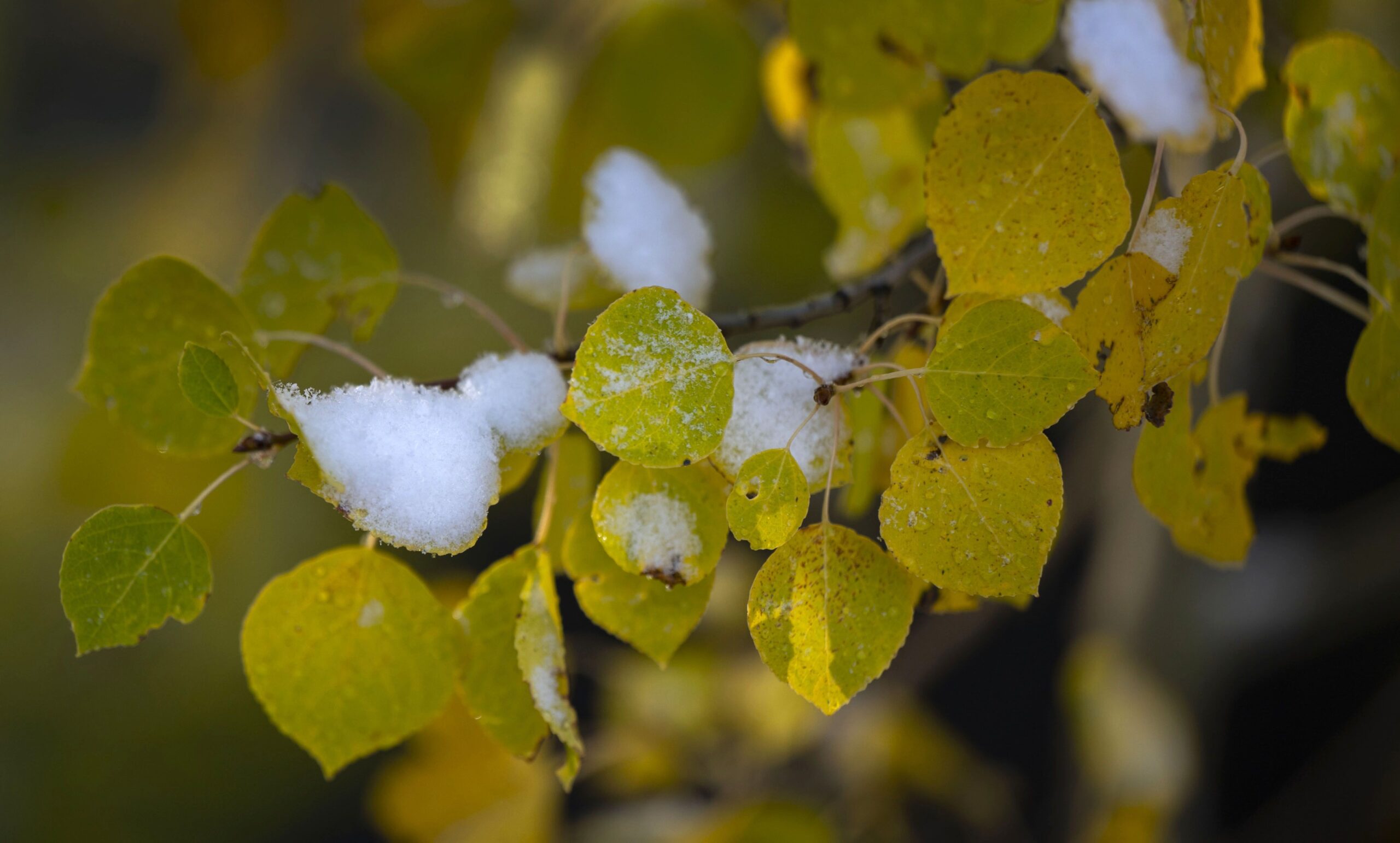
Heavy snow fell across some parts of north-central Colorado’s mountains Tuesday, particularly the mountains along the Continental Divide west of Denver from Interstate 70 to the Wyoming state line.
Up to of 12 inches was forecast by the National Weather Service in Boulder on the high peaks above 11,000 feet and between 1-3 inches down to 9,000 feet.
What also comes with that snow are varying effects to Colorado’s fall color change, particularly the state’s aspen groves, which typically grow between 6,500 to 11,500 feet-in-elevation.
Freezing temperatures and heavy snow can expedite the leaves falling off the trees due to weight snapping the branches, even if the leaves haven’t fully changed.
Early snow events do not directly affect the aspen’s color change, however, cold temperatures can ‘trick’ the trees into thinking it is further along in the fall cycle, with the tree then dropping its leaves prematurely.
Some remote weather stations across Colorado’s Front Range mountains recorded low temperatures between 29 and 32 Monday night, but that might not have been cold enough to truly ruin the aspen change — the dreaded blackening effect.
“A lot of the trees, I think, will just turn black with the freeze,” said Sharon Harding-Shaw, with Colorado Springs’ Harding Nursery, as reported by Gazette report Seth Boster.
However, Mike Till, a forester with the Colorado State Forest Service field office in Woodland Park, said previously there will probably be some blackening or browning and the leaves could shrivel up and fall off.

Some good news from a quick snow event, like this week’s, is that it probably won’t ruin the second, and most-likely peak weekend, of leaf peeping along Colorado’s Front Range and northern mountains.
The southern and central mountains received little-to-no snow from Monday and Tuesday’s snow event.
State Forest Service forester JT Shave from Salida said of 2020’s event, “one cold spell, one snow is not the end-all. It’s really the pattern after that.”
The National Weather Service office in Boulder forecasts conditions to dry out and warm back up in the Front Range mountains for the rest of the week and into the weekend, creating ideal conditions for viewers of the fall color change to witness the golds, reds and oranges one more time.
The NWS forecast for popular spots on Guanella, Cameron and Berthoud passes, and near mountain towns Blackhawk, Estes Park, Nederland and Idaho Springs, calls for high temperatures in the low 50s during the day and low temperatures in the low- to mid-30s at night, with no rain or snow showers present.

Denver area events for Dec. 2
Carlotta Olson
carlotta-olson@denvergazette.com
Updated 12 hours ago
If you have an event taking place in the Denver area, email information to carlotta.olson@gazette.com at least two weeks in advance. All events are listed in the calendar on space availability. Tuesday Downtown Denver Food Tour — 1-4 p.m., Denver, $60 and...
Carlotta Olson
Reporter

Red alert: After 24 years, Rattlebrain is tying Santa’s ‘Sack’
John Moore
john.moore@denvergazette.com
Updated 8 hours ago
2025 DENVER GAZETTE TRUE WEST AWARDS: DAY 2 More than 35,000 have enjoyed Dave and Jane Shirley’s irreverent seasonal sketch comedy When funnyman Dave Shirley told me his venerable if itinerant Rattlebrain Productions will be opening up its smirkily-titled seasonal...
John Moore
Reporter
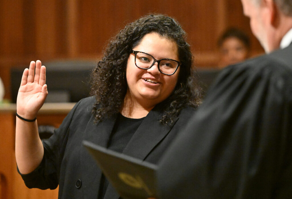
Aurora seats new progressive council
Kyla Pearce
kyla-pearce@denvergazette.com
Updated 4 hours ago
Aurora’s four new councilmembers and an incumbent were sworn in Monday night, marking the beginning of a progressive-majority council rule in the city that has been led by conservatives for years. “This is what democracy looks like,” new at-large member...
Kyla Pearce
Reporter
Denver City Council approves $600 million for DOTI on-call services
Deborah Grigsby
deborah.smith@denvergazette.com
Updated 6 hours ago
A cluster of close to 55 resolutions – totaling $600 million for contracts to provide on-call services for the city’s Department of Transportation and Infrastructure won council approval Monday. However, two resolutions tied to the city’s homeless operation were tabled...
Deborah Grigsby
Reporter

Heading into holidays, shoplifting on the rise in Colorado, study says
Mark Samuelson
mark-samuelson@denvergazette.com
Updated 7 hours ago
Shoplifting and other forms of retail crime are seeing a sharp rise as Colorado heads into the holidays, according to a study. After falling from a recent-record 24,975 thefts reported in 2015 to around 18,000 in 2021, Colorado Bureau of...
Mark Samuelson
Reporter

Funeral for Sen. Faith Winter will be held Friday at the Colorado Capitol
Marianne Goodland
marianne-goodland@denvergazette.com
Updated 7 hours ago
Colorado Sen. Faith Winter will be remembered on Dec. 5 at 2 p.m. in a funeral service on the state Capitol’s west steps. A celebration of life reception will follow. Winter died on Wednesday, Nov. 26, in a three-vehicle accident...
Marianne Goodland
Reporter

Commerce City to open holiday skating rink, market at annual tree lighting ceremony
Kyla Pearce
kyla-pearce@denvergazette.com
Updated 9 hours ago
Commerce City will open its first Merry Market and Winter Wonderland Ice Rink on Wednesday, bringing another outdoor seasonal ice rink to the few in the metro Denver area. The market and ice rink are set to open to the...
Kyla Pearce
Reporter

Gaytán builds support for Denver school board presidency bid
Nico Brambila
nico-brambila@denvergazette.com
Updated 4 hours ago
Denver Public Schools Director Xóchitl Gaytán has been seeking support behind the scenes for a bid to lead the school board, according to people familiar with the conversations — a move that follows her visible role at the swearing-in last...
Nico Brambila
Reporter

Copper Creek yearling wolf blamed for livestock death in Gunnison County
Marianne Goodland
marianne-goodland@denvergazette.com
Updated 9 hours ago
A heifer found dead in eastern Gunnison County on Nov. 22 was killed by one of the yearlings from the Copper Creek wolf pack, according to a rancher, who did not want to be identified. It’s the fourth livestock death...
Marianne Goodland
Reporter

‘Goldens in Golden’ event announces changes to ease crowds
9News
9news@denvergazette.com
Updated 9 hours ago
GOLDEN, Colo. — After last year’s “Goldens in Golden” event overwhelmed Golden with traffic, limited parking and heavy crowds, city officials are rolling out changes to keep the celebration fun while reducing chaos. The “Goldens in Golden” event has grown...
9News
Reporter
PREV
PREVIOUS

Arapahoe County gives developer access to quiet lane used by cyclists, pedestrians
After months of controversy and “agonizing” over how to move forward, Arapahoe County Commissioners on Tuesday approved giving a developer access to a quiet road in Columbine for a new 55-plus community. Christensen Lane, a one-lane concrete street, currently sits quietly among tall trees, offering a peaceful place for cyclists and pedestrians to recreate and […]

DoBetterDnvr social media accounts taken down, new handle created
The Instagram, Facebook and X accounts for the social media platform DoBetterDnvr were taken down from their respective websites Tuesday morning. Not much is currently known why the accounts, which had more than 120,000 followers on Instagram and over 25,000 on X, were disabled, but a newly created X account under the handle @DoBetterDenver claimed […]