


Multiple snow storms enter Colorado as snowmaking ramps up at more ski areas
Thirteen days into October and some snow has fallen at most of Colorado’s ski area bases and on its peaks, yet Mother Nature’s efforts haven’t amounted to much accumulation so far.
Remnants from Hurricane Priscilla provided much needed precipitation to southwestern Colorado, but it was mostly in the form of rain.
Temperatures are closer to ideal conditions for snowmaking at ski areas that have the capabilities.
Snowmaking in Colorado:
Temperatures have cooled enough during some overnight periods, creating better conditions for snowmaking at ski areas, like at Loveland Ski Area in Clear Creek County and Arapahoe Basin Ski Area in Summit County.

The infamous term ‘wet-bulb temperature’ is thrown around in the snowmaking process frequently, and this time of year ski areas watch for ideal wet-bulb temps in order to make snow for their slopes.
An optimal wet-bulb temperature for making snow is between 10-20 degrees, although snowmaking can begin at wet-bulb temperatures below 27.5 degrees.
An example is when the air temperature is 30 degrees + a 25% humidity = a 22.6 degree wet-bulb temperature, which is more than enough to make snow.
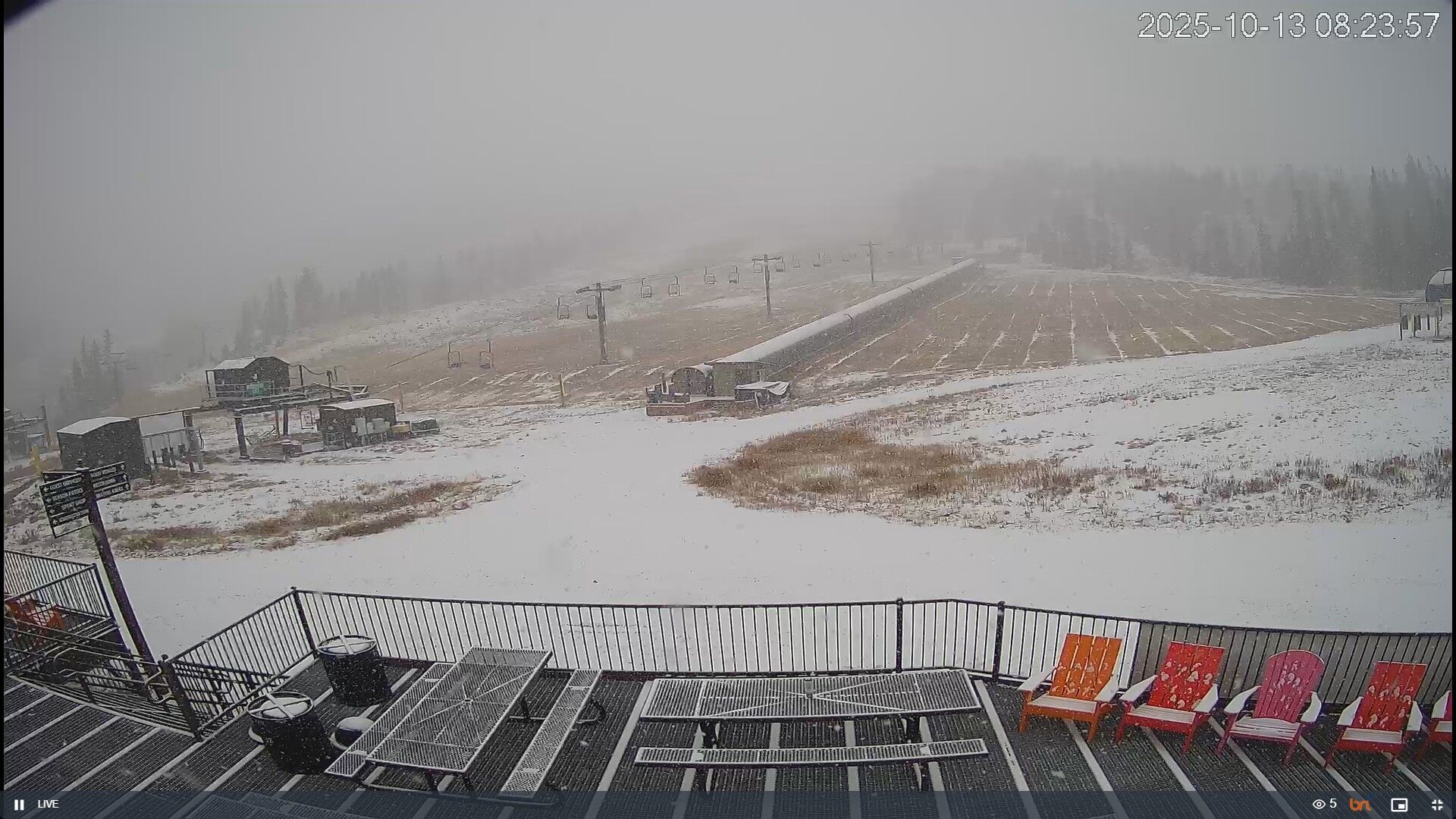
Loveland Ski Area fired up some of its snow guns on Monday.
“Around midnight on October 13, 2025, Loveland’s snowmaking team fired up the snow guns for the first time this season, officially kicking off snowmaking operations for the 2025–2026 season,” the ski area said in an email.
Loveland said the ski area is ahead of schedule compared to last year, when snowmaking began on Oct. 18.
Recap:
Rain showers dropped between 3 to 6 inches of water to parts of the San Juan Mountains over the weekend; mostly Friday and Saturday.
Flooding in Pagosa Springs closed down parts of town over the weekend and Wolf Creek Pass received 5.8 inches of rain, according to the SNOTEL remote weather station on the west side of the pass.
Snow fell above 11,000 feet, with accumulations of between 4-6 inches.
Forecast:
An additional 1-3 inches of rain is expected to fall from Monday through Tuesday across the same regions of the San Juan mountains, with heavy wet snow sticking to the peaks above 9,000 feet.
The latest ECMWF model forecasts up to 12 inches of snow could fall around the peaks near Silverton and Lake City by Tuesday night. Lesser amounts of snow is forecast to fall in the central and northern mountains, but between 3-6 inches above 10,000 feet is probable.

After a mostly quiet Tuesday and Wednesday, snow showers pick up again in northern Colorado.
Snow is expected starting late Wednesday night, lasting through early Friday morning with between 2-4 inches of snow falling in the northern central mountains (Elks), Flattops, Park and Front Range ranges mostly.
One more snow wave brushes northern Colorado on Saturday, with an additional 1-3 inches for the northern Park and Medicine Bow ranges.

Long-term forecast:
Another shot of snow is possible for northern Colorado on Monday, Oct. 20 and Tuesday, Oct. 21.
More details to follow as forecast models become more clear from this possible storm.