


Two snow storms for Colorado bookend weekend, accumulations between 12-20″ forecast
Colder temperatures arrive along the Front Range with snow levels possibly down to 5,700 feet
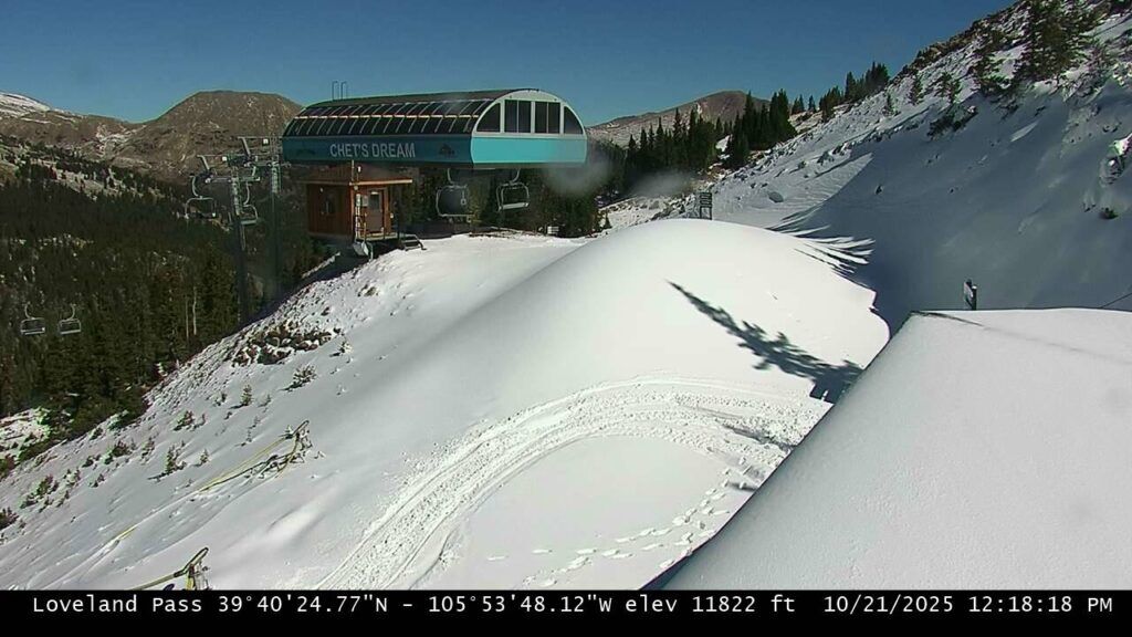
Snow fell quickly on parts of the Front Range Mountains on Monday, bringing a few inches to places like Loveland Ski Area and shutting down Interstate 70 for a few hours before the storm left Colorado by early afternoon.
The second storm of three arrives overnight Thursday and is forecast to bring moderate snowfall to the southern, central and eastern northern mountains by Friday night.
The last storm before Halloween starts Sunday night, ends Monday night, and who’s primary focus will mostly like be the northern mountains.
Recap:
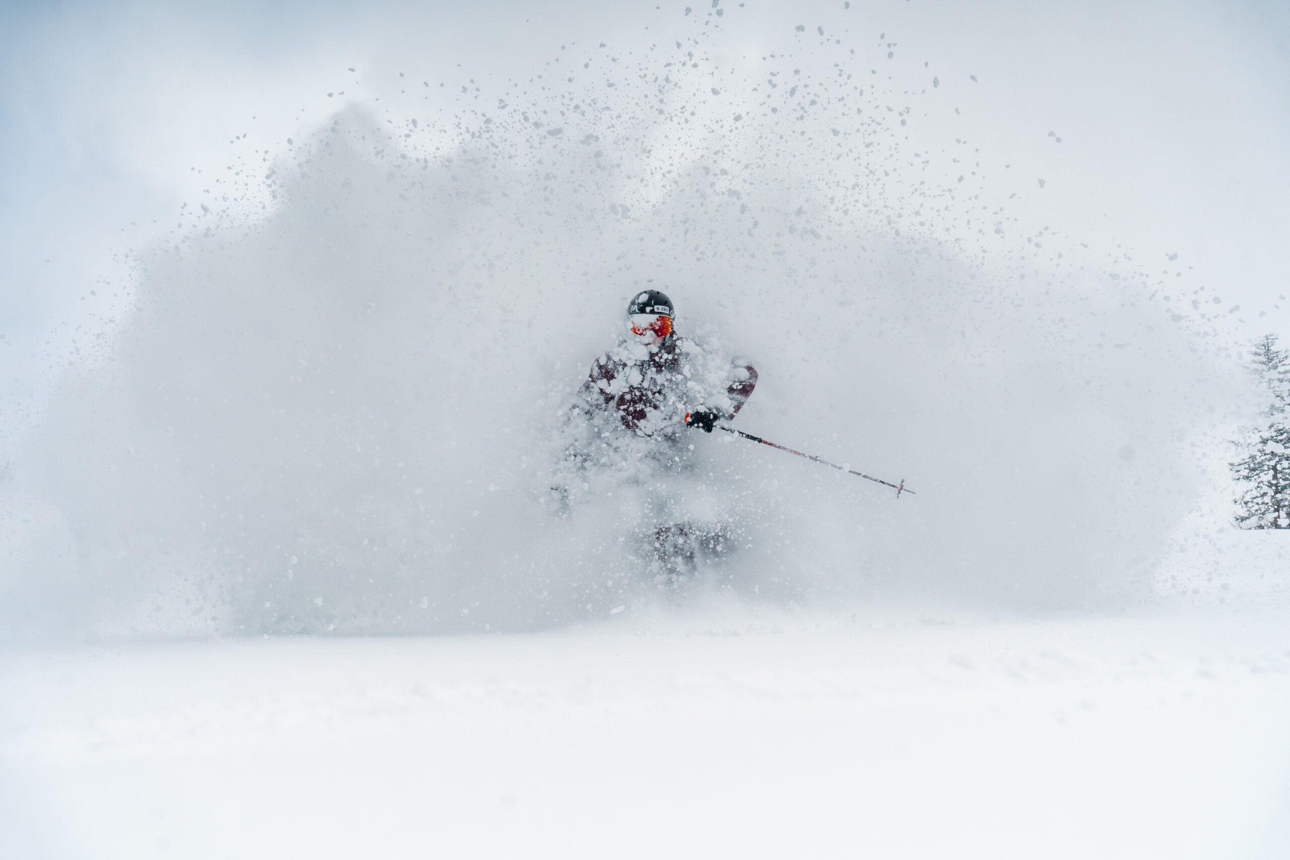
Monday’s fast-moving snow storm dropped a few inches of snow in Colorado’s northern mountains, in particular around the Continental Divide and eastern Park Range.
High temperatures rebounded some on Tuesday across the mountains, but stayed between 25-35 degrees near most ski area summits all day.
The lower-angled sunlight of late October is helping keep naturally-fallen and man-made snow on north faces from melting, which will allow snowmaking crews to continue to add on to bases ahead of opening days.
Forecast:
On Wednesday, the National Weather Service forecasts most of the state to have calm and sunny conditions ahead of an approaching storm leading into Thursday. High temperatures will be between 50-60 degrees at ski the state’s ski area bases, with upper 40s near the summits.
Thursday overnight, the second storm of the three forecast before Halloween arrives in the southern mountains.
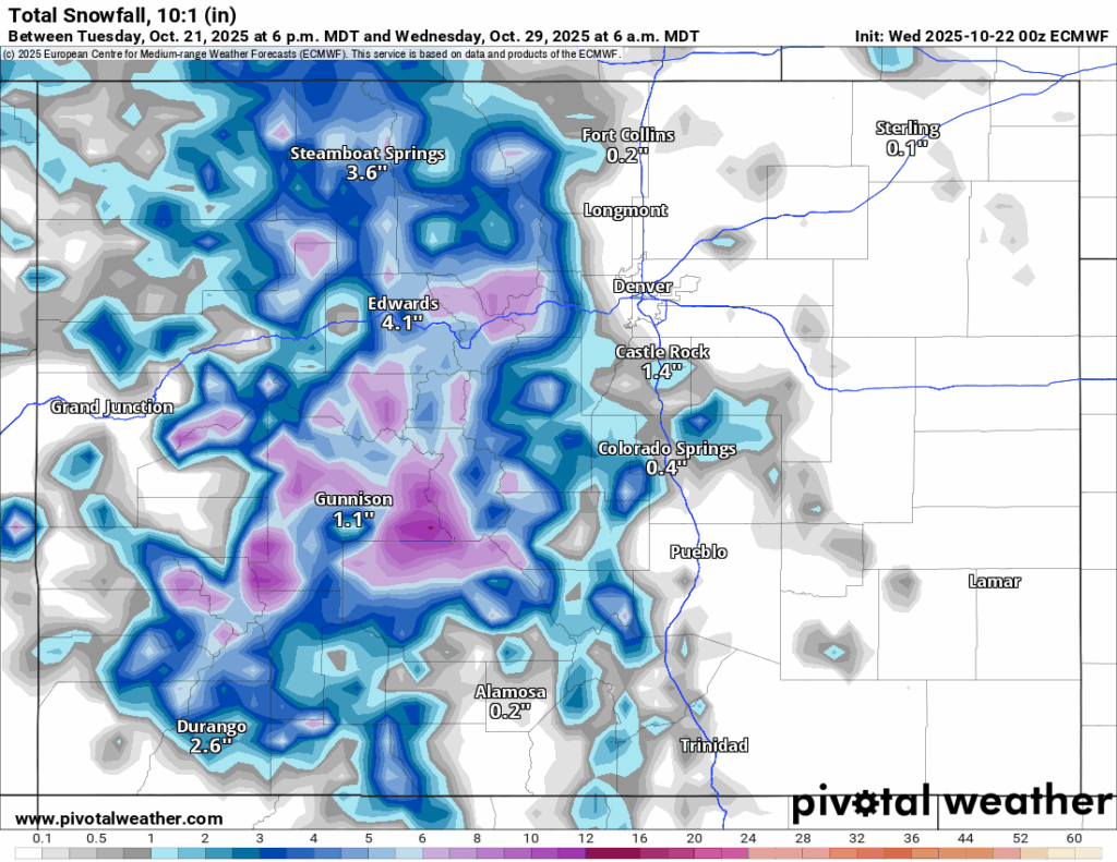
The European Centre for Medium-Range Weather Forecasts (ECWMF) model run from Tuesday afternoon forecasts a low pressure moving across southern Utah into west-central Colorado throughout the day Thursday, bringing moderate snowfall to the southern and central mountains, and areas in southern Summit County, northern Park County and eastern Lake County.
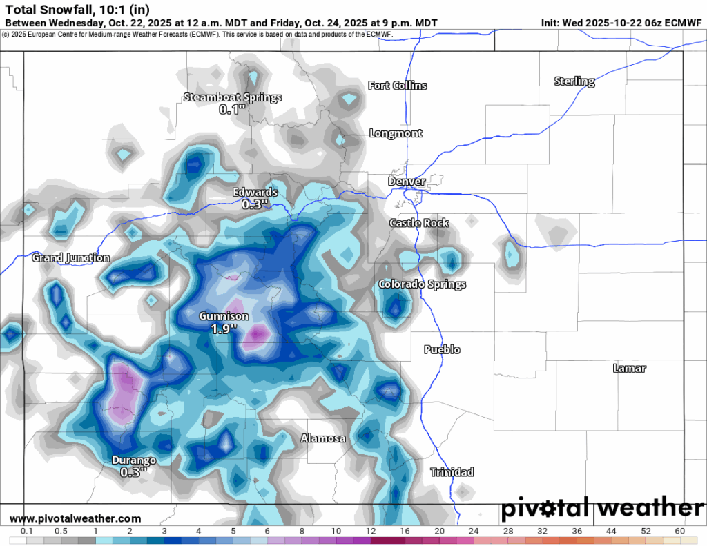
Forecasted accumulations by Friday evening of between 3-8 inches in the southern mountains and between 3-8 inches in the central mountains, with the highest amounts in the Elks and northern San Juan Mountains, and between a trace-1 inch in the northern mountains are possible.
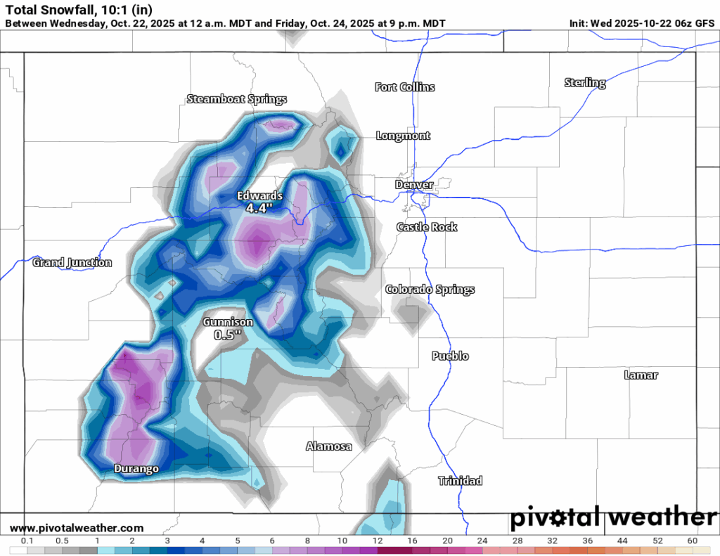
The American GFS model forecasts higher snowfall totals more centralized, with the central mountains receiving the bulk of the snow, but the northern San Juan Mountains should benefit greatly too.
On Saturday, the state will be between storms, with high temperatures a bit cooler than earlier in the week. The forecasted high at Copper Mountain is 49 degrees.
Long-term forecast:
On Sunday, light snow is forecast to develop in the western mountains first, then increase steadily throughout the day, favoring the Sawatch Mountains.
Additional snowfall accumulations of between 3-6 inches is possible for the Flattops, Gore Range and south of I-70.
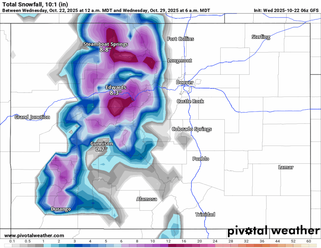
The GFS model forecast has higher snowfall totals in the northern mountains from the third storm, with up to 20 inches in the Elks and Park ranges by Wednesday morning, and snow continuing into Wednesday morning as well.
Regardless, this third storm is forecast to be much colder than the previous two, with high temperatures only reaching into the upper 20s during the day and dropping into the low 10s and even some single digits both Monday and Tuesday nights.
From late Tuesday/early Wednesday to Halloween Friday, Oct. 31, no snow storms are forecast.
It is possible a couple of ski areas could have a run or two open heading into the first few days of November, however, those details will emerge when the ski areas’ slopes are safe and ready to be opened.
Otherwise, the first few days of November are forecast to be seasonal, but the possibility of the next storm comes around Tuesday, Nov. 4 and Wednesday, Nov. 5.