


Forecast shows another 12″ of snow possible in parts of Colorado through Saturday morning
With parts of mountainous Colorado starting to get more regular snowfall as the second half of November hits, it’s likely that more on-and-off snow is on the way over the next few days into the start of next week.
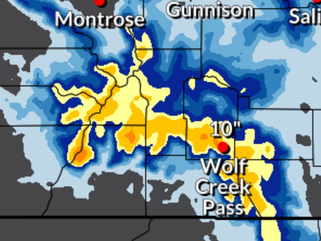
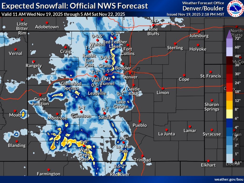
In the most likely scenario (80% chance), the National Weather Service is calling for some parts of southwest Colorado to get about eight to 12 inches of snow through Saturday morning with more than 12 inches possible on a few select peaks. The southern Sangre de Cristos should also get snow in the eight to 12-inch range, as well, with the Continental Divide north of I-70 likely to get about six to eight inches, too. Elsewhere, most mountains should get at least a dusting to about six inches.
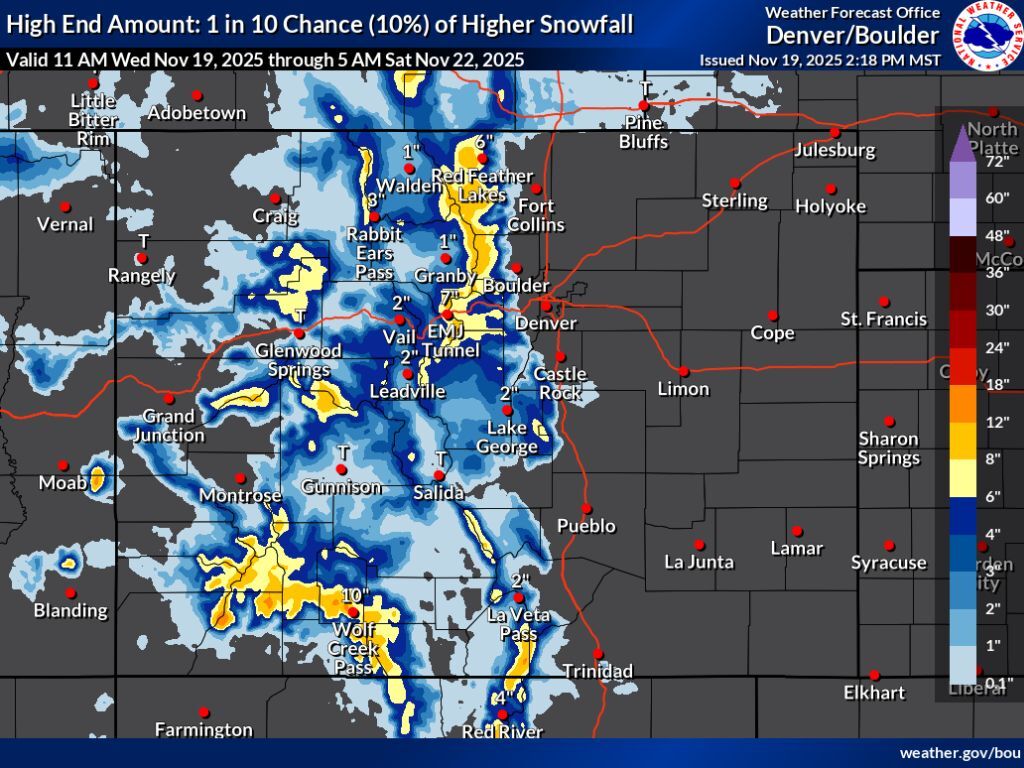
In the less likely, but more impactful ‘high-end’ snowfall scenario (10% chance), the northern Front Range gets snowfall between eight to 12 inches on high elevation peaks, with a larger portion of southwest Colorado and the southern Sangre de Cristos having a shot at a foot of snow or more. This ‘high-end’ scenario also means some peaks in the central mountains and near Aspen could get snow in the six to 12-inch range, too.
Find both scenarios mapped below:
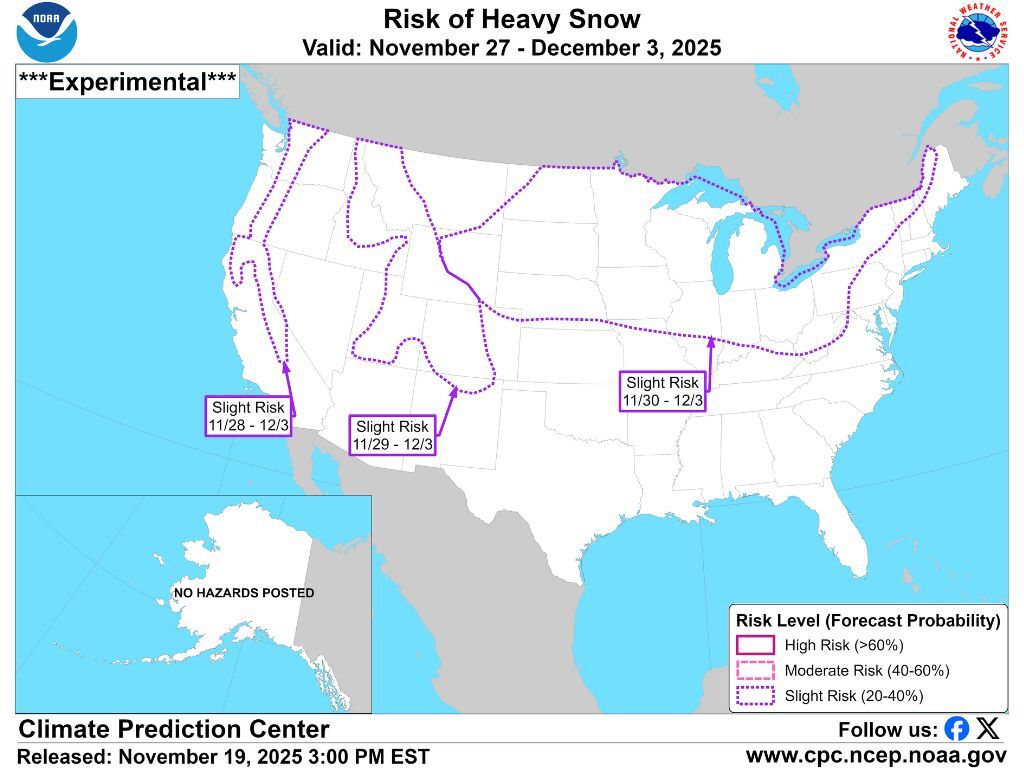
Looking ahead into next week, more snow is possible. It’s also worth noting that much of Colorado is included on the ‘risk of heavy snow’ map that’s produced by the National Weather Service for dates of November 29 through December 3.
Find additional forecasting from the National Weather Service here.
RELATED: Sign up for our free daily newsletter to get top headlines in your inbox
Get OutThere
Signup today for free and be the first to get notified on new updates.
PREV
PREVIOUS

Colorado ski area set to offer free skiing on Sundays all season long
Often described as one of the affordable places to ski and snowboard in Colorado, the historic Howelsen Hill in Steamboat Springs has long been a great place to learn the skills before headed to bigger resorts. First opening in 1915, Howelsen Hill takes pride in having produced close to 100 Winter Olympians throughout its existence, […]

Colorado’s Collaboration Fest set to bring hundreds of breweries together
Mastermind breweries will once again unite to create eclectic concoctions when the Colorado Collaboration Fest returns next spring. The Collaboration Fest, presented by On Tap Credit Union and the Colorado Brewers Guild, will bring nearly 200 different craft breweries to the Westin Westminster in April, continuing a nearly 10-year-long tradition for local beer lovers. The […]