


Wind gust hits 90 mph on Colorado’s Front Range ahead of bleak 10-day snow forecast
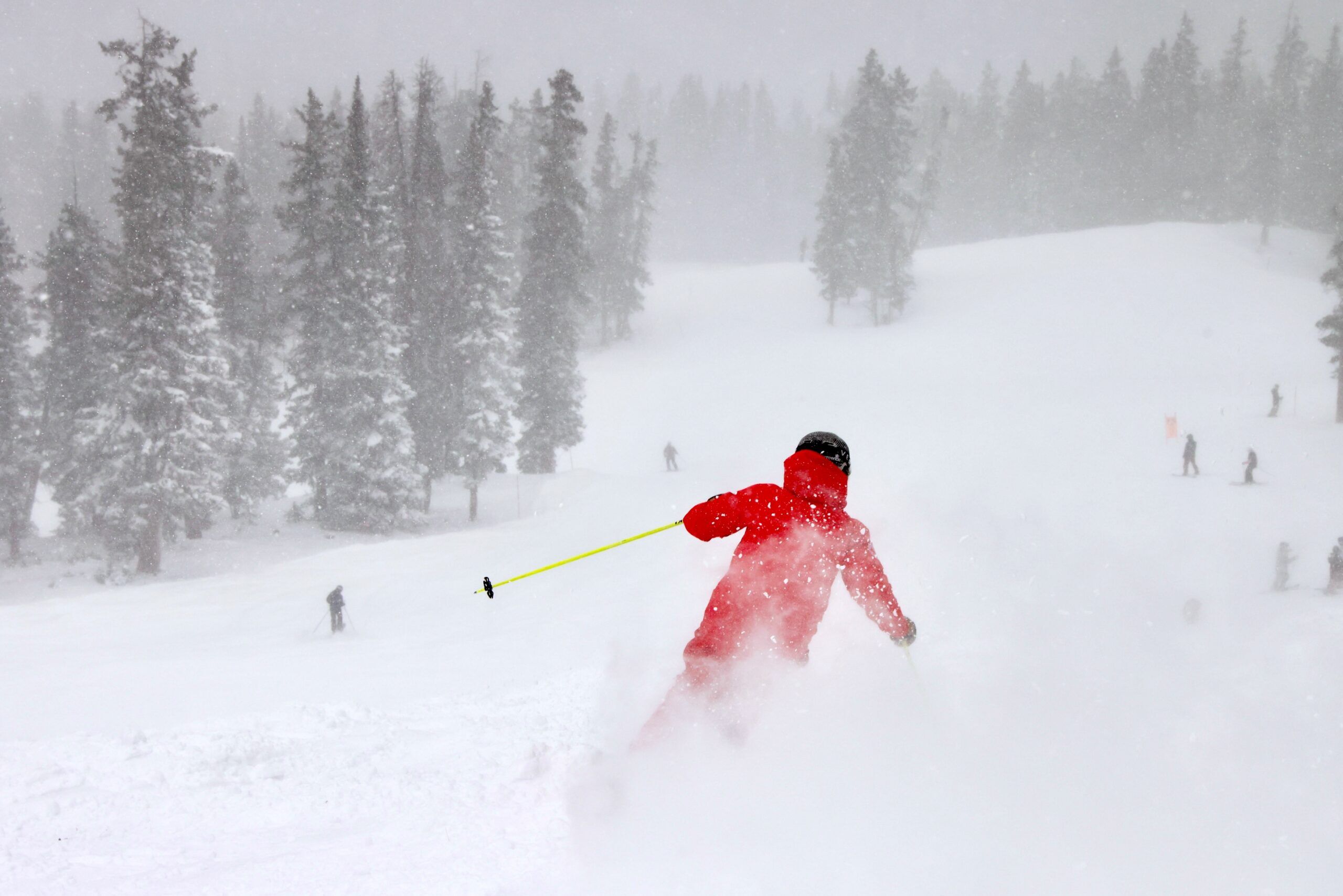
Windy weather will dominate parts of Colorado’s high country over the next two days, with gusts between 50-60 mph on ridge tops possible and 30-40 mph at the ski areas in the Front Range and Sawatch mountains.
Some light snow is forecast to develop on Wednesday for the northern mountains, but then a possible 10ish-day dry spell looms in the middle of the month.
Possible snow before Christmas? Chances are looking better.
Recap:
Monday’s weather brought a few inches to the northern mountains, otherwise the state’s high country was fairly quiet.
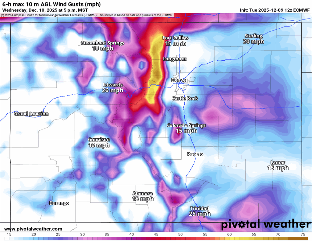
Tuesday was a very windy day in the mountains, especially the Front Range. The Homestead Rd at W Beaver Brook (top of Floyd Hill) CDOT weather station recorded a wind gust of 86 mph at 5:06 p.m., and the Dakota Hill ASOS/AWOS weather station north of Idaho Springs recorded a wind gust of 90 mph at 4:53 a.m.

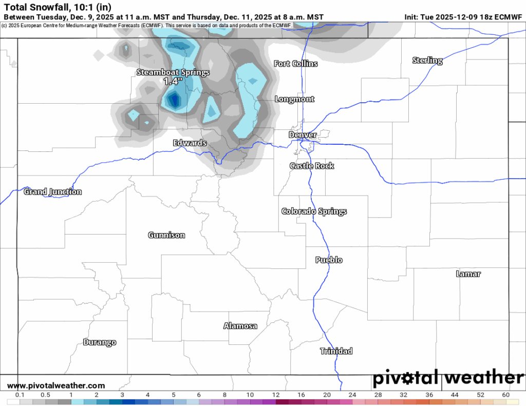
Snow also developed in the northern mountains throughout the day, with between 1-3 inches falling for Wednesday’s first chairs.
Forecast:
On Wednesday and Thursday, wind will return to the Front Range mountains and Sawatch Mountains mostly, with gusts forecast to be between 50-60 mph or more.
Snow will more than likely scour from west facing slopes onto eastern facing slopes over the next 48 hours, creating wind slabs on leeward faces, but could also transport some snow onto ski area slopes and fill in gaps allowing for possible terrain openings throughout the rest of the week; maybe.
Some additional snow is forecast to fall during the day Wednesday, but after that the state could be entering a long dry spell as mid-month approaches.
Forecasted additional snowfall from the European model for Wednesday’s storm in the northern mountains is between 1-2 inches and in the central and southern mountains most likely nothing at all.
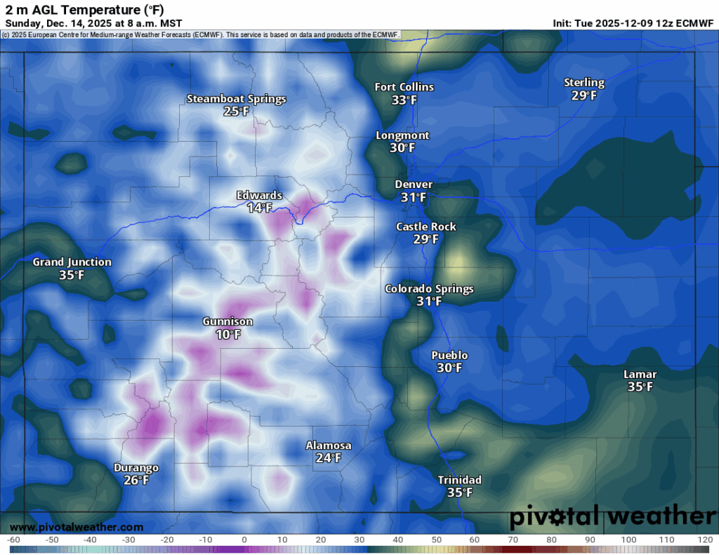
From Thursday to Sunday, sunny skies will dominate Colorado’s high country, with high temperatures in the low 40s at the base areas and low- to mid-30s mid mountain and at the summits.
On Saturday night and overnight Sunday, some arctic air is forecast to back into the Front Range of Colorado and eastern Plains as a sagging blast of very cold air will drive temperatures in the northern Plains and Grand Lakes region well below zero.
Early morning lows in Denver could be nearly equal to the early morning low in Steamboat, however, no snow is associated with this cold plunge.
Long-term forecast:
Current weather forecasts from Monday, Dec. 15 to Saturday, Dec. 20, appear Colorado is too far south for any good storms to bring snow to the high country, and overall sunny conditions will most likely prevail.
The next better chance for snow starts around Saturday, Dec. 20, giving the state possible fresh snow for a couple of days a few days before Christmas.
More model runs will need to render to dial in better details regarding any storm activity this far out, including snowfall totals, timing and duration of storm(s).
Colorado ski resorts’ planned opening dates and 24-hour totals:
Arapahoe Basin – 2″
Aspen Highlands – Dec. 13
Aspen Mountain – 0″
Beaver Creek – 0″
Breckenridge – 1″
Buttermilk – Dec. 13
Cooper – 0″
Copper Mountain – 0″
Crested Butte – 0″
Echo Mountain – Dec. 12
Eldora Mountain – 1″
Granby Ranch – 0″
Hesperus – Closed for the season
Howelsen Hill – 0″
Kendall Mountain – Dec. 13
Keystone – 1″
Loveland – 4″
Monarch – 0″
Powderhorn – 0″
Purgatory – 0″
Silverton – Private mountain after Dec. 1, Guided and Heli season Dec. 27
Snowmass – 0″
Steamboat – 1″
Sunlight – Dec. 12
Telluride – 0″
Vail – 0″
Winter Park – 0″
Wolf Creek – 0″
Outside Aurora VA hospital, hundreds memorialized nurse killed in Minneapolis
Mary Shinn
mary-shinn@denvergazette.com
Updated 3 hours ago
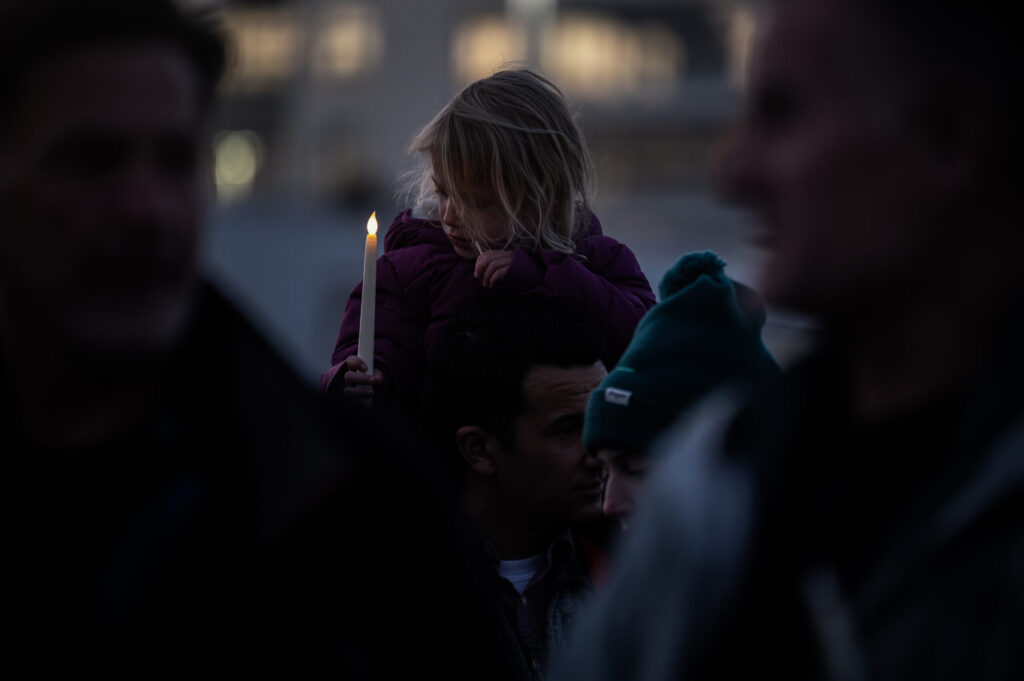
Outside the Department of Veterans Affairs Hospital in Aurora on Wednesday night, soft light from battery-powered candles illuminated hundreds of mourning faces. The crowd of nurses and other community members gathered to remember Alex Pretti, a VA nurse, who was...
Mary Shinn
Reporter
Contract for National Western Center pedestrian bridge advances
Deborah Grigsby
deborah.smith@denvergazette.com
Updated 5 hours ago
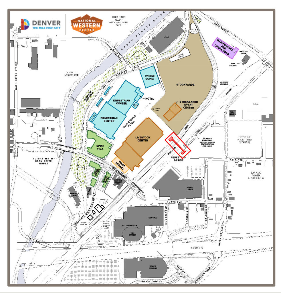
Members of the South Platte River Committee voted on Wednesday to advance a $12.7 million contract with Ames Construction to construct a new pedestrian bridge at the National Western Center. City officials say the project will improve east-west campus and...
Deborah Grigsby
Reporter
Colorado snow forecast shows 3 rounds incoming, but accumulation expected to be minimal
Spencer McKee
spencer@outtherecolorado.com
Updated 7 hours ago
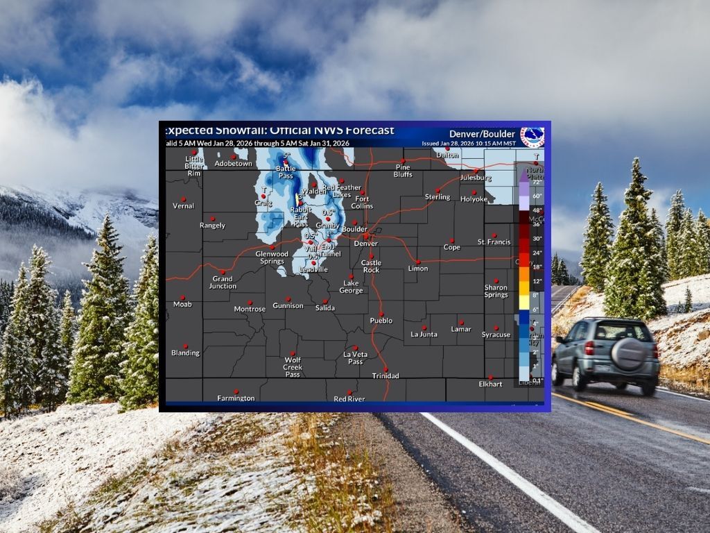
As of Jan. 28, Colorado’s statewide snowpack level remains at an all-time low – about 58 percent of what’s typical for this point in the season. While there’s some snow in the short-term forecast, it’s unlikely this snow will be...
Spencer McKee
Reporter
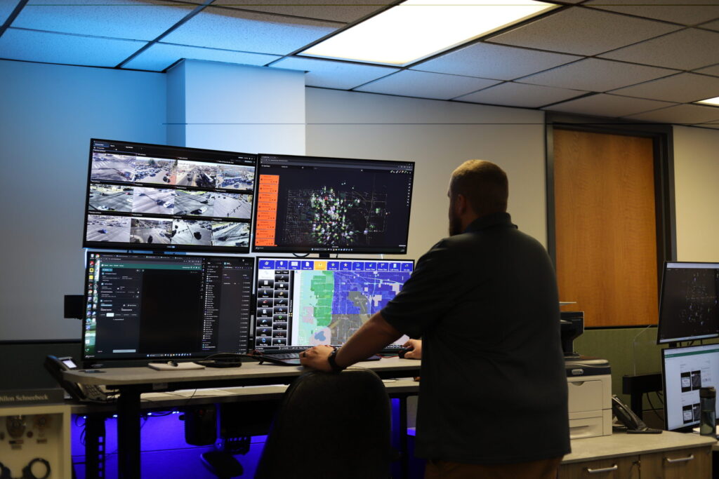
Denver backs Minnesota’s legal action to end ICE deployment
Deborah Grigsby
deborah.smith@denvergazette.com
Updated 6 hours ago
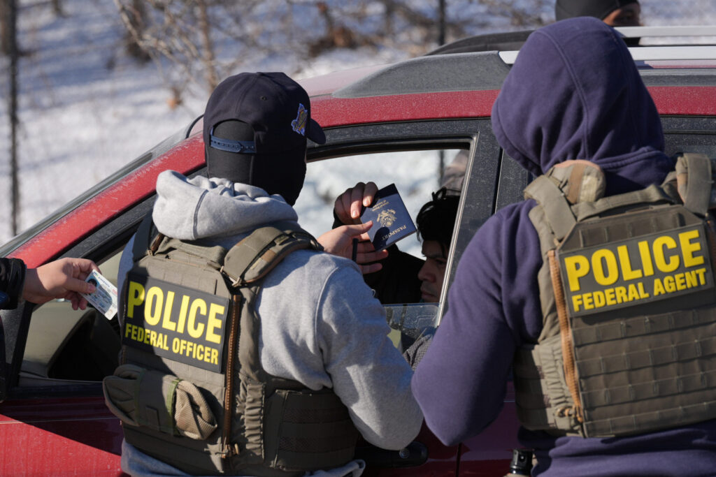
The City of Denver has joined dozens of U.S. cities and counties in filing an amicus brief backing Minnesota’s legal action seeking to end “Operation Metro Surge” and the deployment of thousands of federal immigration agents to Minnesota. The brief...
Deborah Grigsby
Reporter
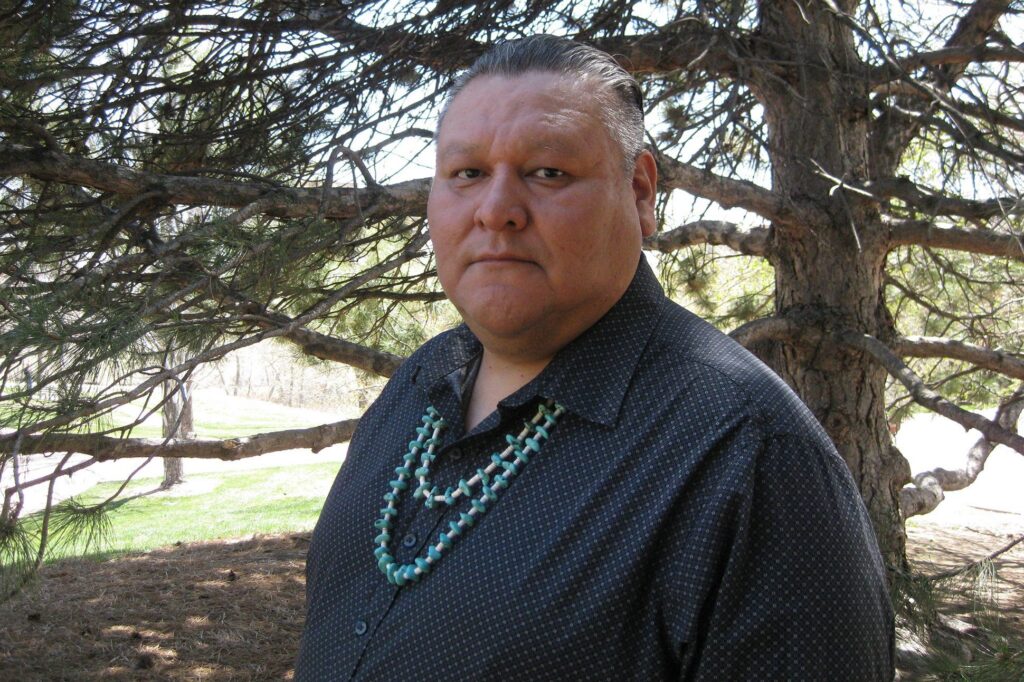
Crisosto Apache named Colorado’s 11th Poet Laureate
John Moore
john.moore@denvergazette.com
Updated 7 hours ago
Indigenous poet will succeed Andrea Gibson, who died of cancer last summer, and serve two-year term Gov. Jared Polis continued to make history Wednesday with the appointment of his third Colorado Poet Laureate: Crisosto Apache, an associate professor at Rocky...
John Moore
Reporter

Weekend things to do around Denver and beyond: Colorado Motorcycle Expo and more
Linda Navarro
linda-navarro@denvergazette.com
Updated 7 hours ago
Each Thursday, explore Denver’s essential weekend events curated by The Denver Gazette. Dive into cultural experiences and entertainment delights across the city. Whether you enjoy art galleries, pottery, or outdoor sports, there’s something for everyone in Denver’s vibrant cultural scene....
Linda Navarro
Reporter

Tax bill shock: Colorado homeowners could see property taxes jump by as much as 40%
Marianne Goodland
marianne-goodland@denvergazette.com
Updated 3 hours ago
Mike Fitz, 76, who lives in Centennial in a single-family home he has owned since 2001, paid $3,876.98 in property taxes to Arapahoe County two years ago. Fitz just learned after checking the website of the Arapahoe County Assessor’s Office...
Marianne Goodland
Reporter

Cherry Creek Schools superintendent resigns after allegations of toxic workplace
Nicole C. Brambila nico.brambila@denvergazette.com
nico.brambila@denvergazette.com
Updated 6 hours ago
Cherry Creek Schools Superintendent Chris Smith resigned abruptly during an executive session Tuesday, school officials confirmed, after allegations of a toxic work environment surfaced earlier this month. “We’ve had some tremendous achievements under Chris’ leadership including Traverse, the first of...
Aurora files Petition for Rehearing in court ruling on crime punishment, seeking ‘clarity’
Kyla Pearce
kyla-pearce@denvergazette.com
Updated 8 hours ago
The city of Aurora filed a Petition for Rehearing with the Colorado Supreme Court on Monday seeking clarity on a court decision in Aurora v. Simons. The court determined that municipal criminal penalties cannot exceed state sentencing caps for similar...
Kyla Pearce
Reporter
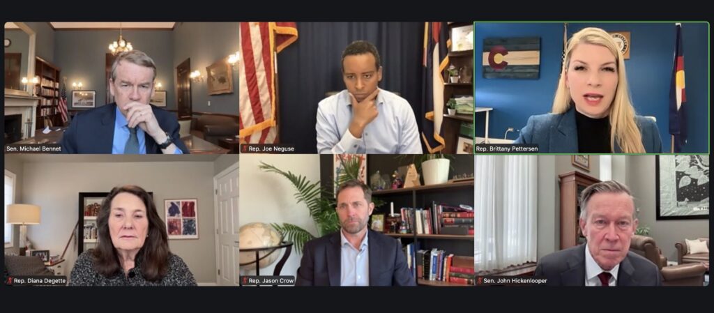
Colorado’s Democratic delegation calls for Noem’s removal, ICE overhaul
Ernest Luning
ernest-luning@denvergazette.com
Updated 9 hours ago
The Democratic members of Colorado’s congressional delegation on Tuesday called for Department of Homeland Security Secretary Kristi Noem to resign or be impeached in the wake of the second fatal shooting by federal immigration agents in Minnesota this month amid...
Ernest Luning
Reporter
PREV
PREVIOUS
Denver weather: Sunny and warmer Wednesday, less wind in the city
Windy conditions will mostly stay confined to the Front Range foothills and mountains on Wednesday while in metro Denver more melting of snow, high temperatures in the upper 50s and less wind are all forecast. Denverites can expect sunny skies today, with a high near 58, according to the National Weather Service in Boulder. South […]

New Christkindlmarket to open in Colorado Springs
Colorado Springs will soon add a bit more German culture to its repertoire. The inaugural Old Colorado City Christkindlmarket, created by the Colorado chapter of the German American Chamber of Commerce (GACC), will open Thursday and run over two weekends through Dec. 23 in Bancroft Park. “There’s so much German heritage and a lot of […]