


12″ of snow possible in Colorado mountains this week, with ‘risk of heavy snow’ to follow
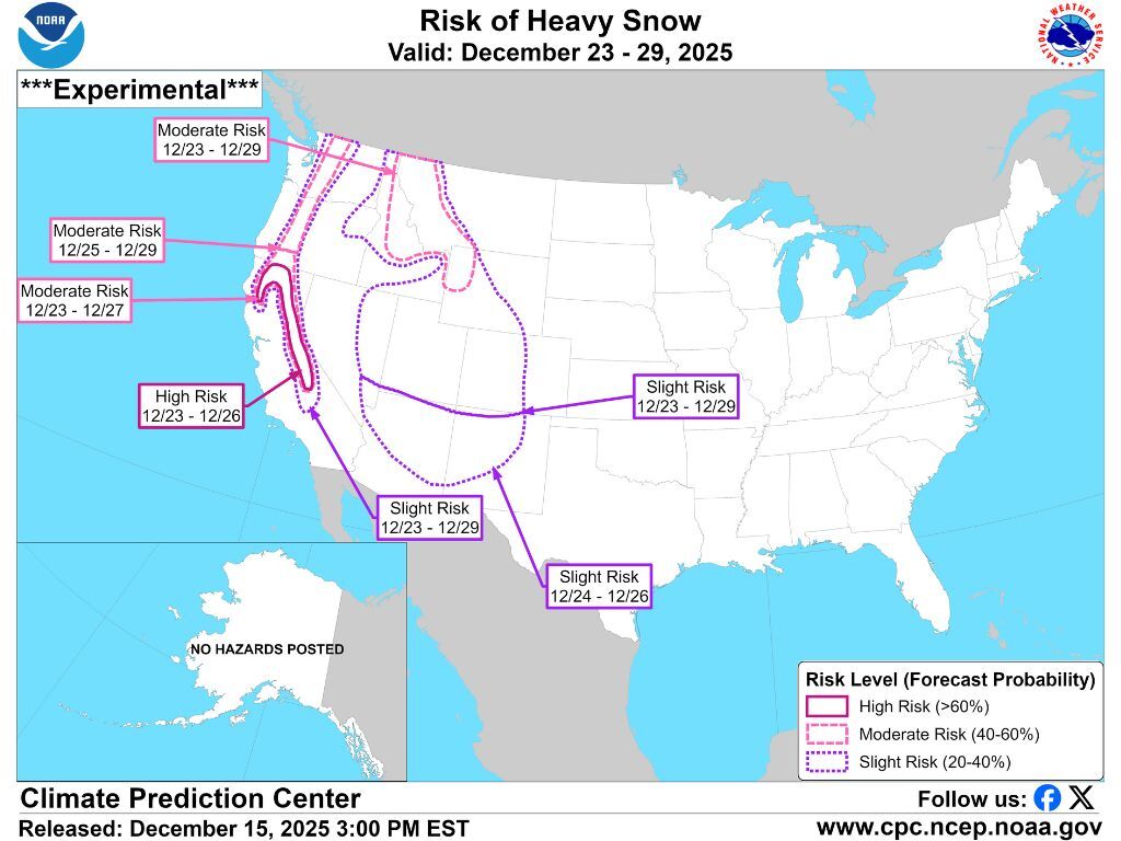
While another dry stretch has hit most of Colorado over recent days, the National Weather Service is showing a chance that this might change with another ‘risk of heavy snow’ on the way.
Per mapping from the forecasting service, the western half of the state is at ‘risk of heavy snow’ from December 23 to December 29. That’s still a ways out, but localized forecasts have shown a chance for snow in many mountain towns around Christmas and the days that follow.
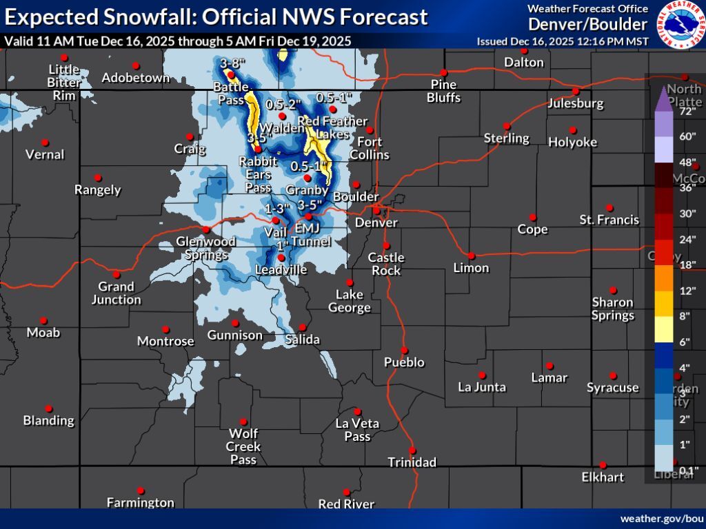
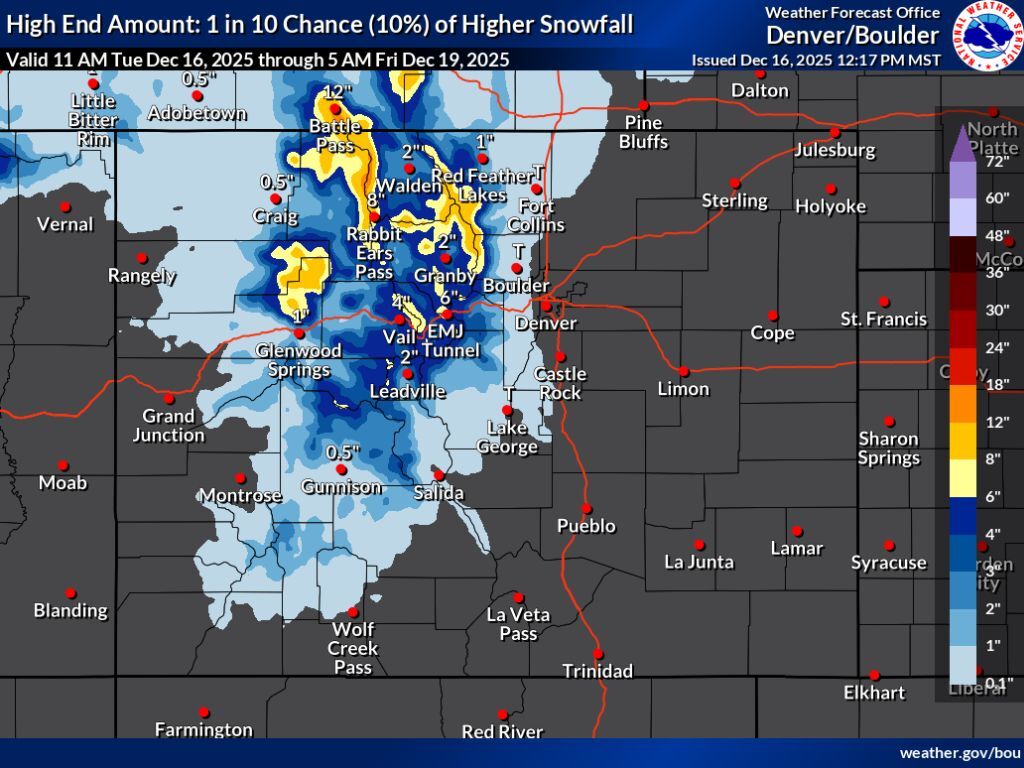
It’s also looking like a bit of snow is expected this week, though areas with deeper accumulation should be limited to the Continental Divide north of I-70 and the Park Range. In the high-end scenario, totals on these peaks top out at about 12 inches through Friday morning, with most of the central and northern mountains expected to get six inches or less over that 3.5-day stretch (both the ‘expected’ 80% chance and the ‘high-end’ 10% chance scenarios can be seen below):
According to OpenSnow, about five inches of snow should land at Steamboat Resort over the next five days, with other resorts around the state getting less.
After an early-December bump, the gap between the state’s current snowpack and what’s typical for this point in the season has started to increase again, with the state now at 62 percent of the norm for December 16, per the USDA
Find additional forecasting information from the National Weather Service here.
STAY INFORMED: Get free Colorado news with our daily newsletter (Click here)
Get OutThere
Signup today for free and be the first to get notified on new updates.
PREV
PREVIOUS

Authorities hunt for 14 head of cattle presumed stolen in northern Colorado
More than a dozen head of cattle have been reported missing, presumed to be stolen from ranchland in northern Colorado. According to a December 9 press release from the Weld County Sheriff’s Office, a total of 14 Black Angus cows are missing across multiple herds that roam northeast of Greeley. It’s believed the cattle went […]

Warm weather in Denver ties record set 104 years ago in 1921
According to the National Weather Service, Denver tied the daily record high for December 15 this week, reaching a temperature on Monday not felt on that date since 1921. On December 15, 1921, the city reached 68 degrees Fahrenheit – a temperature that would not be felt again on that date for 104 years until […]