


Upcoming gasp of snow means powder refill, but expect return of record-low snowpack by February
While about two inches of snow fell in Denver overnight (along with eight inches in mountainous terrain just west of Nederland), drier-than-normal conditions continue to persist in Colorado.
As of January 19, Colorado’s snowpack sits at about 59 percent of the norm for the date – still at record lows (records date back to 1987).
As of Monday morning, the National Weather Service isn’t calling for much additional snow this week, either, with about one to two inches of snow expected in the ‘high-end’ scenario through Thursday across a large swath of central and eastern Colorado, per the National Weather Service. Meanwhile, a bit of relief could be on the way in days that follow, but not much.

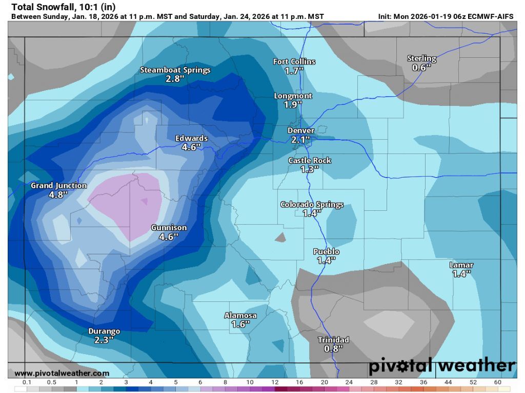
Per a longer-term outlook from Pivotal Weather, between four and seven inches of snow should hit mountains in central and western Colorado Thursday night through Saturday evening. This report is echoed by Joel Gratz’ OpenSnow forecast, with Gratz noting that peak totals could hit about eight inches.
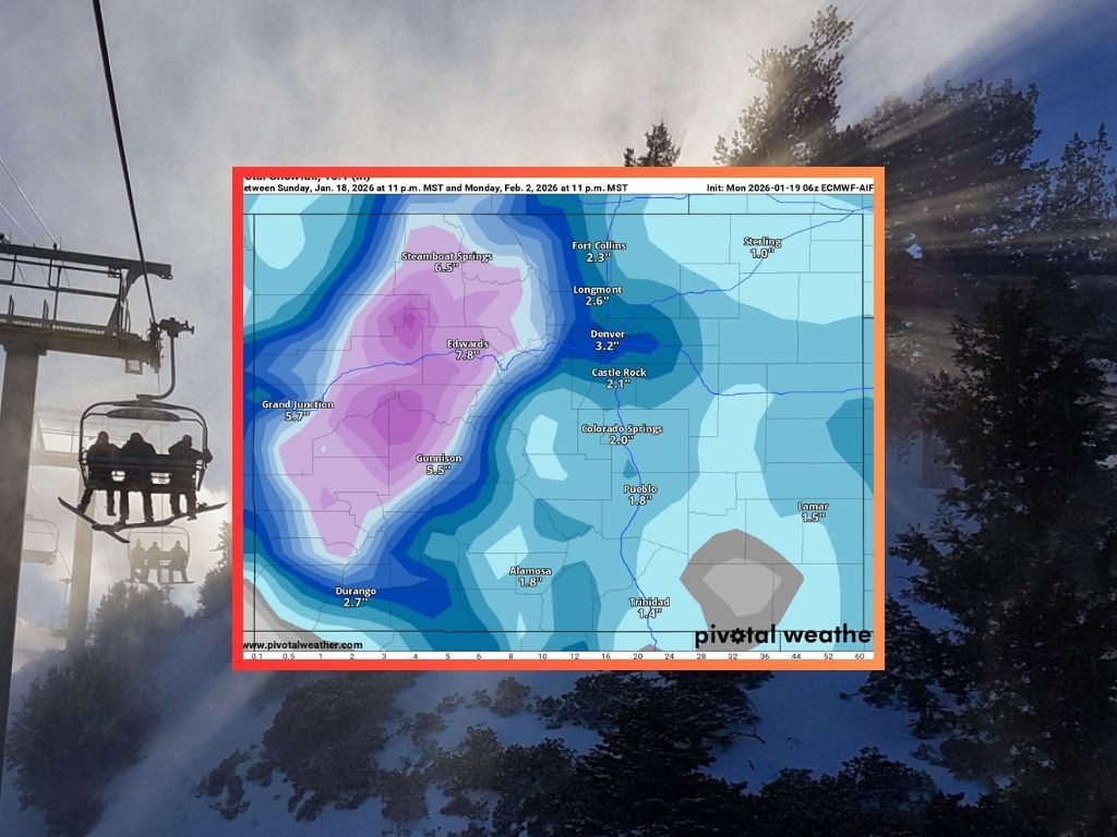
Unfortunately for Centennial State skiers and snowboarders, this round of snow will likely be the most significant through the end of the month, with only about seven to nine inches of total snow expected in parts of the state that get hit the hardest through February 2. This means a little bit of snow will move through after the upcoming weekend and prior to the month’s end, but it will be nothing to brag about.

There will be some snow through the second half of January, sure – it might even be able to push Colorado above record lows for a brief moment. That said, it’s likely that any snow that hits between January 22 and January 25 won’t be enough to keep enough to keep the state from dropping back to record setting lows by February 1.
STAY INFORMED: Get free Colorado news with our daily newsletter (Click here)
Get OutThere
Signup today for free and be the first to get notified on new updates.
PREV
PREVIOUS

Skier "extremely lucky" after getting buried up to chest in avalanche near highway in Colorado
A skier got “extremely lucky” after getting hit by a backcountry avalanche in Colorado’s Grand County over the weekend, escaping with no injuries despite getting reportedly buried up to his chest in a steep slide near a highway. Per a press release from Grand County Search and Rescue, their team, along with the local sheriff’s […]

Weekly Weather Outlook for Colorado: January 19 through January 25
This week will start off mild and relatively dry in Colorado. The later week will bring cooler temperatures with cloudier conditions and even occasional snow showers in the mountains. Here’s a look at daily temperatures across Colorado this week, courtesy of the Weather.com report: Monday: Skies will be sunny. Tuesday: Expect partly cloudy skies with […]