


12-plus inches of snow possible in Colorado over upcoming days

A winter storm is setting up to hit Colorado between Thursday evening and Saturday, with totals of over a foot possible in several mountain ranges according to multiple forecasting services.
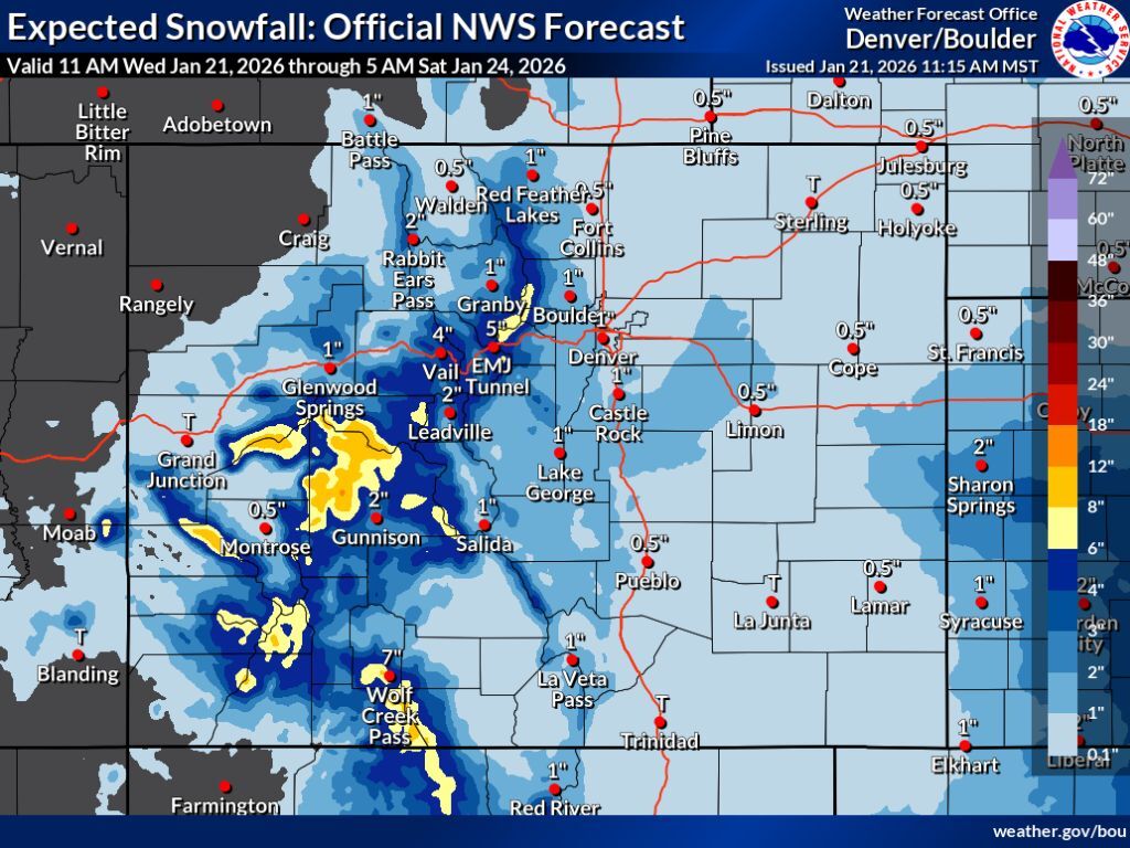
In the most likely scenario, the National Weather Service is calling for about 4 to 6 inches on many peaks in Colorado’s central and southwest regions through Saturday morning, with some select spots expected to get more – in the range of 6 to 12 inches.
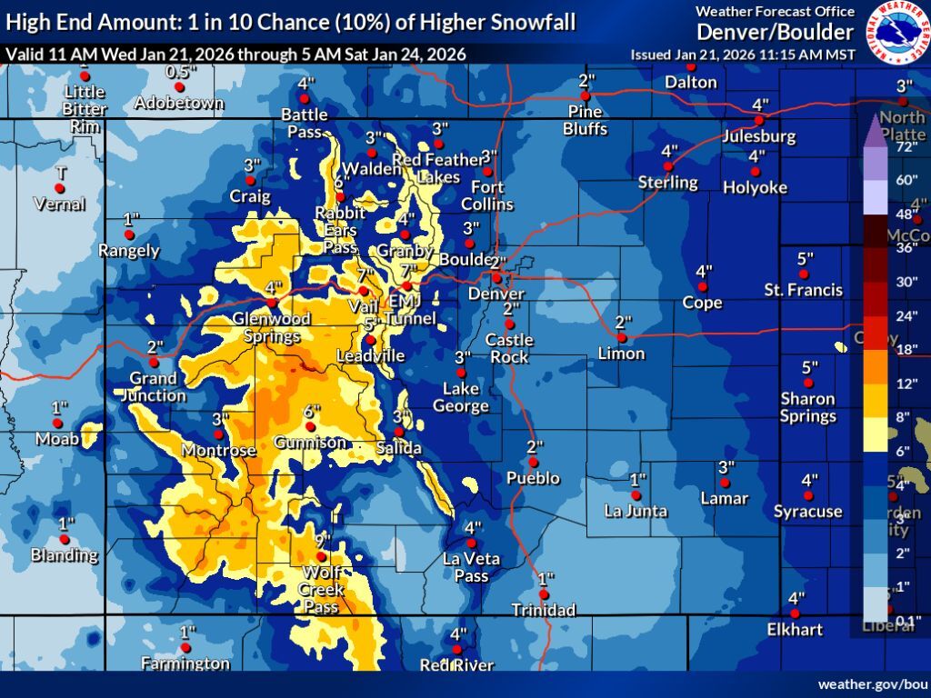
Meanwhile, a high-end snowfall forecast produced by the same agency that has a 10 percent chance of coming to fruition depicts the possibility of widespread snow totals in Colorado’s mountains reaching about 8 to 12 inches, with spots that get hit the hardest having potential for up to 18.
In both of these scenarios, not much snow is expected along the I-25 corridor. Even in the high-end scenario, only about 2 inches of snow should fall in Denver.
The two maps below depict the National Weather Service “expected” and “high-end” snowfall scenarios:
Meanwhile, Pivotal Weather reports that peak totals of about 9 inches can be expected in the Aspen area through the end of the weekend. On the other end of the spectrum, OpenSnow is calling for the possibility of up to 20 inches of snow at Wolf Creek Ski Area over the next five days.
A lot of uncertainty remains in regard to how hard this storm will hit. Either way, it’s looking like a lot of Colorado will get at least some snow. Given that current snowpack levels are at about 57 percent of the norm for the date – a record low – that’s good news.
Currently, no resort is reporting snowfall over the last 24 hours.