







Big snow could bring double-digit totals to Colorado peaks in upcoming days
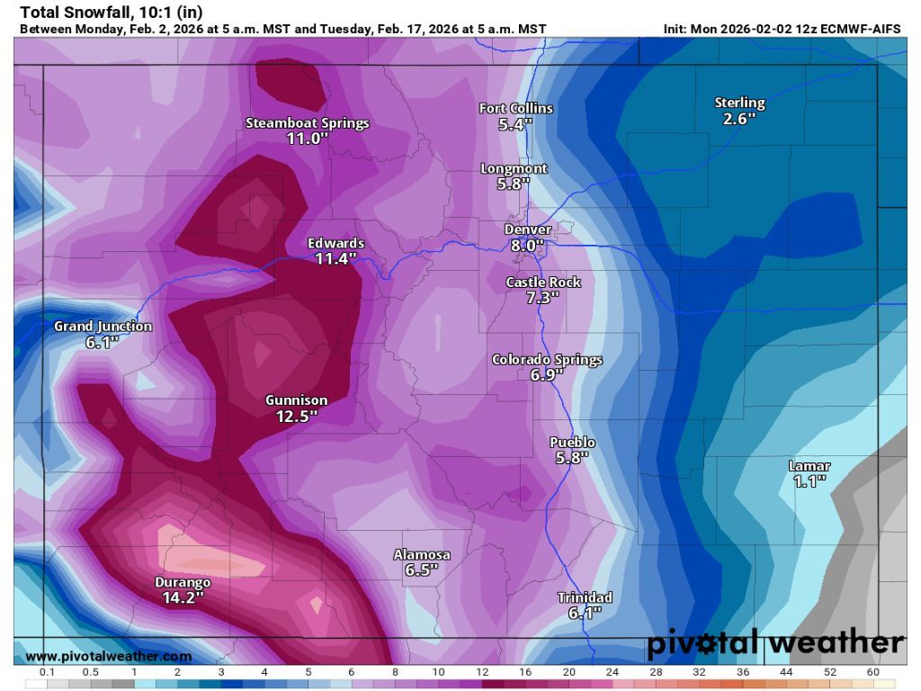
Not much snow is expected this week in Colorado, but the extended forecast is showing that heavy precipitation is likely later this month.
According to the National Weather Service, parts of northern Colorado could get about 1 to 3 inches of snow through Thursday afternoon. Other forecasting services echo this prediction, as well. More interesting, however, is what’s expected mid-February.
Mapping from Pivotal Weather indicates that snow in the range of 8 to 22 inches could land in Colorado between Feb. 10 and the morning of Feb. 13, favoring peaks north of Durango and those in the area of Aspen. Along the Front Range, Denver could get around 3 inches and Colorado Springs could get 4.
Looking farther ahead, more snow is expected between Feb. 13 and the morning of Feb. 17, with maps from Pivotal Weather showing that 4 to 6 additional inches of snow could land on many Colorado peaks during this period.
According to the USDA, Colorado’s statewide snowpack currently sits at about 56 percent of the norm for Feb. 2 – an all-time low among records that date back to 1987. That said, the typical peak snowpack is hit around April 8, meaning that there’s plenty of time for this season to depart from record-setting dryness. Mid-February could bring the start of that turnaround.
Denver Gazette reporting shows that no Colorado ski areas have gotten snow over the last 24 hours, with only Keystone recording snow – about an inch – over the past two days. Snowfall expected at Colorado’s ski areas over the next five days is minimal.