







Colorado ski areas could see double-digit snow totals over the next two weeks
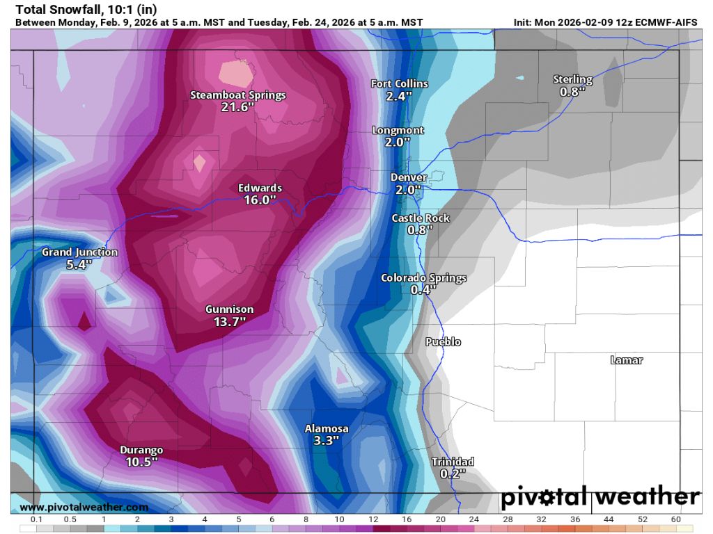
Over the next two weeks, on-and-off snow is expected to hit Colorado in a shift toward weather that’s more typical of mid-February.
A first storm that’s expected to hit should drop snow between Feb. 10 and Feb. 14, according to weather models. Most peaks in western Colorado should get at least 4 inches of snow during this period with peak accumulation expected to top out between 7 and 9 inches on mountaintops near Steamboat Springs, Aspen and Durango.
Just two days after this winter storm ends, more snow is expected to roll through on Feb. 16 with periodic snowfall taking place through Feb. 24, per the most recent Pivotal Weather mapping.
By the time the two-week period between Feb. 10 and Feb. 24 is over, many peaks will have at least 18 inches of new snow or more, meteorologists predict. Most of this snow, however, should be limited to the state’s mountainous terrain found west of the Continental Divide.
The Front Range metro may get a few flakes here and there, but should be mostly skipped, projections show. Denver, for example, should get about 2 inches over the two weeks.
Heading into this storm, only five of Colorado’s ski areas report getting snow over the past 48 hours: Arapahoe Basin (2 inches), Cooper (1 inch), Copper Mountain (1 inch), Howelsen Hill (1 inch), and Loveland Ski Area (1 inch).
Looking ahead, OpenSnow reports that Steamboat Resort will lead the charge over the next five days with 12 inches expected.