


What to know about Friday’s snowstorm in Denver
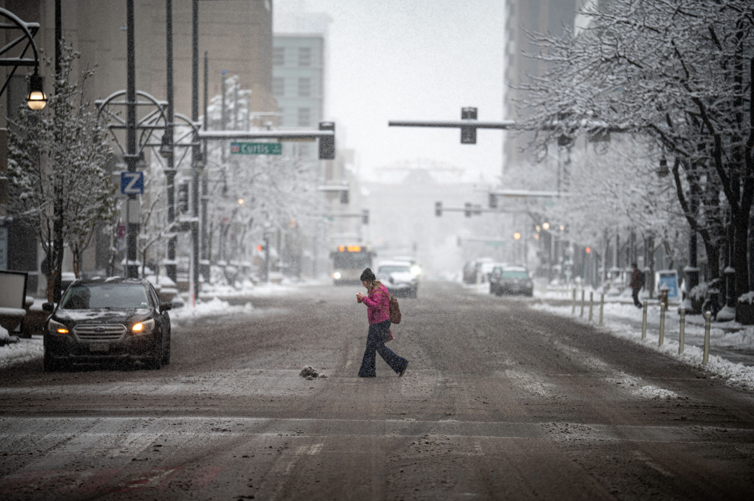
After an unseasonably warm winter, a storm began dumping heavy, wet snow on the metro Denver area Friday morning.
The snow is expected to continue throughout the day Friday and could significantly impact the evening commute, forecasters said.
The National Weather Service in Boulder has issued a Winter Weather Advisory through 8 p.m. Friday for Denver, where it says 3 to 5 inches of snow is possible.
“Things have been trending up just a little bit in the last 12 to 24 hours or so,” Bruno Rodriguez, a meteorologist with the National Weather Service in Boulder, said of the Denver snow forecast.
Rodriguez said to expect most of the accumulation in Denver to happen on colder surfaces such as grass and cars.
“Roadway accumulation will happen during times of higher-intensity snowfall,” he said.
I-25, U.S. 36 reopened around Denver after conditions, crashes closed roadways
Several highways around the Denver area are at least partially closed Friday morning due to both the weather conditions and crashes.
Snowy weather prompted Wyoming transportation officials to close Interstate 25 northbound at the state border with Colorado to begin Friday before its reopening as of 12:30 p.m., a Colorado Department of Transportation spokesperson confirmed Friday.
Additionally, U.S. 287 was closed in both directions between Laporte, northwest of Fort Collins, and the Wyoming border due to the adverse conditions, before its subsequent reopening as well, CDOT said.
Between Estes Park and Boulder, U.S. 36 was also closed in the eastbound direction due to a crash.
The slick roadways caused traffic delays to start earlier than usual Friday evening, with I-25 and parts of I-70 seeing significant slowdowns around 4 p.m., according to CDOT.
Crashes earlier in the morning on I-25 north and south of downtown had closed lanes to traffic, slowing, but not stopping, the flow of commuters.
Denver snow forecasted to keep falling throughout the day
Rodriguez said to expect the snowfall to intensify mid-morning in Denver, around 9 a.m. or so, and continuing through about 3 or 4 p.m. The snow should taper off around 8 p.m., he said.
“The biggest impact is looking like the afternoon commute,” Rodriguez said.
The snow could be on the wetter, slushier side, Rodriguez said, which is expected to impact driving conditions.
The western and southern parts of the Denver metro area will see the biggest snowfall totals, with about 4 to 6 inches possible, Rodriguez said. Areas to the north are likely to see the least, with about 2 to 5 inches.
Denver temperatures are expected to hover around freezing or just slightly above freezing most of the day, Rodriguez said.
The high temperature in Denver is only expected to reach 33 degrees on Friday, the weather service said. That’s about 19 degrees colder than the average high for March 6 in Denver, according to weather service archive data.
Denver International Airport under ground delay, area schools closed
Denver International Airport issued a ground stop due to the snow and ice just before 9 a.m. Friday, according to the Federal Aviation Administration. That stop turned into a ground delay at 10 a.m., with an average delay time of 43 minutes.
The announcement follows de-icing procedures by the planes starting at 7:30 a.m. Friday, just after snow began falling around the Denver area.
Air travel could also become impacted by the weather on Friday.
“We’re likely looking at reduced arrival rates,” Rodriguez said.
As of 4 p.m., DIA has nearly 1,200 delays and 102 flight cancellations, according to FlightAware.com. United and Southwest Airlines each make up about a third of the total delays, with SkyWest providing over half of the cancellations on its own.
Jefferson County Schools on Friday announced its mountain schools were closed Friday due to the snow. Some shared bus routes will also be impacted, school officials said.
I-70, foothills to get most snow
Officials with the weather service said Friday to expect hazardous travel conditions if you’re heading up into the Colorado mountains or foothills or south toward Colorado Springs.
Foothills communities such as Golden, Evergreen, Conifer and areas to the south such as Castle Pines and Castle Rock are expected to see moderate impacts, hazardous driving conditions and impacts to daily life, the weather service said.
A Winter Storm Warning is in effect for the Front Range mountains and the foothills south and southwest of Boulder until midnight Friday. Forecasters said the mountains and foothills should expect about 6 to 15 inches of snowfall, with the heaviest snowfall along and south of I-70.
The Palmer Divide, northern Front Range foothills and the Park Range could get 4 to 9 inches, the weather service said. Colorado’s Eastern Plains should expect about 1 to 4 inches of snowfall.