




‘Winter weather advisories’ issued with 36-plus inches of snow possible on some Colorado peaks
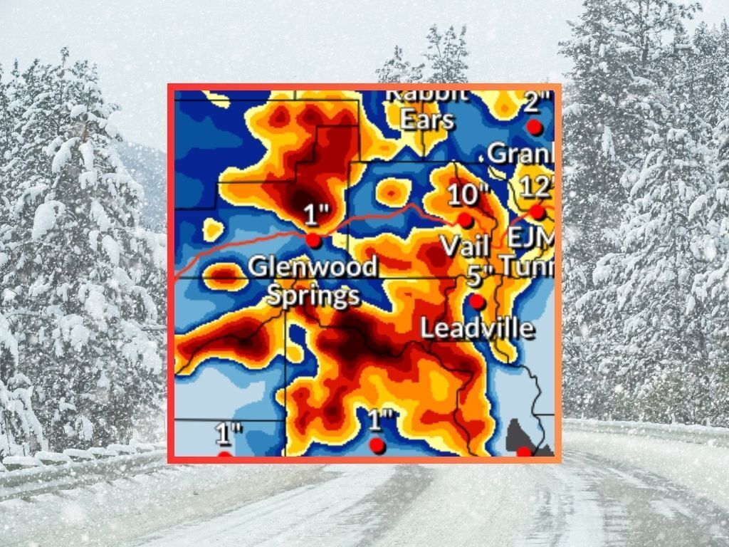
The start of Colorado’s first April snowstorm is a day away and the strong snowfall forecast is holding true.
According to the National Weather Service, a storm that’s forecasted to hit between Wednesday and Thursday should bring totals in the range of eight to 24 inches of snow to most peaks across Colorado’s mountainous region in the most likely scenario (80% chance). Meanwhile, the high-end scenario (10% chance) calls for deeper totals around the state’s high-elevation terrain, with top accumulation in the range of 24 to 48 inches. The 36 to 48 inches of snow in the higher range of the prediction would be restricted to a few select peaks, of course, but areas where this high total is possible includes peaks in the San Juans, those near Aspen, a small area of the Flat Tops, and parts of the Park Range near Steamboat Springs.
While Pikes Peak is still likely to be lacking in terms of snowfall compared to other 14,000-foot mountains around the state – expected to get about three to four inches in the most likely scenario – the forecast now shows a chance for at least six inches on parts of the Sangre de Cristos and totals in the range of eight to 18 inches along the northern Front Range. No significant snow is expected along the I-25 corridor in both the ‘expected’ and ‘high-end’ scenarios.
It’s also worth noting that this storm could bring big totals to key travel routes around the state. In the most likely scenario, Wolf Creek Pass gets 17 inches and I-70 in the area of the Eisenhower-Johnson Memorial Tunnel gets nine. In the ‘high-end’ scenario, those numbers get bumped up to 27 inches and 12 inches, respectively.
See both snowfall scenarios depicted on the may below:
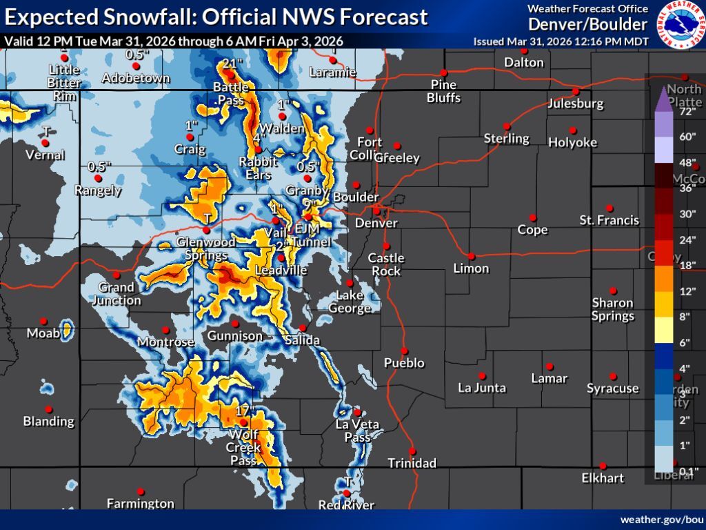

Per the OpenSnow daily report, Wolf Creek ski area is expected to get the most snow over the next five days – about 24 inches. Steamboat Resort isn’t far behind though, expected to get about 20 inches. It’s also worth noting that more snow is expected to hit the state come Friday.
A variety of ‘winter weather advisories’ have been activated in the impacted area, with the National Weather Service warning of the potential for “very difficult” travel. Wednesday morning and evening commutes are expected to be impacted. Additional region-specific alert information can be found here.
This snow is expected to hit as Colorado’s statewide snowpack level continues its steep decline, now at about 22 percent of what’s normal for March 31 and at a record-low by a shocking margin. The current snow-water equivalent of the statewide snowpack is 3.3 inches, with snowpack not reaching that level until May 30 during the typical year.
Find additional forecasting information on the National Weather Service website.
STAY INFORMED: Get free Colorado news with our daily newsletter (Click here)
Get OutThere
Signup today for free and be the first to get notified on new updates.
PREV
PREVIOUS

There's a new must-try Mexican restaurant in Colorado Springs
There’s a new Mexican restaurant in Colorado Springs and it belongs on your list of places to try. Over the weekend, I popped by Don Turi’s Tacos y Tortas and there’s no doubt that I’ll soon be back. Found in the area where Centennial hits Garden of the Gods, this is a spot where every […]

Here's a look at the Colorado nominees for the James Beard Restaurant and Chef Awards
The nominees for the 2026 James Beard Restaurant and Chef Awards have been announced. Here’s a look at who was nominated in Colorado: The James Beard Awards have “served as the pinnacle of culinary recognition in the U.S.” for almost four decades. The prestigious awards recognize “exceptional talent and leadership within the independent restaurant industry.” […]