


Pikes Peak could get 30 to 36 inches of snow
As many Colorado Springs residents have noticed in recent weeks, there’s not much snow on Pikes Peak. That said, that’s about to change in a major way.
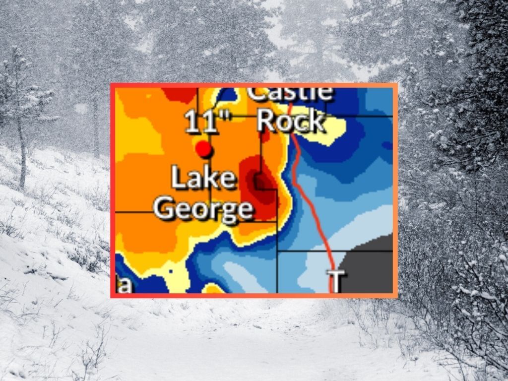
According to National Weather Service reporting, the peak could get between 18 and 36 inches of snow through Saturday morning, with the ‘high-end’ prediction calling for between 30 to 36 inches on the mountain’s highest stretch. The Mountain-Forecast prediction echos this prediction, calling for 21 inches of snow on Wednesday night, alone. Heavy snow should continue on the peak throughout the day on Thursday, tapering off as Friday hits.
It’s likely some snow will land in Colorado Springs, too, but not nearly as much. In the National Weather Service’s ‘high-end’ scenario, about two to four inches of snow hits the city – and that scenario comes with a 10 percent chance.
This snow will be crucial for adding some moisture to the region. Colorado Springs is located in the Arkansas River Basin, which is currently at about 10 percent of the typical snowpack for April 29 – on par with what’s normal for the first week of June.
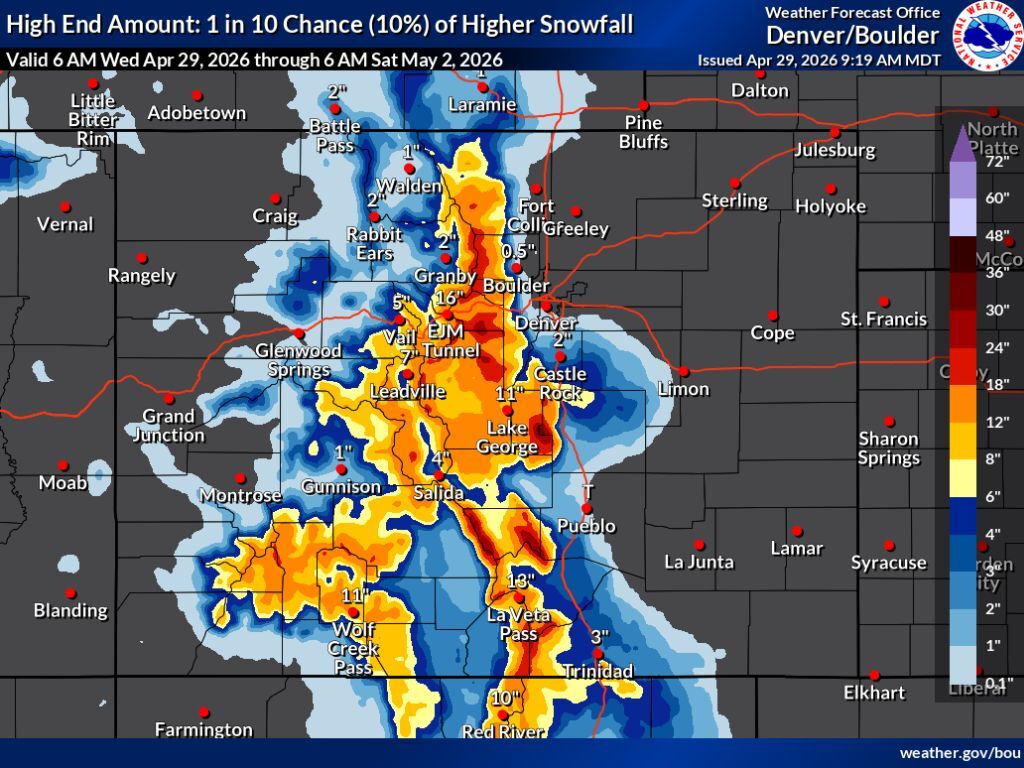
Meanwhile, big snow is expected elsewhere in the state, as well, favoring the Front Range, central Colorado, and southern Colorado. Many peaks should get at least a foot of snow through Saturday morning.
Here’s a look at the 10-percent chance ‘high-end’ snowfall forecast at the statewide level. Note that in the ‘expected’ snowfall scenario (80% chance), totals are about six inches less – still very significant:
Follow along with the National Weather Service forecast here.
STAY INFORMED: Get free Colorado news with our daily newsletter (Click here)
Get OutThere
Signup today for free and be the first to get notified on new updates.
PREV
PREVIOUS

2-plus feet of snow possible in parts of Colorado over the next few days
Amid a turn toward wet and cold weather in Colorado, big snow is expected over the next few days favoring the Front Range, central, and southern Colorado. According to the National Weather Service, the most likely ‘expected’ snowfall scenario (80% chance) would mean about 18 to 24 inches of snow on Pikes Peak through Saturday […]
Going to Argo: What to know about scenic gondola, trails and more at new Colorado attraction
One day ahead of the much anticipated debut of the Mighty Argo Cable Car in Idaho Springs, Mary Jane Loevlie gave a tour to the man who would be emceeing the celebratory event. The two walked around the top of the gondola, around the attractions here at Miners Point, where the Continental Divide dazzles in […]