




Severe damage could occur if expected ‘golf ball-size’ hail hits Colorado
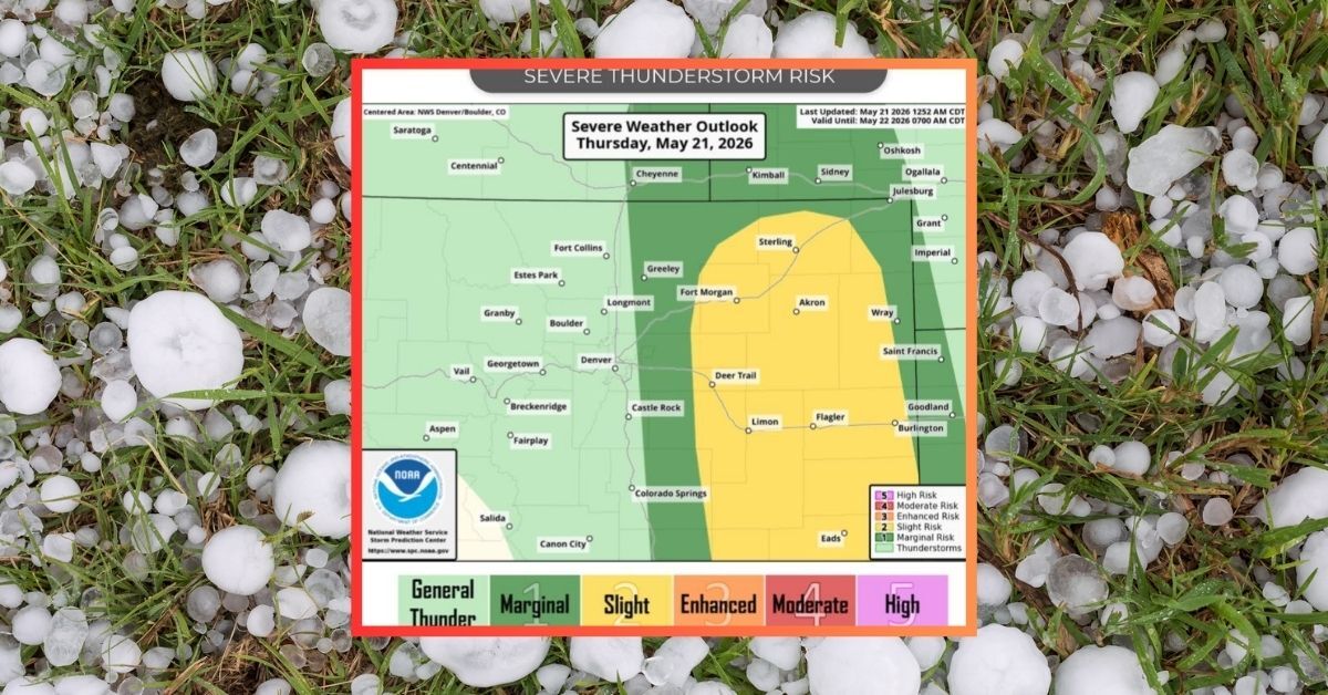
Springtime is here and with it, monsoonal rains and hail tend to become more common in Colorado. With that said, the National Weather Service is warning the public about the potential for large hail and rain just east of I-25 on May 21.
According to a report from the agency, severe thunderstorms are expected to form in Colorado mid-afternoon on Thursday with the possibility that some of these storms become severe. Key hazards may include golf ball-size hail, damaging wind gusts of up to 60 miles per hour, and the potential for a couple tornados. The risk is expected to start around 3 p.m., with the highest rain coverage set to occur east of the I-25 corridor between 6 p.m. and 11 p.m.
‘Golf ball-size’ hail has a diameter of about one and three-quarters inches. Damage to vehicles tends to occur when hail measures at about an inch or larger, with golf ball-size hail capable of causing severe damage and shattering glass.
Travel may become dangerous as these storms move through and being outside is ill-advised.
Find additional weather updates on the National Weather Service website.
STAY INFORMED: Get free Colorado news with our daily newsletter (Click here)
Get OutThere
Signup today for free and be the first to get notified on new updates.
PREV
PREVIOUS

Rabid bat found in northern Colorado prompts public warning about exposure
Health officials in Larimer County have reminded the public to exercise caution around some species after a rabid bat was found in an open space near the Adriel Hills neighborhood of northeast Fort Collins, per a May 19 press release. This is the first local rabies case of the year for the county, with animal […]

9 of Colorado's 'last great Wild West towns' – and 11 spots that didn't make the cut
The impacts of the Wild West era, Manifest Destiny, and the ‘Pikes Peak or Bust’ mining days are still quite obvious around Colorado. From ghost towns to sprawling dude ranches to tiny towns that somehow thrive in the middle of remote and rugged terrain, history isn’t hard to find in the Centennial State. That said, […]