


Colorado wildfire roundup: Aspen Acres blaze increases to 28,314 acres; at least 150 structures damaged
Several uncontained wildfires across Colorado have scorched roughly 90,000 acres in the past three days. Red flag fire conditions on Monday and Tuesday, including low humidity and high winds, contributed to the blazes and, in some cases, made air support difficult and dangerous.
Weather forecasts promise more “critical fire weather” over the next two days, according to the National Weather Service, with more red flag warnings and fire weather watch alerts in effect Wednesday and Thursday.
Here is the latest on seven wildfires:
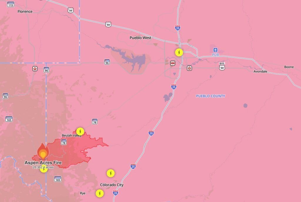
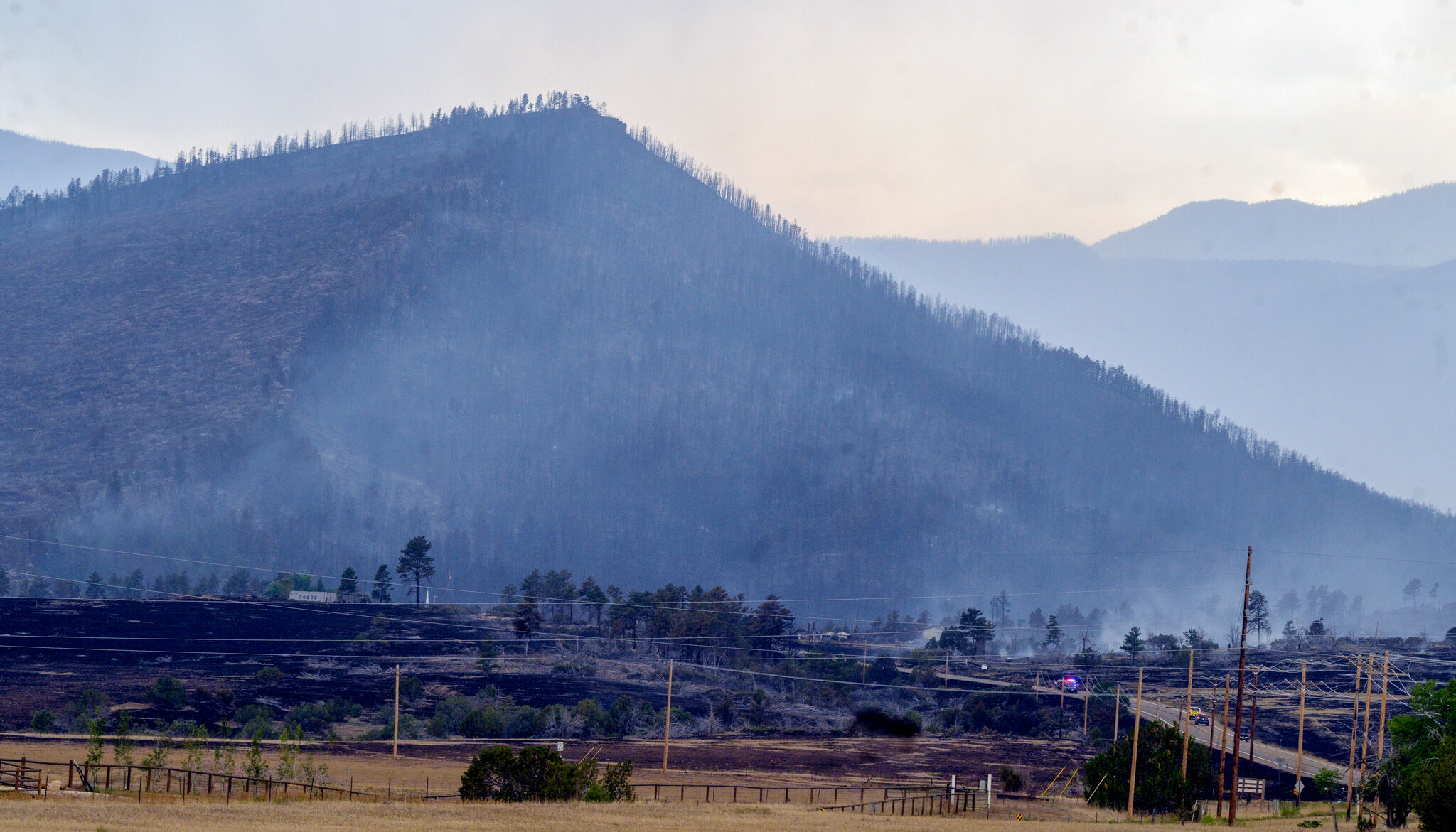
Aspen Acres
Last official update: 3 p.m.
Size: 28,314 acres
Containment: 0 percent
Cause: Undetermined
At a 3 p.m. news conference, Pueblo County Sheriff David Lucero clarified that “zero containment” does not mean zero progress in fighting the fire.
“Firefighters have been making tremendous progress by slowing the fire’s advance, protecting homes and building containment lines,” Lucero said.
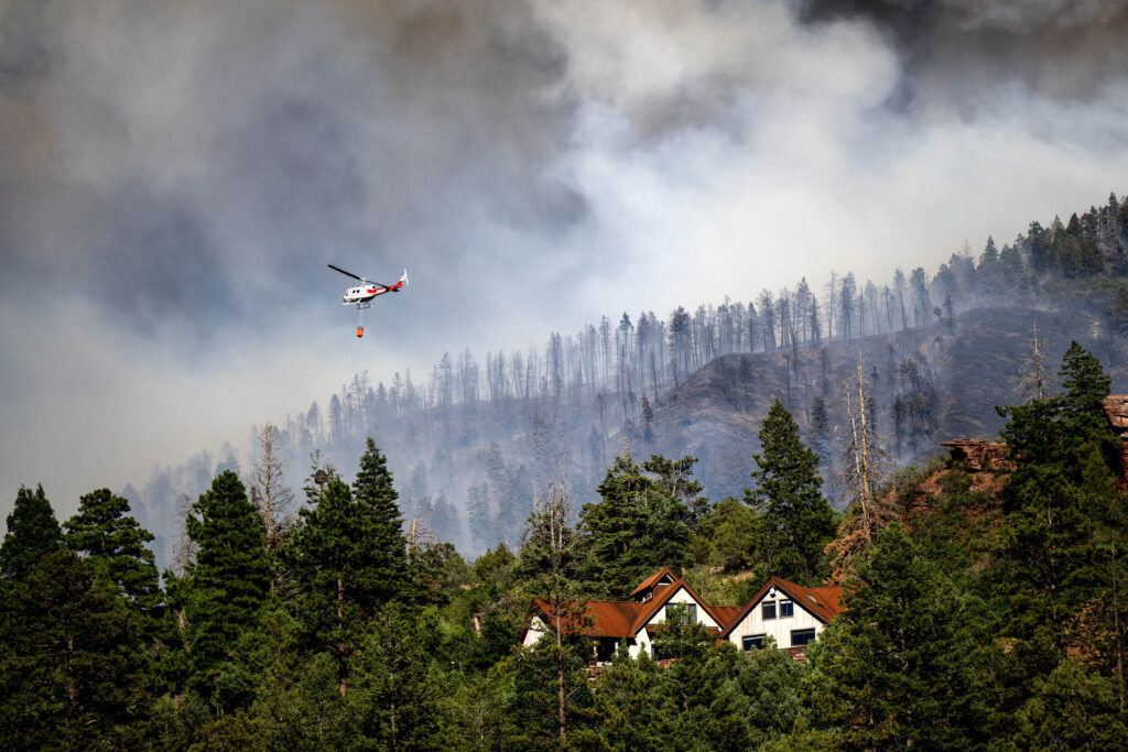
Weather conditions were favorable for much of the day, and state, local and federal crews took advantage, with 8-10 aircraft actively dropping water and fire retardant on the flames.
However, wind speeds were expected to pick up later in the day.
“While we made significant progress today, this remains a dynamic incident and conditions can change rapidly,” Lucero said.
At least 150 structures combined in Pueblo and Custer counties have been damaged, including the Horseshoe Lodge and Retreat Center in Beulah, officials said. Specifics about affected buildings were being withheld until all property owners are contacted.

Residents were advised to stay out of evacuation areas unless officially authorized, and even then, to minimize time spent in the area so emergency crews can move about freely.
Incident commander Phil Daniels said the Aspen Acres blaze is the No. 1 priority in the U.S. as far as resources, and that a larger incident team from Alaska is expected to arrive Thursday.
The incident management team is expected to remain in the area for 3-4 weeks, Daniels said.
11 fire
Last official update: 3 p.m. Tuesday
Size: 107 acres
Containment: 30 percent
Cause: Undetermined
All evacuation orders and road closures were lifted Monday evening.
Big Sheep fire
Location: Huerfano County, south and west of Big Sheep Mountain.
Last official update: 9 a.m. Tuesday
Size: 1,148 acres
Containment: 30 percent
Cause: Undetermined
No evacuation notices have been issued, according to Huerfano County officials. Pre-evacuation notice remains in effect and will be reevaluated later in the day.
Willow fire
Location: Lake County, west of Leadville
Last official update: 8:30 a.m. Tuesday
Size: 1,919 acres
Containment: 0 percent
Cause: Undetermined
The Willow blaze is on U.S. Forest Service land, so the U.S. Forest Service is the lead firefighting agency. Crews from the Colorado Department of Fire Prevention and Control, the Colorado Department of Homeland Security and surrounding counties are assisting.
Evacuations were still in place as of Tuesday morning.
Gold Mountain fire
Location: Approximately 2 miles northeast of the town of Ouray
Last official update: 6 p.m. Tuesday
Size: 8,277 acres
Containment: 0 percent
Cause: Undetermined
A mandatory evacuation notice was issued for the area east of U.S. 550 north of CR-8 and south of CR-8A east to the U.S. Forest Service boundary south to CR-8B along Cow Creek.
Ferris fire
Location: Glade area north of the town of Dolores
Last official update: 6 p.m. Tuesday
Size: 19,613 acres
Containment: 0 percent
Cause: Undetermined
“Today has brought good progress earned by hard labor,” officials said late Tuesday. “The Arroyo Grande Hotshots are digging fireline on the northeast edge of the fire, building fireline north from the intersection of NFSR 240 and 514. Lighter, patchy fuels between the fire and Road 514 have meant fire behavior has moderated in that area.”
Helicopters were on site to provide air support.
Snyder-Mesa fire
Location: Colorado-Utah border
Last official update: 5 p.m. Tuesday
Size: 30,209 acres
Containment: 10 percent
Cause: Undetermined
Along the Colorado-Utah border, crews continued to battle the Snyder Mesa blaze, which has combined with the Knowles and Gore fires, according to multiple reports. The Knowles and Gore fires led to the deaths of three firefighters over the weekend, with two additional crew members injured.
See a map of statewide fires by following this link: MAP: Where Colorado wildfires are burning – Colorado Springs Gazette