







Turn around, don’t drown as monsoon moisture raises flash-flood danger, CDOT says
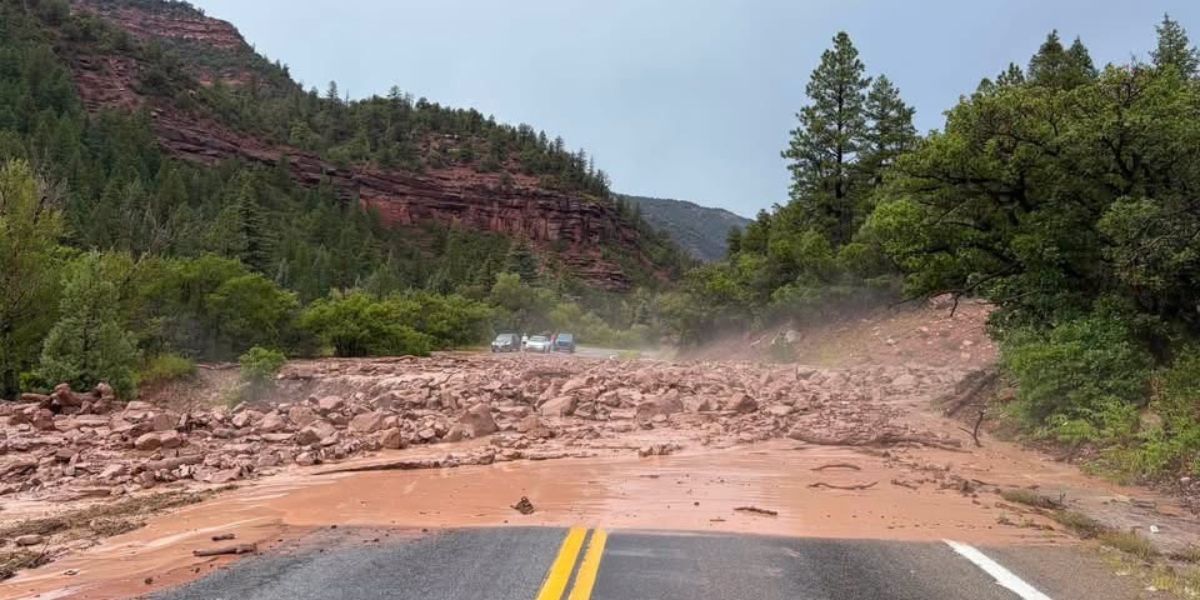
A debris flow closed Interstate 70 in both directions between Silt and New Castle on Monday evening after torrential rain and hail overwhelmed dry ground and local drainages, the Colorado Department of Transportation reported.
Officials at the department said in a statement Monday that monsoonal moisture is moving into Colorado, with the most active storms expected Wednesday and Thursday. Fast-moving water, debris and rockfalls can quickly wash out pavement or leave material on state highways.
Highways near the Ferris and Gold Mountain fire burn scars face elevated risk because the barren ground increases the chance of sudden debris flows during and after heavy rain, according to the news release.
Department crews are monitoring those corridors and are prepared to close roads on short notice.
Flash flooding can occur many miles from a thunderstorm and long after the storm appears to have dissipated as intense rainfall races down dry channels.
The department reminded motorists never to drive through flooded roadways or standing water, noting that just 12 inches of rushing water can carry away a small car and the road surface underneath may already be gone. Drivers who encounter flowing water, mud or rocks on burn scars or canyon roads should stop or pull over safely before reaching the hazard.
The 1976 Big Thompson Canyon flood, triggered by a stationary thunderstorm that dropped as much as 12 to 14 inches of rain in a few hours, killed 144 people and destroyed hundreds of homes and businesses along U.S. 34, according to U.S. Geological Survey records.
The disaster prompted lasting “climb to safety” warning signs and public education efforts that remain in place in Colorado canyons today.
On wet pavement, drivers should reduce speed, turn on headlights and leave extra stopping distance. Hydroplaning can begin at 35 mph. Cruise control should be avoided. Stopping under overpasses or on unstable slopes is discouraged, the statement said.
The department advised checking COtrip.org or the COtrip Planner app for real-time conditions and closures before travel, reviewing flash-flood driving tips on its summer driving webpage, monitoring National Weather Service watches and warnings, packing an emergency kit, allowing extra time and never driving around barricades.
Department maintenance crews are already staged with loaders, plows and heavy equipment, the statement said. The department will coordinate with the Colorado State Patrol, local emergency managers and the National Weather Service. High-risk stretches, including portions of I-70 in Glenwood Canyon, may be closed proactively if conditions warrant.
Post-fire debris flows after the 2020 Grizzly Creek fire repeatedly closed Interstate 70 through Glenwood Canyon in 2021, with some flows 5 to 10 feet deep and closures lasting from hours to more than two weeks. The July 20 closure west of Glenwood Springs occurred under the same combination of heavy rain and dry soils that the department is now warning about statewide.