


Hike to the Dragon’s Backbone, an aircraft crash site, and an old cabin on this Colorado trail
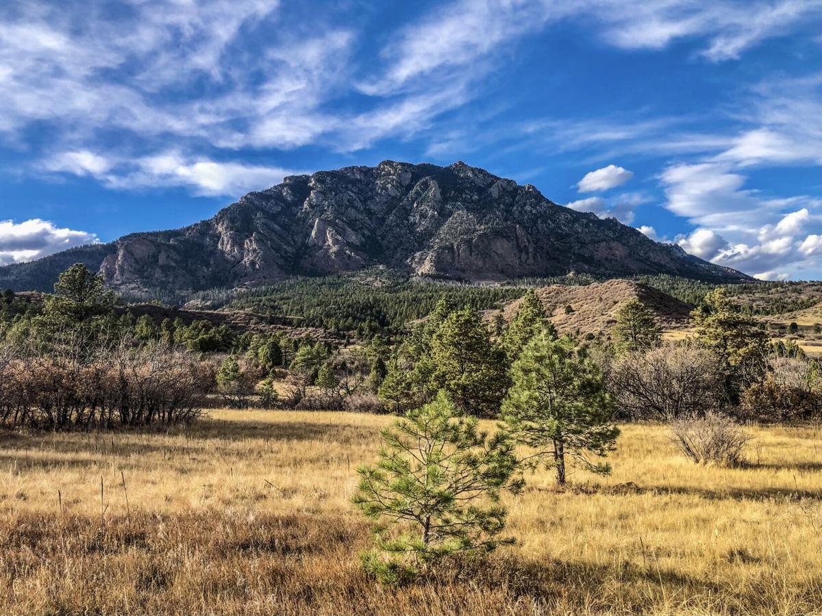
Cheyenne Mountain as seen from Talon Trail in Colorado Springs. Photo Credit: Spencer McKee.
Spencer McKee
Highly recognizable thanks to a field of antennas found near the summit, Cheyenne Mountain is one of the most notable features found along the mountainscape that stretches west of Colorado Springs. Reaching an elevation of 9,570 feet, getting to the top of this mountain via legal and official means was made possible as recently as 2018 after a trail-building process that had lasted nearly two decades. Today, the Dixon Trail provides a long route full of overlooks and unique features that delivers hikers to the (almost) summit.
Starting from the Limekiln Trailhead in Cheyenne Mountain State Park, accessing the top of Cheyenne Mountain via the Dixon Trail means a long 16-plus mile hike, round-trip, with additional distance possible via a few variations. The route starts on Talon Trail before transitioning to the newer and less-trafficked Dixon Trail, climbing more than 3,000 feet along the way.
Hikers on this route are first met with sweeping mountain views, including Cheyenne Mountain and the surrounding peaks. As the route gains vertical feet, there’s no shortage of stunning panoramic scenes.
The transition from Talon Trail to Dixon Trail is marked by looser, steeper, and more rugged terrain, which continues to wind upward toward the top of Cheyenne Mountain for several well-marked miles.
Near the end of the trail, hikers pass plane wreckage left behind from a 1957 accident that killed two. Treat this area with the utmost respect and do not touch or remove any of the metal fragments. This area is also accompanied by a sign that details the story behind the crash.

Some of the crash site wreckage on Cheyenne Mountain. Photo Credit: Spencer McKee.
Continuing along, hikers are met with the option to push forward into an aspen grove or travel the rocky Dragon’s Backbone ridge, allegedly consisting of bones left behind from the dragon that drank all of the water on the mountain, thus rendering it too heavy to fly away. The looping nature of the various trail options makes experiencing both routes possible.

A rock outcropping along the Dragon’s Backbone ridge. Photo Credit: Spencer McKee.
In short, the Dragon’s Backbone Trail is much more rugged, offering opportunities for scrambling and exposure. On the other hand, the trail through the aspens is quite tame, featuring the remains of a cabin built in the early 1900s.
At several points from the top of the peak, the nearby antennae field on top of the well-known NORAD complex can be observed.

Antennas on top of Cheyenne Mountain in Colorado Springs. Photo Credit: Spencer McKee.
After enjoying the summit, hikers head back down to the trailhead via the same route they ascended.
A couple things to note about this trail would be how well-marked it is and how there’s likely wildlife lurking. Along the way, a number of signs describe various scenes and provide directional assistance. One of those signs also warns passersby of the presence of mountain lions and black bears. Due to the remote and relatively low-traffic nature of this trail, it’s easy to see how wildlife encounters are possible.
It’s also worth mentioning that this trail is a long-haul. Expect to spend hours hiking and plan to bring plenty of water and sustenance for a strenuous effort. While the trail is well-marked and well-constructed, the length and the vertical gain earn this trail a ‘difficult’ rating.
Editor’s Note: Three things – One, this trail doesn’t reach the true summit of Cheyenne Mountain, which is not accessible via trail. Two, this trail requires purchasing a pass to Cheyenne Mountain State Park. Find more info about that here. And three, the length of this trail and typical weather patterns in the area make watching the skies crucial. Be aware of the forecast prior to leaving the trailhead and always be willing to turn back.
Get OutThere
Signup today for free and be the first to get notified on new updates.