


Up to 24″ of snow could hit Colorado mountain range in most likely scenario
A couple rounds of snow are set to hit Colorado this week and while impacts of this winter storm won’t be as widespread as that of last week, some mountains should get some decent snow.
Per the National Weather Service, snow this week should favor northern Colorado, with an initial wave of snow set to hit from Tuesday night into Wednesday and another wave hitting Wednesday night into Thursday.
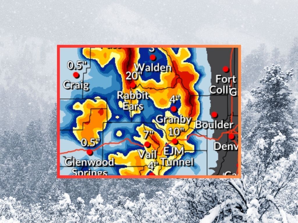
Between Tuesday morning and Friday morning, the Park Range near Steamboat Springs could get between 18 and 24 inches of snow on some of its higher stretches in the most likely snowfall scenario scenario, with accumulation along Continental Divide north of I-70 right behind that at about 12 to 18 inches. Meanwhile, the central mountains could get some decent powder, too – between about eight to 12 inches on high elevation peaks.
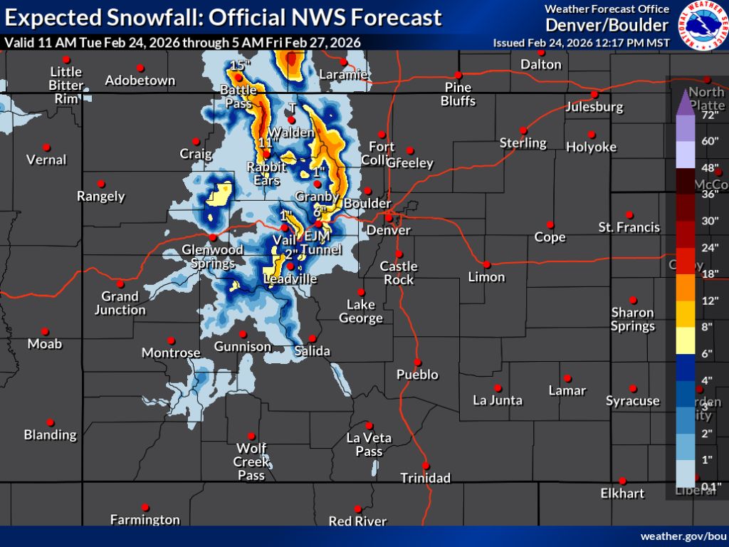
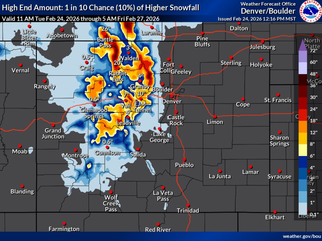
The National Weather Service ‘high-end’ scenario calls for the same part of the state to be favored, though with heavier snow possible. In this scenario, peak totals could reach into the 24 to 30-inch range in northern Colorado through Friday morning. This ‘high-end’ scenario would also mean significantly more snow for parts of central Colorado found south of I-70. In both scenarios, southern Colorado doesn’t get much accumulation with the Front Range I-25 corridor completely missed.
Colorado has officially broke its streak of setting new record daily lows for snowpack, which had been ongoing since January 13. As of February 24, the snow-water equivalent of Colorado’s snowpack is 7.7 inches, which ties the previous record. This is just 63% of the norm for the date.
OpenSnow is calling for Steamboat Resort to be the snowiest Colorado ski area over the next five days getting about 13 inches of fresh powder. It’s the only spot expected to get double-digits during that period.
Find additional forecasting information on the National Weather Service website.
STAY INFORMED: Get free Colorado news with our daily newsletter (Click here)
Get OutThere
Signup today for free and be the first to get notified on new updates.
PREV
PREVIOUS
Will that ice hold your weight? Here's a look at how to judge ice thickness plus other safety tips
Amid an unusually warm winter, ice isn’t quite forming on the same scale that it usually does around the Centennial State. This makes it that much more important to follow best practices in terms of ice safety, especially those related to determining how thick ice is. While most Coloradans probably won’t come anywhere close to […]
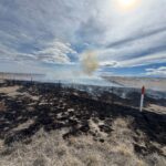
Wildfire prompts evacuations in Colorado on gusty 'Red Flag' day
UPDATE: Per a 3:32 p.m. update from Franktown Fire, this fire is 100% contained. Mop up continues. Per the Douglas County Sheriff’s Office, the evacuation order has been lifted. Per a 12:56 p.m. alert from Franktown Fire on February 24, a grass fire has sparked near Dahlberg Road and Lake Gulch Road. Initially reported to […]