


30″ new at one Colorado mountain, heavy snow Thursday: Whiteout daily snow report, March 14

What was forecast several days ago as a potentially strong winter storm has become a reality for the slopes of Colorado’s mountains, and the storm will continue to empty its contents near Denver and throughout the mountains into Friday morning before amplifying snow in the southern mountains through Monday. Powder day!
Lots of fresh snow to ski and ride in Thursday, if you can make it to the resort. Eldora did announced at 7 a.m., Thursday it is closed for skiing and riding today due to multiple avalanches across the access road, Shelf Road, to the ski area. Monarch, Echo Mountain, Arapahoe Basin and Loveland are also closed.
Recap:
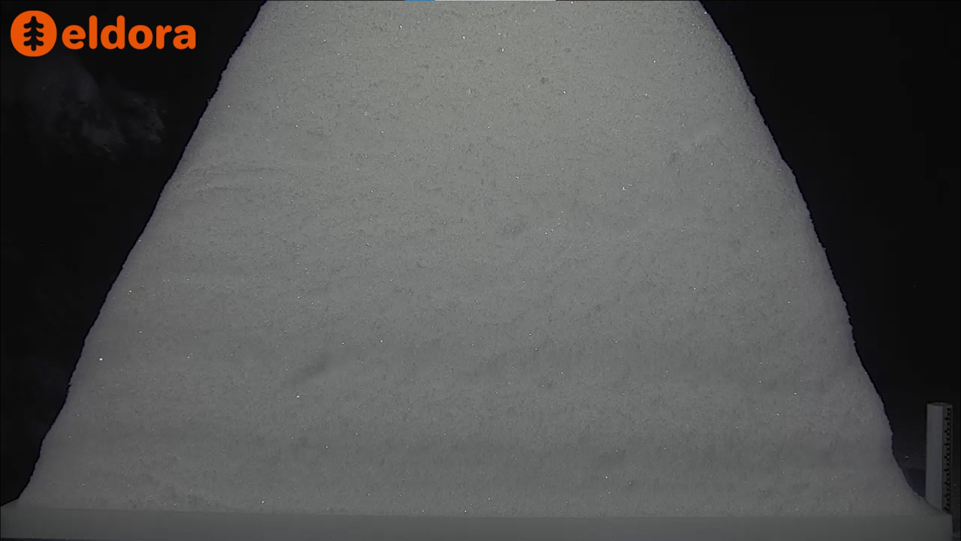
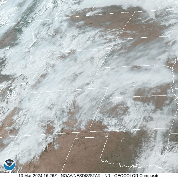
On Wednesday the snow started falling in the eastern Front Range mountains and foothills around 11 a.m. One example was seen on Eldora’s snow stake camera, where multiple waves of moisture surging uphill dropped about an inch per hour multiple times until last chair, giving the ski area approximately 6 inches by 4 p.m., and by 8 p.m., the area had received another 6 inches.
Similar accumulations were seen on Winter Park’s, Loveland’s and Echo’s snow stake cameras as the storm ramped up in intensity.
Thursday’s first chairs will offer between 2-30 inches of fresh snow for skiers and riders to enjoy, especially at Eldora (30″) and Echo (18″).
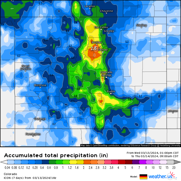
Forecasted totals from the ICON (German) model for Thursday morning aligned with the other models, with 20-30 inches of snow accumulation in the foothills and mountains west of Denver. Lower, but decent totals along the divide were between 10-16 inches but Monarch should have received more down in the southern end of the Sawatch mountains. That ski area should receive the bulk today, however.
Forecast:
On Thursday snow will continue all day as the low pressure continues spinning moisture counter clock wise into Colorado from the southwest.
Most snow will be contained to the eastern side of the Continental Divide on Thursday, including metro Denver, Boulder, Fort Collins and Colorado Springs, with another 10-20 inches in the forecast.
On Friday the snow will shift its focus to the southern mountains, who only picked up between 2-4 inches from the Wednesday waves. The southern mountains but not the Sangre de Cristo mountains, will see accumulations between 16-32 inches by Monday morning with Wolf Creek and Purgatory being the most likely biggest beneficiaries of the southwest flowing storm.
Long Range:
After more or less continuous snow through Monday, Colorado’s mountains will see light snow in the southern mountains through next week (Tuesday-Friday) while ski areas and resort north of US Highway 50 will have dry and mostly sunny conditions.
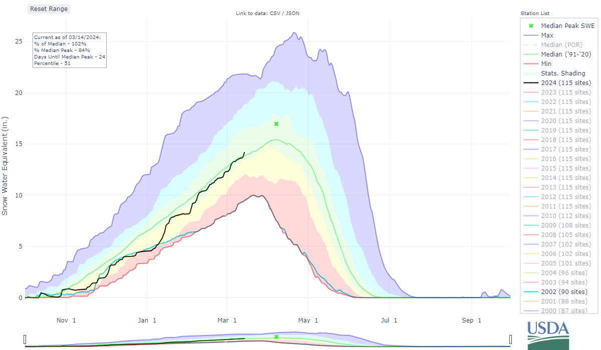
Statewide snow pack grew 4-5% overnight with the storm. The statewide snow pack average is now at 102% with 14.2 inches of snow water equivalent.
More details to follow regarding the southern mountains snow Friday morning.
Today’s 24 hour snow total from Colorado resorts:
Arapahoe Basin – 15″
Aspen Mountain – 4″
Aspen Highlands – 2″
Beaver Creek – 5″
Breckenridge – 1″
Buttermilk – 1″
Cooper – 6″
Copper Mountain – 5″
Crested Butte – 3″
Echo Mountain – 26″
Eldora Mountain – 30″
Granby Ranch – 8″
Hesperus – Closed for season
Howelsen Hill – 2″
Kendall Mountain – 2″, open weekends
Keystone – 9″
Loveland – 11″
Monarch – 3″
Powderhorn – 5″
Purgatory – 4″
Silverton – 2″
Snowmass – 3″
Steamboat – 7″
Sunlight – 1″
Telluride – 8″
Vail – 5″
Winter Park – 15″
Wolf Creek – 4″