


Bitter cold start to 2025 forecast plus 8-12 inches of snow for Colorado | Whiteout snow report
Windy conditions could impact upper mountain access Monday
Snow is falling Monday across much of Colorado’s northern and central mountains, with 3-6 inches to fall by New Year’s Eve. The last snow event of 2024 will wrap up Tuesday morning.
Bitter cold temperatures will accompany the snow beginning Monday night, with several ski areas dipping below 0 to close out the year.
Next chance for snow starts New Year’s Day Wednesday, with the focus still on the northern and central mountains.
Recap:
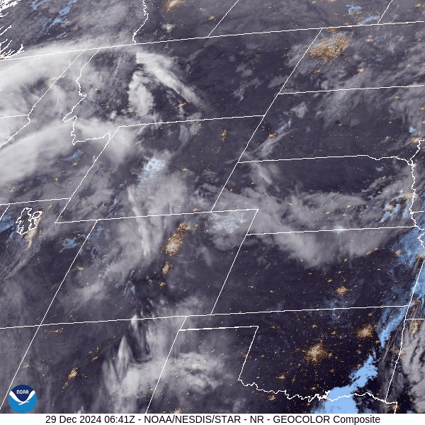
Sunday was mostly sunny in the morning, but high clouds streamed in ahead of Monday’s storm in the afternoon, with the main storm energy pushing across the Utah/Colorado/Wyoming intersection around sunset.
Snow began falling in the northern mountains early afternoon as the storm front pushed east through Wyoming.
Snow accumulations for Monday in the northern mountains range between 1-10 inches (a bit higher than previously forecasted), in the central mountains between 2-4 inches and in the southern mountains between 0-1 inches.

Forecast:
Monday is forecast to be both snowy and windy, especially in the Front, Sawatch, Park and West Elks ranges, and Sangre de Cristo Mountains. Wind gusts in the afternoon are forecast to blow between 40-50 mph in the Park and West Elk ranges and 55-70 mph in the Front and Sawatch ranges and Sangre de Cristo Mountains.
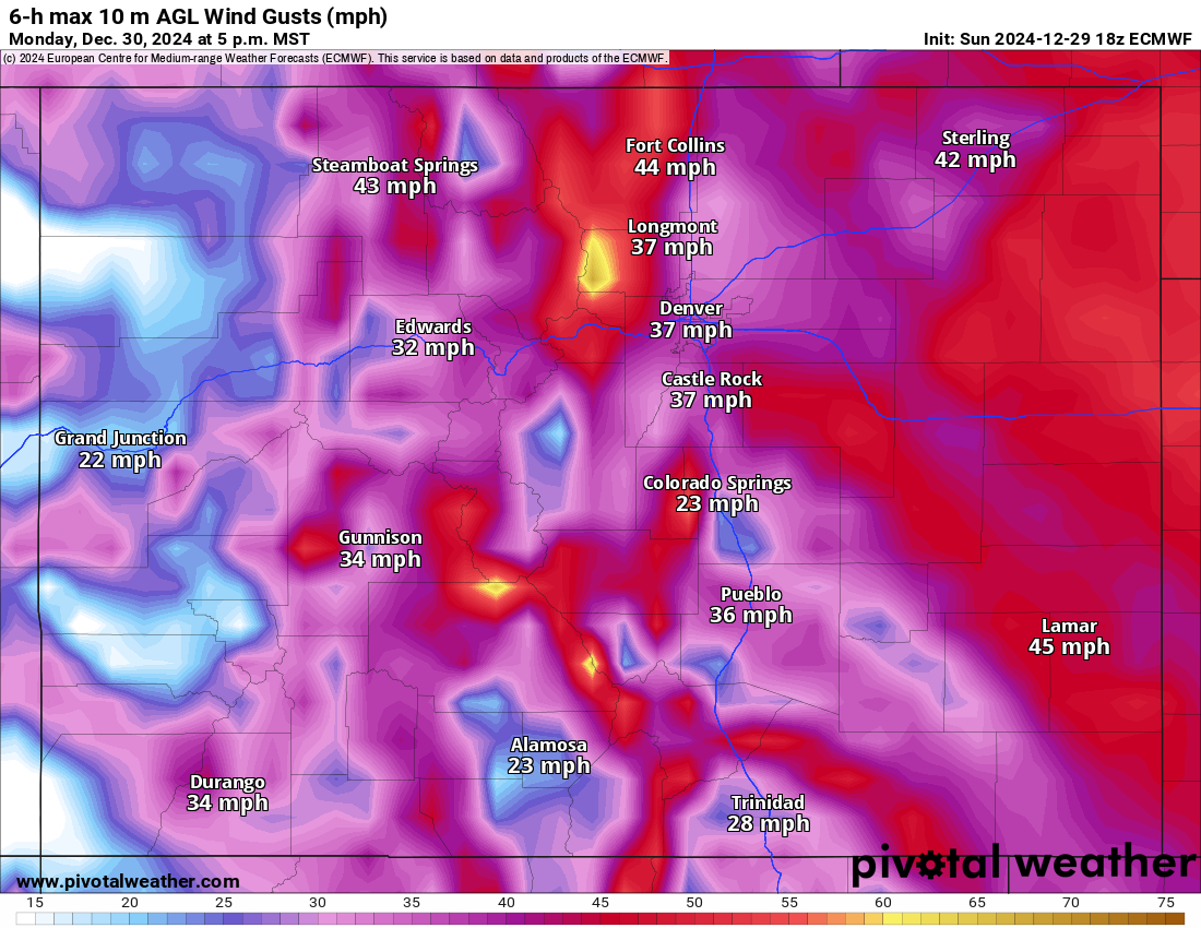
Wind gusts at the summits of most ski areas will be between 30-40 mph, possibly impacting upper-mountain chairlift access and closing terrain.
On Tuesday and Wednesday mornings, temperatures in Colorado’s high country will finish off 2024 very cold and ring in 2025 very cold as well. The European (ECMWF) model from Sunday afternoon forecasts low temperatures on Tuesday morning to be below 0 at many ski areas and resort bases by first chair.

Locations such as Winter Park, Breckenridge, Copper Mountain, Crested Butte, Loveland and Arapahoe Basin are forecast for morning lows between 0 to -5. Higher elevation spots at the mid-mountain stations and resort’s summits are forecast to be between -10 to -20.
Snow starts up again late Wednesday morning and continues through Friday night, again focusing on the northern and central mountains.
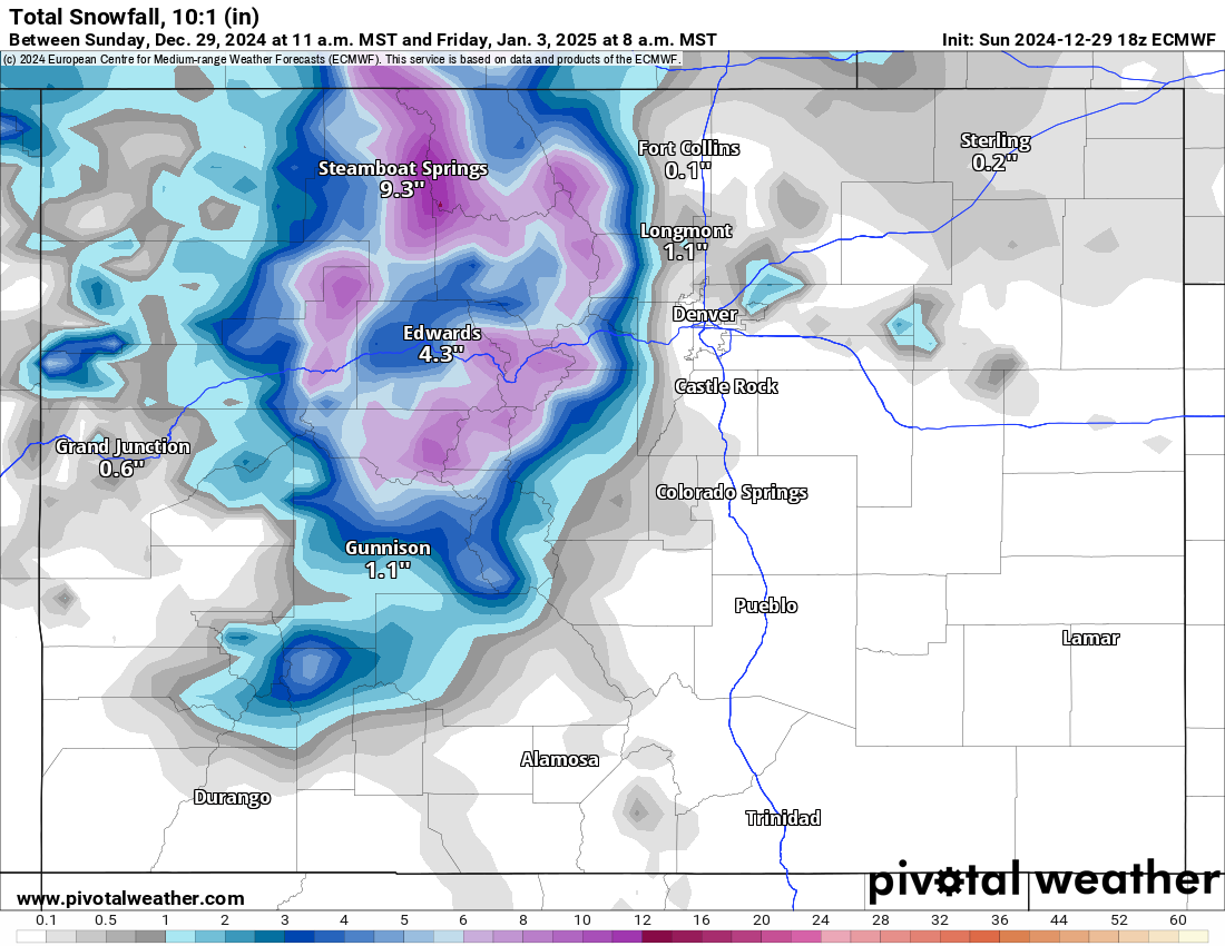
Forecasted snowfall totals from the ECWMF for this wave for the northern mountains are between 4-7 inches, in the central mountains between 3-6 inches and the southern mountains between 1-2 inches.
Grand totals by Friday afternoon for the northern mountains are between 8-12 inches, in the central mountains, 6-10 inches and the southern mountains 3-6 inches.
The ECWMF model:
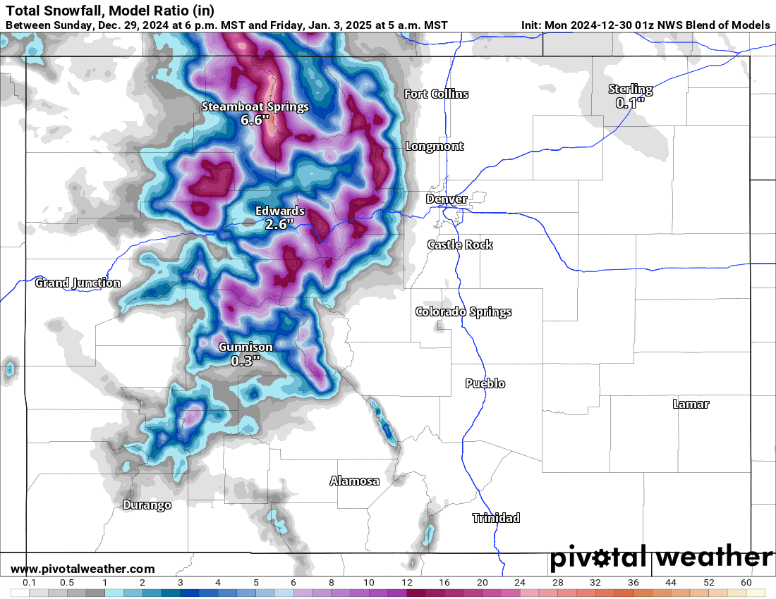
The NWS Blend of Models model:
Long range:
Beginning Saturday and heading into Sunday, a new series of systems enter the western US and are forecast to impact Colorado from Sunday to Wednesday, Jan. 8.
These systems, two or three waves, look to bring snow to northern and central Colorado mostly, with southern Colorado receiving lighter amounts.
More details to come from this series of storms later in the week as model runs line up better data, including potential snowfall totals, duration and impacts in to Colorado.
Today’s 24-hour snow totals from Colorado resorts:
Arapahoe Basin – 6″
Aspen Highlands – 6″
Aspen Mountain – 1″
Beaver Creek – 1″
Breckenridge – 9″
Buttermilk – 1″
Cooper – 8″
Copper Mountain – 8″
Crested Butte – 4″
Echo Mountain – 1″, plus tubing
Eldora Mountain – 5″
Granby Ranch – 2″
Hesperus – Closed for the season
Howelsen Hill – 3″
Kendall Mountain – 0″
Keystone – 8″
Loveland – 10″
Monarch – 2″
Powderhorn – 1″
Purgatory – 0″
Silverton – 1″
Snowmass – 2″
Steamboat – 3″
Sunlight – 2″
Telluride – 0″
Vail – 4″
Winter Park – 3″
Wolf Creek – 0″