




Ping pong ball-size hail, tornado the risks of afternoon storms set to hit Colorado
According to the National Weather Service, storms are set to roar into Colorado on Tuesday, September 14, most likely to impact the eastern plains and parts of the Denver metro. That being said, a chance of showers and thunderstorms is also possible across Colorado’s mountain region.
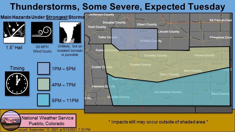
A warning posted by the Pueblo branch of the National Weather Service states that key hazards in central and southeast Colorado will be 1.5-inch hail (ping pong ball-size), 60 mile per hour wind gusts, and a possible isolated tornado. The storm may start to hit parts of Teller and El Paso County as early as 1 PM before impacting areas southeast of that.
UPDATE: A recent update from the National Weather Service states that the hail could now reach the size of a lime – 2 inches in diameter
Here’s how the National Weather Service has mapped out the timing in this region:
The eastern plains region to the north will also likely see tumultuous weather this afternoon, as well as the Denver metro area. The Boulder branch of the National Weather Service, which monitors this region, warns of half dollar-size hail (1.25-inch) and winds of up to 70 miles per hour, taking place from 1 PM to 7 PM.
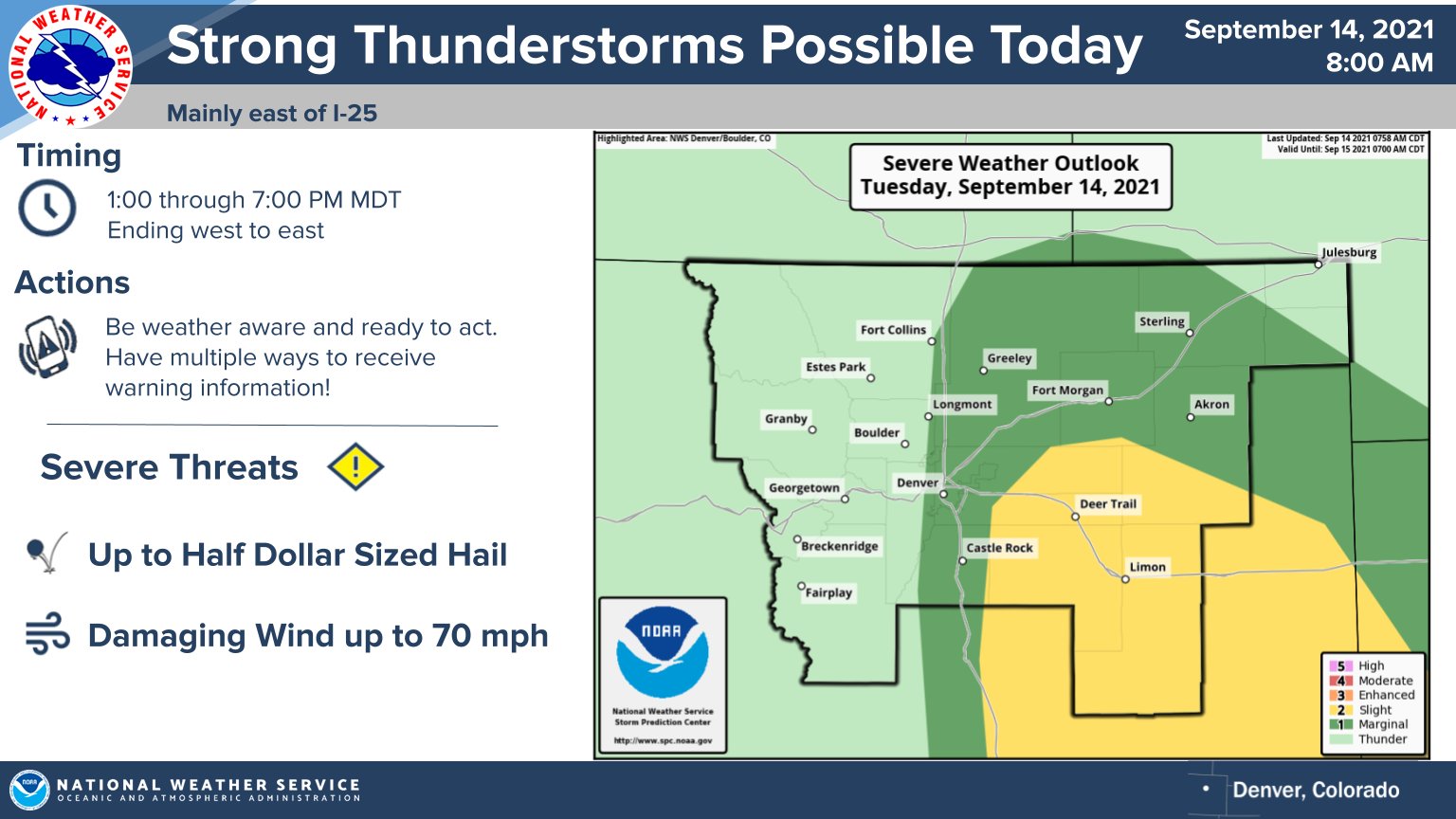
Storms are expected to develop in the foothills and push east.
Morning storms also rolled through parts of the Denver area, which is a bit unusual given the time of day.
STAY INFORMED: Sign-up for the daily OutThere Colorado newsletter here

Get OutThere
Signup today for free and be the first to get notified on new updates.
PREV
PREVIOUS

Sneak peek reveals behind-the-scenes look at Denver's new Meow Wolf attraction
Dizzying. Fascinating. Cool. Astonishing. Colorful. Surprising. Awe-inspiring. Wow. These words will fall from the lips of visitors as they wander through the Meow Wolf Denver permanent exhibit Convergence Station – a four-story wonderland of art, culture, music and food. Ahead of Friday’s planned grand opening the venue has offered sneak peeks daily this week as employees […]

Applications for $2.7 million in food relief grants open to Denver nonprofits
Applications for $2.7 million in funding from the Denver Emergency Food Relief Fund opened Tuesday to nonprofits in the city, the Denver Department of Public Health and Environment announced. The grants are available to Denver-based nonprofits that provide meals and groceries to residents facing food insecurity as a result of the COVID-19 pandemic. During the […]