


Uncompahgre Peak worth the effort | Happy Trails
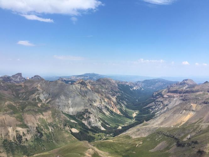
The view to the northeast from the summit of Uncompaghre. Photo by Liz Forster.
LIZ FORSTER [email protected]
function subscribeSuccess() {
var nsltrform = document.querySelector(“#nsltr”);
var nsltrSuccess = document.querySelector(“#successnsltr”);
nsltrform.classList.add(“hideblock”);
nsltrSuccess.classList.remove(“hideblock”);
}
function validateEmail(email) {
return String(email)
.toLowerCase()
.match(
/^(([^()[].,;:s@”]+(.[^()[].,;:s@”]+)*)|(“.+”))@(([[0-9]{1,3}.[0-9]{1,3}.[0-9]{1,3}.[0-9]{1,3}])|(([a-zA-Z-0-9]+.)+[a-zA-Z]{2,}))$/
);
}
function validateEmailAddress() {
const result = document.querySelector(“#result”);
const email = document.querySelector(“#email”).value;
result.innerText = “”;
if(validateEmail(email)) {
newsletterSubscribe(email);
} else {
result.innerText = ‘The email entered: ‘ + email + ‘ is not valid :(‘;
result.style.color = “red”;
}
return false;
}
function newsletterSubscribe(email) {
fetch(“https://services.gazette.com/mg2-newsletters.php?action=subscribe&site=denvergazette.com&emailPreferenceId=60&email=” + email, {
method: “POST”
}).then(res => {
console.log(“SUCCESSFUL POST”);
subscribeSuccess();
});
}
#nsltr {
min-width: 100%;
margin: 10px 0;
padding: 10px 20px;
background-color: #2076b3;
background-image: url(https://static.gazette.com/emails/circ/Audience%20Images/dg%20outdoors%20sign%20up.png);
background-size: cover;
}
#nsltr-header {
color: #fff4f4;
}
#nsltr-body {
text-align: center;
color: ;
}
#nsltr-button {
margin-top: 5px;
}
#successnsltr {
min-width: 100%;
margin: 10px 0;
padding: 10px 20px;
background-color: green;
text-align: center;
color: white;
}
#successnsltr a {
color: white;
}
.hideblock {
display:none;
}
h6 a {
color: black;
text-decoration: none;
padding: 5px;
background-color: #bbccdd;
font-weight: 600;
}
@media only screen and (min-width: 768px) {
#nsltr {
background-image: url(https://static.gazette.com/emails/circ/Audience%20Images/dg%20outdoors%20sign%20up.png);
background-size: cover;
}
}
Featured Local Savings
After the hike, enjoy a beer and a gourmet brat at Lake City Brewing Co.
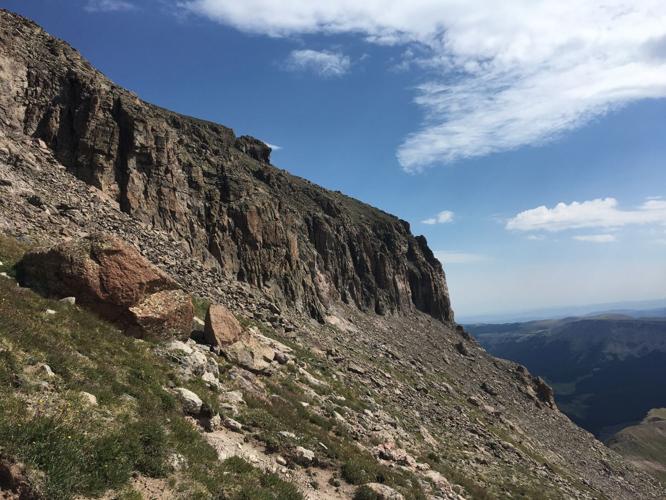
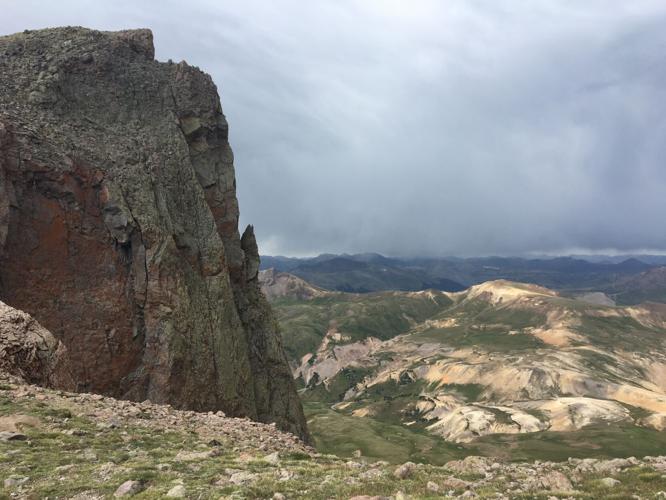
Trip log: 7 miles round trip (out and back, 15 miles if starting from the 2WD road), 3,000 feet elevation gain, 14,309 feet max
Difficulty: Difficult
Getting there: From Colorado 115, turn right onto U.S. 50 west in Penrose. Just past Gunnison, turn onto Colorado 149 south toward Powderhorn. Turn right onto Second Street in Lake City, then left onto Henson Creek Road. Drive 5 miles to the sign for Nellie Creek Trail, Forest Service Road 877. If you don’t have a high-clearance, four-wheel drive vehicle, park on Henson Creek Road and hike from there. The trailhead is 4 miles up Nellie Creek Road.
FYI: Hiking only. Dogs must be on a leash and might need to be carried up the final section of scrambling.
Liz Forster, The Gazette
Twitter: @lizmforster
Phone: 636-0193